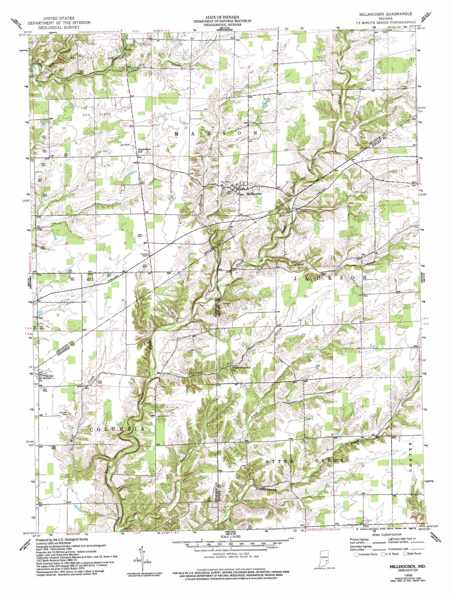
Millhousen Topo Map Indiana
To zoom in, hover over the map of Millhousen
USGS Topo Quad 39085b4 - 1:24,000 scale
| Topo Map Name: | Millhousen |
| USGS Topo Quad ID: | 39085b4 |
| Print Size: | ca. 21 1/4" wide x 27" high |
| Southeast Coordinates: | 39.125° N latitude / 85.375° W longitude |
| Map Center Coordinates: | 39.1875° N latitude / 85.4375° W longitude |
| U.S. State: | IN |
| Filename: | o39085b4.jpg |
| Download Map JPG Image: | Millhousen topo map 1:24,000 scale |
| Map Type: | Topographic |
| Topo Series: | 7.5´ |
| Map Scale: | 1:24,000 |
| Source of Map Images: | United States Geological Survey (USGS) |
| Alternate Map Versions: |
Millhousen IN 1958, updated 1959 Download PDF Buy paper map Millhousen IN 1958, updated 1977 Download PDF Buy paper map Millhousen IN 1958, updated 1993 Download PDF Buy paper map Millhousen IN 2010 Download PDF Buy paper map Millhousen IN 2013 Download PDF Buy paper map Millhousen IN 2016 Download PDF Buy paper map |
1:24,000 Topo Quads surrounding Millhousen
Waldron |
Adams |
Milroy |
Clarksburg |
Metamora |
Hartsville |
Forest Hill |
Greensburg |
New Point |
Batesville |
Grammer |
Westport |
Millhousen |
Osgood |
Pierceville |
North Vernon |
Butlerville |
Holton |
Versailles |
Milan |
Hayden |
Vernon |
San Jacinto |
Rexville |
Cross Plains |
> Back to 39085a1 at 1:100,000 scale
> Back to 39084a1 at 1:250,000 scale
> Back to U.S. Topo Maps home
Millhousen topo map: Gazetteer
Millhousen: Populated Places
Millhousen elevation 273m 895′Millhousen: Post Offices
Lock Spring Post Office (historical) elevation 265m 869′Millhousen: Streams
Fall Branch elevation 243m 797′Flatrock Creek elevation 236m 774′
Honey Creek elevation 250m 820′
Jordan Creek elevation 257m 843′
Square Run elevation 241m 790′
Wolf Creek elevation 228m 748′
Millhousen digital topo map on disk
Buy this Millhousen topo map showing relief, roads, GPS coordinates and other geographical features, as a high-resolution digital map file on DVD:
Northern Illinois, Northern Indiana & Southwestern Michigan
Buy digital topo maps: Northern Illinois, Northern Indiana & Southwestern Michigan