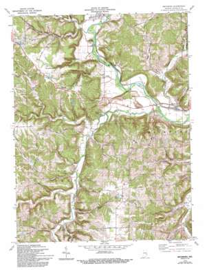
Metamora Topo Map Indiana
To zoom in, hover over the map of Metamora
USGS Topo Quad 39085d2 - 1:24,000 scale
| Topo Map Name: | Metamora |
| USGS Topo Quad ID: | 39085d2 |
| Print Size: | ca. 21 1/4" wide x 27" high |
| Southeast Coordinates: | 39.375° N latitude / 85.125° W longitude |
| Map Center Coordinates: | 39.4375° N latitude / 85.1875° W longitude |
| U.S. State: | IN |
| Filename: | o39085d2.jpg |
| Download Map JPG Image: | Metamora topo map 1:24,000 scale |
| Map Type: | Topographic |
| Topo Series: | 7.5´ |
| Map Scale: | 1:24,000 |
| Source of Map Images: | United States Geological Survey (USGS) |
| Alternate Map Versions: |
Metamora IN 1956, updated 1957 Download PDF Buy paper map Metamora IN 1972, updated 1973 Download PDF Buy paper map Metamora IN 1972, updated 1990 Download PDF Buy paper map Metamora IN 1972, updated 1993 Download PDF Buy paper map Metamora IN 2010 Download PDF Buy paper map Metamora IN 2013 Download PDF Buy paper map Metamora IN 2016 Download PDF Buy paper map |
1:24,000 Topo Quads surrounding Metamora
> Back to 39085a1 at 1:100,000 scale
> Back to 39084a1 at 1:250,000 scale
> Back to U.S. Topo Maps home
Metamora topo map: Gazetteer
Metamora: Dams
Gemco Lake Dam elevation 272m 892′Laurel Feeder Dam elevation 214m 702′
Metamora: Falls
Derbyshire Falls elevation 291m 954′Metamora: Lakes
Triple Lakes elevation 218m 715′Metamora: Populated Places
Lake View elevation 308m 1010′Metamora elevation 219m 718′
Midway elevation 297m 974′
Peppertown elevation 295m 967′
Metamora: Reservoirs
Canal Lakes elevation 301m 987′Gemco Lake elevation 272m 892′
Metamora: Ridges
McGuire Ridge elevation 280m 918′Metamora: Streams
Bachelors Run elevation 216m 708′Baker Branch elevation 216m 708′
Brown Branch elevation 225m 738′
Bull Fork elevation 213m 698′
Clear Fork elevation 207m 679′
Dodson Branch elevation 210m 688′
Dry Branch elevation 222m 728′
Fremont Branch elevation 209m 685′
Hamburg Branch elevation 219m 718′
Harvey Branch elevation 219m 718′
Jim Run elevation 219m 718′
Kroeger Branch elevation 208m 682′
Little Duck Creek elevation 210m 688′
Little Salt Creek elevation 245m 803′
Little Sanes Creek elevation 219m 718′
Little Walnut Fork elevation 224m 734′
Marlin Branch elevation 216m 708′
Salt Creek elevation 204m 669′
Sanes Creek elevation 216m 708′
Sillimans Creek elevation 210m 688′
South Fork Little Salt Creek elevation 231m 757′
Walnut Fork elevation 205m 672′
Whistle Creek elevation 207m 679′
Metamora: Summits
Jackson Hill elevation 279m 915′Wiley Indian Mound elevation 254m 833′
Metamora: Valleys
Coalpit Hollow elevation 245m 803′Halls Hollow elevation 245m 803′
Metamora digital topo map on disk
Buy this Metamora topo map showing relief, roads, GPS coordinates and other geographical features, as a high-resolution digital map file on DVD:
Northern Illinois, Northern Indiana & Southwestern Michigan
Buy digital topo maps: Northern Illinois, Northern Indiana & Southwestern Michigan


