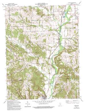
Alpine Topo Map Indiana
To zoom in, hover over the map of Alpine
USGS Topo Quad 39085e2 - 1:24,000 scale
| Topo Map Name: | Alpine |
| USGS Topo Quad ID: | 39085e2 |
| Print Size: | ca. 21 1/4" wide x 27" high |
| Southeast Coordinates: | 39.5° N latitude / 85.125° W longitude |
| Map Center Coordinates: | 39.5625° N latitude / 85.1875° W longitude |
| U.S. State: | IN |
| Filename: | o39085e2.jpg |
| Download Map JPG Image: | Alpine topo map 1:24,000 scale |
| Map Type: | Topographic |
| Topo Series: | 7.5´ |
| Map Scale: | 1:24,000 |
| Source of Map Images: | United States Geological Survey (USGS) |
| Alternate Map Versions: |
Alpine IN 1956, updated 1957 Download PDF Buy paper map Alpine IN 1971, updated 1973 Download PDF Buy paper map Alpine IN 1971, updated 1973 Download PDF Buy paper map Alpine IN 1971, updated 1994 Download PDF Buy paper map Alpine IN 2010 Download PDF Buy paper map Alpine IN 2013 Download PDF Buy paper map Alpine IN 2016 Download PDF Buy paper map |
1:24,000 Topo Quads surrounding Alpine
> Back to 39085e1 at 1:100,000 scale
> Back to 39084a1 at 1:250,000 scale
> Back to U.S. Topo Maps home
Alpine topo map: Gazetteer
Alpine: Dams
Champion Acre Lake Dam elevation 305m 1000′Alpine: Parks
Bear Creek Camp elevation 262m 859′Boys Club Camp elevation 240m 787′
Delaware Camp elevation 295m 967′
Alpine: Populated Places
Alpine elevation 231m 757′Columbia elevation 303m 994′
Laurel elevation 222m 728′
Mount Auburn elevation 275m 902′
Nulltown elevation 235m 770′
Alpine: Reservoirs
Champion Acre Lake elevation 305m 1000′Alpine: Streams
Bear Creek elevation 222m 728′Dry Branch elevation 242m 793′
Fall Creek elevation 234m 767′
Garrison Creek elevation 222m 728′
Little Williams Creek elevation 245m 803′
North Branch Garrison Creek elevation 237m 777′
Owl Creek elevation 246m 807′
Pot Creek elevation 233m 764′
Sayres Branch elevation 219m 718′
South Branch Garrison Creek elevation 237m 777′
Village Creek elevation 237m 777′
Williams Creek elevation 236m 774′
Wilson Creek elevation 232m 761′
Alpine digital topo map on disk
Buy this Alpine topo map showing relief, roads, GPS coordinates and other geographical features, as a high-resolution digital map file on DVD:
Northern Illinois, Northern Indiana & Southwestern Michigan
Buy digital topo maps: Northern Illinois, Northern Indiana & Southwestern Michigan


