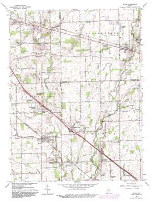
Acton Topo Map Indiana
To zoom in, hover over the map of Acton
USGS Topo Quad 39085f8 - 1:24,000 scale
| Topo Map Name: | Acton |
| USGS Topo Quad ID: | 39085f8 |
| Print Size: | ca. 21 1/4" wide x 27" high |
| Southeast Coordinates: | 39.625° N latitude / 85.875° W longitude |
| Map Center Coordinates: | 39.6875° N latitude / 85.9375° W longitude |
| U.S. State: | IN |
| Filename: | o39085f8.jpg |
| Download Map JPG Image: | Acton topo map 1:24,000 scale |
| Map Type: | Topographic |
| Topo Series: | 7.5´ |
| Map Scale: | 1:24,000 |
| Source of Map Images: | United States Geological Survey (USGS) |
| Alternate Map Versions: |
Acton IN 1953, updated 1954 Download PDF Buy paper map Acton IN 1962, updated 1964 Download PDF Buy paper map Acton IN 1962, updated 1976 Download PDF Buy paper map Acton IN 1962, updated 1982 Download PDF Buy paper map Acton IN 1962, updated 1982 Download PDF Buy paper map Acton IN 2010 Download PDF Buy paper map Acton IN 2013 Download PDF Buy paper map Acton IN 2016 Download PDF Buy paper map |
1:24,000 Topo Quads surrounding Acton
> Back to 39085e1 at 1:100,000 scale
> Back to 39084a1 at 1:250,000 scale
> Back to U.S. Topo Maps home
Acton topo map: Gazetteer
Acton: Canals
Ferris Ditch elevation 239m 784′Hack Ditch elevation 250m 820′
Hunter Ditch elevation 248m 813′
Merlau Ditch elevation 250m 820′
Miller Ditch elevation 253m 830′
Mulliner Ditch elevation 242m 793′
Springer McGaughey Ditch elevation 250m 820′
Acton: Crossings
Exit 101 elevation 247m 810′Exit 99 elevation 248m 813′
Acton: Parks
Southeastway Park elevation 247m 810′Acton: Populated Places
Acton elevation 241m 790′Belle Arbor elevation 254m 833′
Brookfield elevation 233m 764′
Brookville Heights elevation 251m 823′
Burge Terrace elevation 253m 830′
Carriage Estates elevation 253m 830′
Charle Sumac Estates elevation 247m 810′
Charlesmac Village elevation 249m 816′
Green Meadows elevation 238m 780′
Indian Creek Estates elevation 245m 803′
Julietta elevation 253m 830′
London elevation 240m 787′
London Heights elevation 239m 784′
New Palestine elevation 255m 836′
Pleasant View elevation 248m 813′
Schildmeier Park elevation 250m 820′
Southeast Manor elevation 240m 787′
Sugar Creek elevation 241m 790′
Sun Down elevation 251m 823′
Acton: Post Offices
Acton Post Office elevation 242m 793′Acton: Streams
Acton Run elevation 235m 770′Bethel Creek elevation 245m 803′
Big Run elevation 237m 777′
Breier Creek elevation 242m 793′
Chapel Run elevation 239m 784′
Charlesmac Run elevation 236m 774′
Coon Run elevation 245m 803′
Devault Run elevation 231m 757′
Doe Creek elevation 239m 784′
Free Run elevation 240m 787′
Grassy Creek elevation 242m 793′
Hickory Creek elevation 234m 767′
Kitty Creek elevation 239m 784′
Lamb Creek elevation 237m 777′
Little Run elevation 237m 777′
Little Sugar Creek elevation 229m 751′
Maze Creek elevation 230m 754′
Muesing Creek elevation 245m 803′
Opo Run elevation 246m 807′
Opossum Run elevation 244m 800′
Palestine Branch elevation 246m 807′
Poss Branch elevation 248m 813′
Small Branch elevation 240m 787′
Stop Branch elevation 242m 793′
Sugar Run elevation 243m 797′
Sum Brook elevation 249m 816′
Sweet Creek elevation 239m 784′
View Creek elevation 236m 774′
Wildcat Brook elevation 234m 767′
Wildcat Run elevation 233m 764′
Zion Creek elevation 244m 800′
Acton digital topo map on disk
Buy this Acton topo map showing relief, roads, GPS coordinates and other geographical features, as a high-resolution digital map file on DVD:
Northern Illinois, Northern Indiana & Southwestern Michigan
Buy digital topo maps: Northern Illinois, Northern Indiana & Southwestern Michigan


