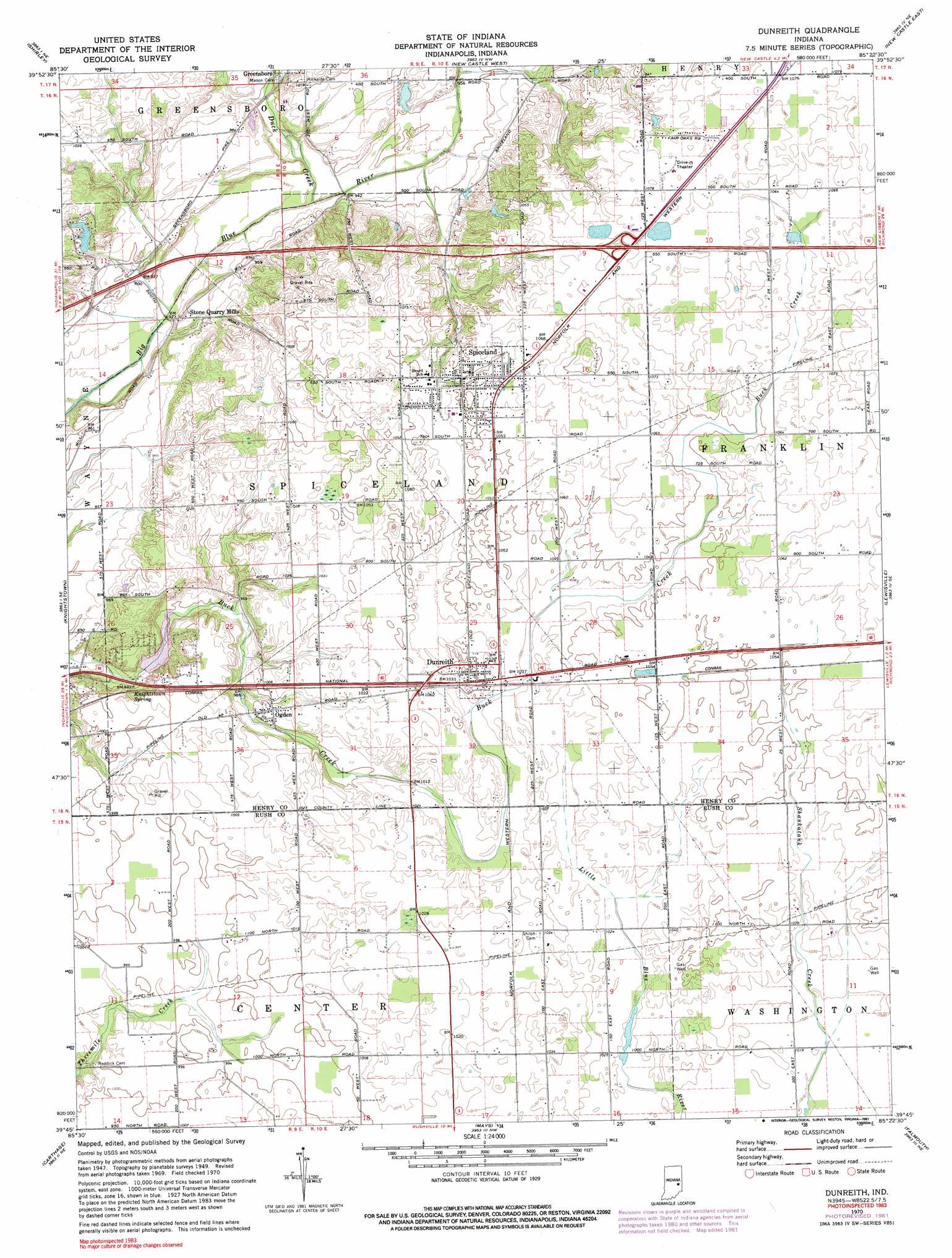
Dunreith Topo Map Indiana
To zoom in, hover over the map of Dunreith
USGS Topo Quad 39085g4 - 1:24,000 scale
| Topo Map Name: | Dunreith |
| USGS Topo Quad ID: | 39085g4 |
| Print Size: | ca. 21 1/4" wide x 27" high |
| Southeast Coordinates: | 39.75° N latitude / 85.375° W longitude |
| Map Center Coordinates: | 39.8125° N latitude / 85.4375° W longitude |
| U.S. State: | IN |
| Filename: | o39085g4.jpg |
| Download Map JPG Image: | Dunreith topo map 1:24,000 scale |
| Map Type: | Topographic |
| Topo Series: | 7.5´ |
| Map Scale: | 1:24,000 |
| Source of Map Images: | United States Geological Survey (USGS) |
| Alternate Map Versions: |
Dunreith IN 1950 Download PDF Buy paper map Dunreith IN 1970, updated 1972 Download PDF Buy paper map Dunreith IN 1970, updated 1982 Download PDF Buy paper map Dunreith IN 1970, updated 1991 Download PDF Buy paper map Dunreith IN 2010 Download PDF Buy paper map Dunreith IN 2013 Download PDF Buy paper map Dunreith IN 2016 Download PDF Buy paper map |
1:24,000 Topo Quads surrounding Dunreith
Anderson South |
Middletown |
Sulphur Springs |
Mount Pleasant |
Modoc |
Pendleton |
Shirley |
New Castle West |
New Castle East |
Hagerstown |
Cleveland |
Knightstown |
Dunreith |
Lewisville |
Cambridge City |
Morristown |
Carthage |
Mays |
Falmouth |
Connersville |
Rays Crossing |
Manilla |
Rushville |
New Salem |
Alpine |
> Back to 39085e1 at 1:100,000 scale
> Back to 39084a1 at 1:250,000 scale
> Back to U.S. Topo Maps home
Dunreith topo map: Gazetteer
Dunreith: Dams
Lake Haven Dam elevation 302m 990′Dunreith: Populated Places
Dunreith elevation 318m 1043′Ogden elevation 306m 1003′
Spiceland elevation 320m 1049′
Stone Quarry Mills elevation 287m 941′
Dunreith: Reservoirs
Lake Haven elevation 302m 990′Dunreith: Springs
Knightstown Spring elevation 287m 941′Dunreith: Streams
Duck Creek elevation 283m 928′Ten Creek elevation 288m 944′
Dunreith digital topo map on disk
Buy this Dunreith topo map showing relief, roads, GPS coordinates and other geographical features, as a high-resolution digital map file on DVD:
Northern Illinois, Northern Indiana & Southwestern Michigan
Buy digital topo maps: Northern Illinois, Northern Indiana & Southwestern Michigan