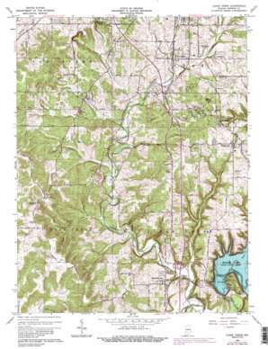
Clear Creek Topo Map Indiana
To zoom in, hover over the map of Clear Creek
USGS Topo Quad 39086a5 - 1:24,000 scale
| Topo Map Name: | Clear Creek |
| USGS Topo Quad ID: | 39086a5 |
| Print Size: | ca. 21 1/4" wide x 27" high |
| Southeast Coordinates: | 39° N latitude / 86.5° W longitude |
| Map Center Coordinates: | 39.0625° N latitude / 86.5625° W longitude |
| U.S. State: | IN |
| Filename: | o39086a5.jpg |
| Download Map JPG Image: | Clear Creek topo map 1:24,000 scale |
| Map Type: | Topographic |
| Topo Series: | 7.5´ |
| Map Scale: | 1:24,000 |
| Source of Map Images: | United States Geological Survey (USGS) |
| Alternate Map Versions: |
Clear Creek IN 1956, updated 1957 Download PDF Buy paper map Clear Creek IN 1965, updated 1968 Download PDF Buy paper map Clear Creek IN 1965, updated 1971 Download PDF Buy paper map Clear Creek IN 1965, updated 1981 Download PDF Buy paper map Clear Creek IN 1965, updated 1988 Download PDF Buy paper map Clear Creek IN 1965, updated 1990 Download PDF Buy paper map Clear Creek IN 1999, updated 2001 Download PDF Buy paper map Clear Creek IN 2010 Download PDF Buy paper map Clear Creek IN 2013 Download PDF Buy paper map Clear Creek IN 2016 Download PDF Buy paper map |
1:24,000 Topo Quads surrounding Clear Creek
> Back to 39086a1 at 1:100,000 scale
> Back to 39086a1 at 1:250,000 scale
> Back to U.S. Topo Maps home
Clear Creek topo map: Gazetteer
Clear Creek: Cliffs
Cedar Cliffs elevation 179m 587′Crum Point elevation 251m 823′
Kelly Point elevation 185m 606′
Clear Creek: Dams
Monroe Lake Dam elevation 176m 577′Clear Creek: Populated Places
Clear Creek elevation 200m 656′Garden Acres elevation 255m 836′
Harrodsburg elevation 170m 557′
Kirksville elevation 267m 875′
Sanders elevation 226m 741′
Smithville elevation 223m 731′
Victor elevation 199m 652′
Clear Creek: Reservoirs
Monroe Lake elevation 176m 577′Clear Creek: Streams
Jackson Creek elevation 188m 616′Judah Branch elevation 149m 488′
Little Clear Creek elevation 152m 498′
May Creek elevation 164m 538′
Sugar Creek elevation 164m 538′
Clear Creek: Summits
Depot Hill elevation 218m 715′Clear Creek: Valleys
Bowen Hollow elevation 183m 600′Clear Creek digital topo map on disk
Buy this Clear Creek topo map showing relief, roads, GPS coordinates and other geographical features, as a high-resolution digital map file on DVD:
Northern Illinois, Northern Indiana & Southwestern Michigan
Buy digital topo maps: Northern Illinois, Northern Indiana & Southwestern Michigan


