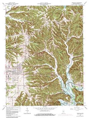
Unionville Topo Map Indiana
To zoom in, hover over the map of Unionville
USGS Topo Quad 39086b4 - 1:24,000 scale
| Topo Map Name: | Unionville |
| USGS Topo Quad ID: | 39086b4 |
| Print Size: | ca. 21 1/4" wide x 27" high |
| Southeast Coordinates: | 39.125° N latitude / 86.375° W longitude |
| Map Center Coordinates: | 39.1875° N latitude / 86.4375° W longitude |
| U.S. State: | IN |
| Filename: | o39086b4.jpg |
| Download Map JPG Image: | Unionville topo map 1:24,000 scale |
| Map Type: | Topographic |
| Topo Series: | 7.5´ |
| Map Scale: | 1:24,000 |
| Source of Map Images: | United States Geological Survey (USGS) |
| Alternate Map Versions: |
Unionville IN 1947 Download PDF Buy paper map Unionville IN 1947 Download PDF Buy paper map Unionville IN 1957, updated 1959 Download PDF Buy paper map Unionville IN 1966, updated 1968 Download PDF Buy paper map Unionville IN 1966, updated 1976 Download PDF Buy paper map Unionville IN 1966, updated 1981 Download PDF Buy paper map Unionville IN 1966, updated 1990 Download PDF Buy paper map Unionville IN 1966, updated 1990 Download PDF Buy paper map Unionville IN 1998, updated 2003 Download PDF Buy paper map Unionville IN 2010 Download PDF Buy paper map Unionville IN 2013 Download PDF Buy paper map Unionville IN 2016 Download PDF Buy paper map |
1:24,000 Topo Quads surrounding Unionville
> Back to 39086a1 at 1:100,000 scale
> Back to 39086a1 at 1:250,000 scale
> Back to U.S. Topo Maps home
Unionville topo map: Gazetteer
Unionville: Dams
Bethal Lake Dam elevation 216m 708′Schacht Lake Dam elevation 207m 679′
Unionville: Populated Places
Dolan elevation 187m 613′Eastern Heights elevation 260m 853′
Hoosier Acres elevation 249m 816′
Knight Ridge elevation 249m 816′
New Unionville elevation 268m 879′
Unionville elevation 268m 879′
Woodville Hills elevation 185m 606′
Unionville: Reservoirs
Bethal Lake elevation 216m 708′Schact Lake elevation 207m 679′
Unionville: Ridges
Bender Ridge elevation 232m 761′Brown Ridge elevation 230m 754′
Devils Backbone elevation 171m 561′
Epsom Ridge elevation 240m 787′
Lampkin Ridge elevation 247m 810′
Unionville: Streams
Baby Creek elevation 184m 603′Brummett Creek elevation 168m 551′
Conrad Branch elevation 171m 561′
Goodley Branch elevation 164m 538′
Kerr Creek elevation 171m 561′
Shuffle Creek elevation 193m 633′
Stephens Creek elevation 164m 538′
Unionville: Summits
Jimmy Sexton Hill elevation 231m 757′Pike Hill elevation 232m 761′
Unionville: Valleys
Bender Hollow elevation 170m 557′Danny Burr Hollow elevation 183m 600′
Goose Hollow elevation 228m 748′
Helton Hollow elevation 166m 544′
Isominger Hollow elevation 184m 603′
Penitentiary Hollow elevation 208m 682′
Sulphur Spring Hollow elevation 202m 662′
Unionville digital topo map on disk
Buy this Unionville topo map showing relief, roads, GPS coordinates and other geographical features, as a high-resolution digital map file on DVD:
Northern Illinois, Northern Indiana & Southwestern Michigan
Buy digital topo maps: Northern Illinois, Northern Indiana & Southwestern Michigan


