Gosport Topo Map Indiana
To zoom in, hover over the map of Gosport
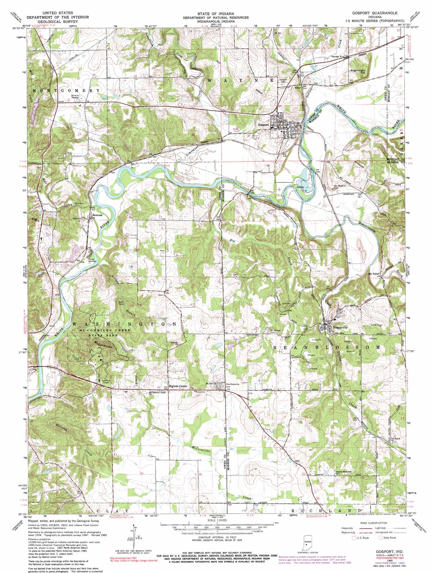
USGS Topo Quad 39086c6 - 1:24,000 scale
| Topo Map Name: | Gosport |
| USGS Topo Quad ID: | 39086c6 |
| Print Size: | ca. 21 1/4" wide x 27" high |
| Southeast Coordinates: | 39.25° N latitude / 86.625° W longitude |
| Map Center Coordinates: | 39.3125° N latitude / 86.6875° W longitude |
| U.S. State: | IN |
| Filename: | o39086c6.jpg |
| Download Map JPG Image: | Gosport topo map 1:24,000 scale |
| Map Type: | Topographic |
| Topo Series: | 7.5´ |
| Map Scale: | 1:24,000 |
| Source of Map Images: | United States Geological Survey (USGS) |
| Alternate Map Versions: |
Gosport IN 1947, updated 1958 Download PDF Buy paper map Gosport IN 1950 Download PDF Buy paper map Gosport IN 1965, updated 1967 Download PDF Buy paper map Gosport IN 1965, updated 1980 Download PDF Buy paper map Gosport IN 1965, updated 1981 Download PDF Buy paper map Gosport IN 1965, updated 1983 Download PDF Buy paper map Gosport IN 1998, updated 2002 Download PDF Buy paper map Gosport IN 2010 Download PDF Buy paper map Gosport IN 2013 Download PDF Buy paper map Gosport IN 2016 Download PDF Buy paper map |
1:24,000 Topo Quads surrounding Gosport
Reelsville |
Cloverdale |
Eminence |
Hall |
Mooresville West |
Poland |
Cataract |
Quincy |
Paragon |
Martinsville |
Patricksburg |
Spencer |
Gosport |
Modesto |
Hindustan |
Arney |
Freedom |
Whitehall |
Bloomington |
Unionville |
Bloomfield |
Solsberry |
Stanford |
Clear Creek |
Allens Creek |
> Back to 39086a1 at 1:100,000 scale
> Back to 39086a1 at 1:250,000 scale
> Back to U.S. Topo Maps home
Gosport topo map: Gazetteer
Gosport: Dams
Amazon Lake Dam elevation 176m 577′Farm Pond Dam elevation 219m 718′
Gosport: Lakes
Hollybrook Lake elevation 175m 574′Gosport: Mines
Gosport Quarry elevation 214m 702′Gosport: Parks
Camp Romona elevation 170m 557′McCormicks Creek State Park elevation 215m 705′
Gosport: Populated Places
Gosport elevation 212m 695′Highets Corner elevation 225m 738′
Mount Tabor elevation 177m 580′
Romona elevation 178m 583′
Silex elevation 183m 600′
Stinesville elevation 177m 580′
Gosport: Reservoirs
Amazon Lake elevation 176m 577′Farm Pond elevation 219m 718′
Gosport: Streams
Beanblossom Creek elevation 164m 538′Big Creek elevation 162m 531′
Fall Creek elevation 166m 544′
Indian Creek elevation 182m 597′
Jacks Defeat Creek elevation 168m 551′
Limestone Creek elevation 164m 538′
Littens Branch elevation 161m 528′
Little Mill Creek elevation 173m 567′
McCormicks Creek elevation 161m 528′
Mill Creek elevation 165m 541′
Gosport: Summits
Arganbright Hill elevation 204m 669′Gosport digital topo map on disk
Buy this Gosport topo map showing relief, roads, GPS coordinates and other geographical features, as a high-resolution digital map file on DVD:
Northern Illinois, Northern Indiana & Southwestern Michigan
Buy digital topo maps: Northern Illinois, Northern Indiana & Southwestern Michigan