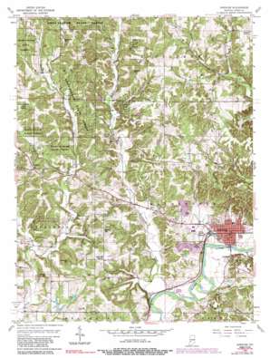
Spencer Topo Map Indiana
To zoom in, hover over the map of Spencer
USGS Topo Quad 39086c7 - 1:24,000 scale
| Topo Map Name: | Spencer |
| USGS Topo Quad ID: | 39086c7 |
| Print Size: | ca. 21 1/4" wide x 27" high |
| Southeast Coordinates: | 39.25° N latitude / 86.75° W longitude |
| Map Center Coordinates: | 39.3125° N latitude / 86.8125° W longitude |
| U.S. State: | IN |
| Filename: | o39086c7.jpg |
| Download Map JPG Image: | Spencer topo map 1:24,000 scale |
| Map Type: | Topographic |
| Topo Series: | 7.5´ |
| Map Scale: | 1:24,000 |
| Source of Map Images: | United States Geological Survey (USGS) |
| Alternate Map Versions: |
Spencer IN 1956, updated 1958 Download PDF Buy paper map Spencer IN 1956, updated 1965 Download PDF Buy paper map Spencer IN 1956, updated 1981 Download PDF Buy paper map Spencer IN 1956, updated 1989 Download PDF Buy paper map Spencer IN 1956, updated 1989 Download PDF Buy paper map Spencer IN 2010 Download PDF Buy paper map Spencer IN 2013 Download PDF Buy paper map Spencer IN 2016 Download PDF Buy paper map |
1:24,000 Topo Quads surrounding Spencer
> Back to 39086a1 at 1:100,000 scale
> Back to 39086a1 at 1:250,000 scale
> Back to U.S. Topo Maps home
Spencer topo map: Gazetteer
Spencer: Airports
Miller Airport elevation 214m 702′Spencer: Dams
Cottons Little Pine Lake Dam elevation 180m 590′Dugan Lake Dam elevation 204m 669′
Ralph Ketchum Lake Dam elevation 177m 580′
Thomas Lake Dam elevation 184m 603′
Spencer: Populated Places
Hancock Corner elevation 220m 721′Southport elevation 171m 561′
Spencer elevation 171m 561′
Vandalia elevation 240m 787′
Spencer: Reservoirs
Cottons Little Pine Lake elevation 180m 590′Dugan Lake elevation 204m 669′
Ralph Ketchum Lake elevation 177m 580′
Thomas Lake elevation 184m 603′
Spencer: Streams
East Fork Fish Creek elevation 168m 551′Elliston Creek elevation 160m 524′
McBride Branch elevation 161m 528′
Naans Branch elevation 176m 577′
Rattlesnake Creek elevation 162m 531′
West Fork Fish Creek elevation 169m 554′
Spencer: Summits
Cooksey Hill elevation 253m 830′Emmins Hill elevation 245m 803′
Gaston Hill elevation 266m 872′
Straley Hill elevation 239m 784′
Taylor Hill elevation 220m 721′
Wolfe Hill elevation 239m 784′
Spencer digital topo map on disk
Buy this Spencer topo map showing relief, roads, GPS coordinates and other geographical features, as a high-resolution digital map file on DVD:
Northern Illinois, Northern Indiana & Southwestern Michigan
Buy digital topo maps: Northern Illinois, Northern Indiana & Southwestern Michigan


