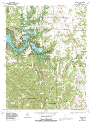
Cataract Topo Map Indiana
To zoom in, hover over the map of Cataract
USGS Topo Quad 39086d7 - 1:24,000 scale
| Topo Map Name: | Cataract |
| USGS Topo Quad ID: | 39086d7 |
| Print Size: | ca. 21 1/4" wide x 27" high |
| Southeast Coordinates: | 39.375° N latitude / 86.75° W longitude |
| Map Center Coordinates: | 39.4375° N latitude / 86.8125° W longitude |
| U.S. State: | IN |
| Filename: | o39086d7.jpg |
| Download Map JPG Image: | Cataract topo map 1:24,000 scale |
| Map Type: | Topographic |
| Topo Series: | 7.5´ |
| Map Scale: | 1:24,000 |
| Source of Map Images: | United States Geological Survey (USGS) |
| Alternate Map Versions: |
Cataract IN 1956, updated 1957 Download PDF Buy paper map Cataract IN 1956, updated 1964 Download PDF Buy paper map Cataract IN 1956, updated 1972 Download PDF Buy paper map Cataract IN 1956, updated 1985 Download PDF Buy paper map Cataract IN 1956, updated 1987 Download PDF Buy paper map Cataract IN 2010 Download PDF Buy paper map Cataract IN 2013 Download PDF Buy paper map Cataract IN 2016 Download PDF Buy paper map |
1:24,000 Topo Quads surrounding Cataract
> Back to 39086a1 at 1:100,000 scale
> Back to 39086a1 at 1:250,000 scale
> Back to U.S. Topo Maps home
Cataract topo map: Gazetteer
Cataract: Dams
Camp Otto Lake Dam elevation 228m 748′Cataract: Falls
Lower Cataract Falls elevation 198m 649′Upper Cataract Falls elevation 213m 698′
Cataract: Forests
Owen-Putnam State Forest elevation 241m 790′Cataract: Islands
Ernie Pyle Island elevation 194m 636′Cataract: Populated Places
Atkinsonville elevation 270m 885′Carp elevation 220m 721′
Cataract elevation 235m 770′
Cuba elevation 256m 839′
Cunot elevation 242m 793′
Devore elevation 230m 754′
Cataract: Reservoirs
Camp Otto Lake elevation 228m 748′Paradise Lake elevation 222m 728′
Cataract: Ridges
Corns Ridge elevation 269m 882′Cataract: Streams
Doe Creek elevation 194m 636′Cataract: Summits
Hale Hill elevation 269m 882′Cataract digital topo map on disk
Buy this Cataract topo map showing relief, roads, GPS coordinates and other geographical features, as a high-resolution digital map file on DVD:
Northern Illinois, Northern Indiana & Southwestern Michigan
Buy digital topo maps: Northern Illinois, Northern Indiana & Southwestern Michigan


