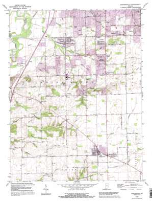
Bargersville Topo Map Indiana
To zoom in, hover over the map of Bargersville
USGS Topo Quad 39086e2 - 1:24,000 scale
| Topo Map Name: | Bargersville |
| USGS Topo Quad ID: | 39086e2 |
| Print Size: | ca. 21 1/4" wide x 27" high |
| Southeast Coordinates: | 39.5° N latitude / 86.125° W longitude |
| Map Center Coordinates: | 39.5625° N latitude / 86.1875° W longitude |
| U.S. State: | IN |
| Filename: | o39086e2.jpg |
| Download Map JPG Image: | Bargersville topo map 1:24,000 scale |
| Map Type: | Topographic |
| Topo Series: | 7.5´ |
| Map Scale: | 1:24,000 |
| Source of Map Images: | United States Geological Survey (USGS) |
| Alternate Map Versions: |
Bargersville IN 1952, updated 1953 Download PDF Buy paper map Bargersville IN 1962, updated 1963 Download PDF Buy paper map Bargersville IN 1962, updated 1976 Download PDF Buy paper map Bargersville IN 1962, updated 1981 Download PDF Buy paper map Bargersville IN 1962, updated 1987 Download PDF Buy paper map Bargersville IN 1992, updated 1995 Download PDF Buy paper map Bargersville IN 2011 Download PDF Buy paper map Bargersville IN 2013 Download PDF Buy paper map Bargersville IN 2016 Download PDF Buy paper map |
1:24,000 Topo Quads surrounding Bargersville
> Back to 39086e1 at 1:100,000 scale
> Back to 39086a1 at 1:250,000 scale
> Back to U.S. Topo Maps home
Bargersville topo map: Gazetteer
Bargersville: Canals
Alexander Ditch elevation 242m 793′Roberts Ditch elevation 243m 797′
Scott Ditch elevation 241m 790′
Bargersville: Dams
Doty Run Lake Dam elevation 226m 741′Elmer C Summit Lake Dam elevation 233m 764′
Bargersville: Populated Places
Al-Mar elevation 248m 813′Auburn Trace elevation 219m 718′
Bargersville elevation 250m 820′
Bluff Acres elevation 201m 659′
Bluff Creek elevation 242m 793′
Brentridge elevation 213m 698′
Brentwood elevation 219m 718′
Brockton Manor elevation 219m 718′
Cedar Hills elevation 233m 764′
Clearview elevation 217m 711′
Critchfield elevation 236m 774′
Deerwood elevation 208m 682′
Eagle Trace elevation 229m 751′
El Dorado elevation 236m 774′
Foxberry Trace elevation 225m 738′
Frances elevation 229m 751′
Golden Grove elevation 231m 757′
Green Valley elevation 238m 780′
Hendricks elevation 241m 790′
Horizon Estates elevation 223m 731′
Hunters Pointe elevation 223m 731′
Kinder elevation 242m 793′
McCarty elevation 243m 797′
Old Bargersville elevation 253m 830′
Pebble Hills elevation 213m 698′
Pebble Run elevation 209m 685′
Pennington Estates elevation 239m 784′
Smith Valley elevation 213m 698′
Stones Crossing elevation 243m 797′
Tremont elevation 241m 790′
Waterloo elevation 246m 807′
Waters Edge elevation 220m 721′
Willow Lakes elevation 231m 757′
Woodland Stream elevation 224m 734′
Bargersville: Streams
Auburn Branch elevation 218m 715′Center Creek elevation 213m 698′
Crook Branch elevation 219m 718′
Doty Run elevation 217m 711′
Fair Brook elevation 222m 728′
Fairview Creek elevation 215m 705′
Frances Creek elevation 210m 688′
Gilmore Creek elevation 238m 780′
Honey Creek elevation 197m 646′
Kinder Run elevation 228m 748′
Lake Run elevation 212m 695′
Lowe Creek elevation 201m 659′
Mallow Run elevation 220m 721′
McColgin Creek elevation 225m 738′
Messersmith Creek elevation 203m 666′
Pleasant Run Creek elevation 197m 646′
Salem Brook elevation 215m 705′
Smith Run elevation 206m 675′
Travis Creek elevation 197m 646′
Turkey Pen Creek elevation 206m 675′
Utterback Branch elevation 236m 774′
Waterloo Run elevation 221m 725′
Bargersville: Summits
Sally Doty Hill elevation 246m 807′Travis Hill elevation 239m 784′
Bargersville digital topo map on disk
Buy this Bargersville topo map showing relief, roads, GPS coordinates and other geographical features, as a high-resolution digital map file on DVD:
Northern Illinois, Northern Indiana & Southwestern Michigan
Buy digital topo maps: Northern Illinois, Northern Indiana & Southwestern Michigan


