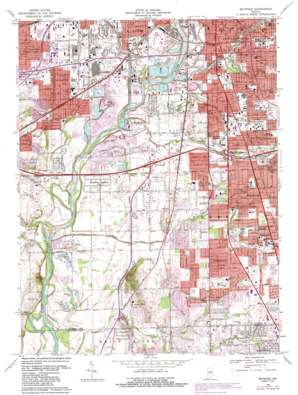
Maywood Topo Map Indiana
To zoom in, hover over the map of Maywood
USGS Topo Quad 39086f2 - 1:24,000 scale
| Topo Map Name: | Maywood |
| USGS Topo Quad ID: | 39086f2 |
| Print Size: | ca. 21 1/4" wide x 27" high |
| Southeast Coordinates: | 39.625° N latitude / 86.125° W longitude |
| Map Center Coordinates: | 39.6875° N latitude / 86.1875° W longitude |
| U.S. State: | IN |
| Filename: | o39086f2.jpg |
| Download Map JPG Image: | Maywood topo map 1:24,000 scale |
| Map Type: | Topographic |
| Topo Series: | 7.5´ |
| Map Scale: | 1:24,000 |
| Source of Map Images: | United States Geological Survey (USGS) |
| Alternate Map Versions: |
Maywood IN 1948 Download PDF Buy paper map Maywood IN 1959, updated 1961 Download PDF Buy paper map Maywood IN 1967, updated 1969 Download PDF Buy paper map Maywood IN 1967, updated 1981 Download PDF Buy paper map Maywood IN 1967, updated 1987 Download PDF Buy paper map Maywood IN 1998, updated 2002 Download PDF Buy paper map Maywood IN 2011 Download PDF Buy paper map Maywood IN 2013 Download PDF Buy paper map Maywood IN 2016 Download PDF Buy paper map |
1:24,000 Topo Quads surrounding Maywood
> Back to 39086e1 at 1:100,000 scale
> Back to 39086a1 at 1:250,000 scale
> Back to U.S. Topo Maps home
Maywood topo map: Gazetteer
Maywood: Airports
Hillenburg Airport elevation 204m 669′Stout Field (historical) elevation 214m 702′
Maywood: Canals
Churchman Ditch elevation 210m 688′Hapgood Ditch elevation 200m 656′
Hare Ditch elevation 202m 662′
Harmon Ditch elevation 203m 666′
Harness Ditch elevation 199m 652′
Haueisen Ditch elevation 209m 685′
Orme Ditch elevation 202m 662′
State Ditch elevation 206m 675′
Maywood: Crossings
Interchange 109 elevation 223m 731′Interchange 2 elevation 220m 721′
Interchange 4 elevation 213m 698′
Interchange 7 elevation 212m 695′
Interchange 75 elevation 228m 748′
Maywood: Lakes
Blue Lake elevation 206m 675′Le-An-Wa Lake elevation 200m 656′
Shannon Lake elevation 198m 649′
Maywood: Mines
Harding Street Quarry elevation 102m 334′Kentucky Avenue Mine elevation 207m 679′
Maywood: Parks
Bluff Park elevation 210m 688′Columbia Park elevation 220m 721′
Garfield Park elevation 221m 725′
Key Stadium elevation 230m 754′
Lilly Recreation Park elevation 206m 675′
Longacre Park elevation 220m 721′
Meridian Woods Park elevation 210m 688′
Perry Park elevation 229m 751′
Smith Mall elevation 228m 748′
South Westway Park elevation 210m 688′
Stout Field Park elevation 213m 698′
Maywood: Populated Places
Drexel Gardens elevation 222m 728′Edgewood elevation 231m 757′
Glenns Valley elevation 211m 692′
Homecroft elevation 230m 754′
Imperial Hills elevation 228m 748′
Lindenwood elevation 237m 777′
Maywood elevation 212m 695′
Rosedale Hills elevation 232m 761′
Southport elevation 228m 748′
Sunshine Gardens elevation 204m 669′
University Heights elevation 227m 744′
Maywood: Post Offices
Garfield Station Indianapolis Post Office elevation 227m 744′Sunnyside Post Office (historical) elevation 224m 734′
Maywood: Reservoirs
Peyton Lake elevation 203m 666′Maywood: Streams
Bean Creek elevation 214m 702′Brushy Fork elevation 204m 669′
Buffalo Creek elevation 209m 685′
Dollar Hide Creek elevation 202m 662′
Drexel Run elevation 218m 715′
Eagle Creek elevation 203m 666′
Fawn Run elevation 219m 718′
Fountain Creek elevation 225m 738′
Germania Creek elevation 206m 675′
Highland Creek elevation 211m 692′
Lick Creek elevation 203m 666′
Little Buck Creek elevation 200m 656′
Little Mann Creek elevation 206m 675′
Lowman Creek elevation 224m 734′
Mann Creek elevation 198m 649′
Mickley Run elevation 226m 741′
Pleasant Run elevation 207m 679′
Pond Branch elevation 219m 718′
Seerley Creek elevation 211m 692′
Swamp Creek elevation 198m 649′
Thompson Run elevation 202m 662′
Maywood: Summits
Mann Hill elevation 250m 820′Mars Hill elevation 212m 695′
Maywood digital topo map on disk
Buy this Maywood topo map showing relief, roads, GPS coordinates and other geographical features, as a high-resolution digital map file on DVD:
Northern Illinois, Northern Indiana & Southwestern Michigan
Buy digital topo maps: Northern Illinois, Northern Indiana & Southwestern Michigan


