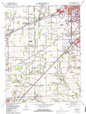
Bridgeport Topo Map Indiana
To zoom in, hover over the map of Bridgeport
USGS Topo Quad 39086f3 - 1:24,000 scale
| Topo Map Name: | Bridgeport |
| USGS Topo Quad ID: | 39086f3 |
| Print Size: | ca. 21 1/4" wide x 27" high |
| Southeast Coordinates: | 39.625° N latitude / 86.25° W longitude |
| Map Center Coordinates: | 39.6875° N latitude / 86.3125° W longitude |
| U.S. State: | IN |
| Filename: | o39086f3.jpg |
| Download Map JPG Image: | Bridgeport topo map 1:24,000 scale |
| Map Type: | Topographic |
| Topo Series: | 7.5´ |
| Map Scale: | 1:24,000 |
| Source of Map Images: | United States Geological Survey (USGS) |
| Alternate Map Versions: |
Bridgeport IN 1953, updated 1954 Download PDF Buy paper map Bridgeport IN 1959, updated 1960 Download PDF Buy paper map Bridgeport IN 1966, updated 1969 Download PDF Buy paper map Bridgeport IN 1966, updated 1981 Download PDF Buy paper map Bridgeport IN 1966, updated 1987 Download PDF Buy paper map Bridgeport IN 1966, updated 1987 Download PDF Buy paper map Bridgeport IN 1998, updated 2000 Download PDF Buy paper map Bridgeport IN 2010 Download PDF Buy paper map Bridgeport IN 2013 Download PDF Buy paper map Bridgeport IN 2016 Download PDF Buy paper map |
1:24,000 Topo Quads surrounding Bridgeport
> Back to 39086e1 at 1:100,000 scale
> Back to 39086a1 at 1:250,000 scale
> Back to U.S. Topo Maps home
Bridgeport topo map: Gazetteer
Bridgeport: Airports
Indianapolis International Airport elevation 241m 790′Bridgeport: Canals
Mars Ditch elevation 223m 731′Thompson Ditch elevation 232m 761′
Bridgeport: Crossings
Interchange 1 elevation 237m 777′Interchange 11 elevation 240m 787′
Interchange 12 elevation 236m 774′
Interchange 66 elevation 226m 741′
Interchange 8 elevation 229m 751′
Interchange 9 elevation 227m 744′
Bridgeport: Parks
Carson Park elevation 224m 734′Central Park elevation 240m 787′
Bridgeport: Populated Places
Ben Davis elevation 240m 787′Bridgeport elevation 230m 754′
Camby elevation 235m 770′
Friendswood elevation 221m 725′
Maple Ridge elevation 235m 770′
Mickleyville elevation 236m 774′
Six Points elevation 235m 770′
Sterling Heights elevation 242m 793′
Valley Mills elevation 233m 764′
West Newton elevation 225m 738′
Bridgeport: Post Offices
West Newton Post Office elevation 225m 738′Bridgeport: Reservoirs
Klondike Pond elevation 239m 784′Lambert Lake elevation 240m 787′
Toms Lake elevation 241m 790′
Walnut Grove Lake elevation 219m 718′
Bridgeport: Streams
Army Branch elevation 237m 777′Avon Creek elevation 230m 754′
Black Creek elevation 210m 688′
Bluff Creek elevation 222m 728′
Bridge Creek elevation 225m 738′
Cam Branch elevation 223m 731′
Camby Creek elevation 217m 711′
Center Creek elevation 219m 718′
Davis Creek elevation 220m 721′
Dead Run elevation 225m 738′
Fair Creek elevation 215m 705′
Flynn Creek elevation 211m 692′
Friends Creek elevation 210m 688′
George Creek elevation 219m 718′
Guilford Branch elevation 214m 702′
Hendricks Creek elevation 209m 685′
Julia Creek elevation 230m 754′
Klondike Creek elevation 224m 734′
Kollman Branch elevation 222m 728′
Lake Branch elevation 211m 692′
Leg Creek elevation 208m 682′
Little Dollar Hide Creek elevation 222m 728′
Luck Creek elevation 214m 702′
March Creek elevation 238m 780′
Marihen Creek elevation 210m 688′
Middle Creek elevation 217m 711′
Milhouse Creek elevation 220m 721′
Moore Creek elevation 207m 679′
Municipal Creek elevation 229m 751′
National Creek elevation 227m 744′
Newton Branch elevation 216m 708′
North Creek elevation 222m 728′
Paddock Run elevation 227m 744′
Penns Run elevation 206m 675′
Port Creek elevation 228m 748′
Pound Creek elevation 226m 741′
Quack Branch elevation 203m 666′
Quill Creek elevation 210m 688′
Rail Run elevation 209m 685′
Rock Creek elevation 211m 692′
Rogers Creek elevation 216m 708′
Salem Creek elevation 228m 748′
School Creek elevation 223m 731′
Silon Creek elevation 205m 672′
Silver Branch elevation 226m 741′
South Branch North Creek elevation 224m 734′
Sterling Run elevation 221m 725′
Tincher Run elevation 211m 692′
Trotter Creek elevation 222m 728′
West Fork Hendricks Creek elevation 216m 708′
Bridgeport digital topo map on disk
Buy this Bridgeport topo map showing relief, roads, GPS coordinates and other geographical features, as a high-resolution digital map file on DVD:
Northern Illinois, Northern Indiana & Southwestern Michigan
Buy digital topo maps: Northern Illinois, Northern Indiana & Southwestern Michigan


