Fayette Topo Map Indiana
To zoom in, hover over the map of Fayette
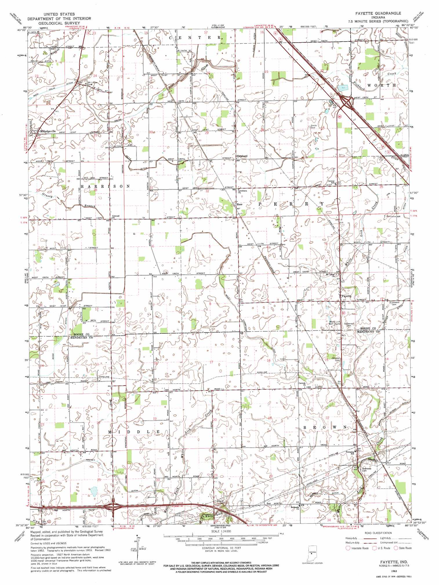
USGS Topo Quad 39086h4 - 1:24,000 scale
| Topo Map Name: | Fayette |
| USGS Topo Quad ID: | 39086h4 |
| Print Size: | ca. 21 1/4" wide x 27" high |
| Southeast Coordinates: | 39.875° N latitude / 86.375° W longitude |
| Map Center Coordinates: | 39.9375° N latitude / 86.4375° W longitude |
| U.S. State: | IN |
| Filename: | o39086h4.jpg |
| Download Map JPG Image: | Fayette topo map 1:24,000 scale |
| Map Type: | Topographic |
| Topo Series: | 7.5´ |
| Map Scale: | 1:24,000 |
| Source of Map Images: | United States Geological Survey (USGS) |
| Alternate Map Versions: |
Fayette IN 1953, updated 1954 Download PDF Buy paper map Fayette IN 1963, updated 1964 Download PDF Buy paper map Fayette IN 2010 Download PDF Buy paper map Fayette IN 2013 Download PDF Buy paper map Fayette IN 2016 Download PDF Buy paper map |
1:24,000 Topo Quads surrounding Fayette
Colfax |
Thorntown |
Mechanicsburg |
Kirklin |
Sheridan |
Shannondale |
Hazelrigg |
Lebanon |
Rosston |
Westfield |
New Ross |
Lizton |
Fayette |
Zionsville |
Carmel |
North Salem |
Danville |
Brownsburg |
Clermont |
Indianapolis West |
Coatesville |
Clayton |
Plainfield |
Bridgeport |
Maywood |
> Back to 39086e1 at 1:100,000 scale
> Back to 39086a1 at 1:250,000 scale
> Back to U.S. Topo Maps home
Fayette topo map: Gazetteer
Fayette: Canals
Beaman Ditch elevation 277m 908′Bett Ditch elevation 291m 954′
Brock Ditch elevation 287m 941′
Edlin Ditch elevation 288m 944′
Keeney Ditch elevation 285m 935′
Main Edlin Ditch elevation 286m 938′
Martin Dugan Ditch elevation 276m 905′
Wiley Thompson Ditch elevation 287m 941′
Fayette: Flats
Seven Mile Prairie elevation 290m 951′Fayette: Populated Places
Fayette elevation 284m 931′Herr elevation 294m 964′
Milledgeville elevation 291m 954′
Shepherd elevation 295m 967′
Fayette digital topo map on disk
Buy this Fayette topo map showing relief, roads, GPS coordinates and other geographical features, as a high-resolution digital map file on DVD:
Northern Illinois, Northern Indiana & Southwestern Michigan
Buy digital topo maps: Northern Illinois, Northern Indiana & Southwestern Michigan