Oblong North Topo Map Illinois
To zoom in, hover over the map of Oblong North
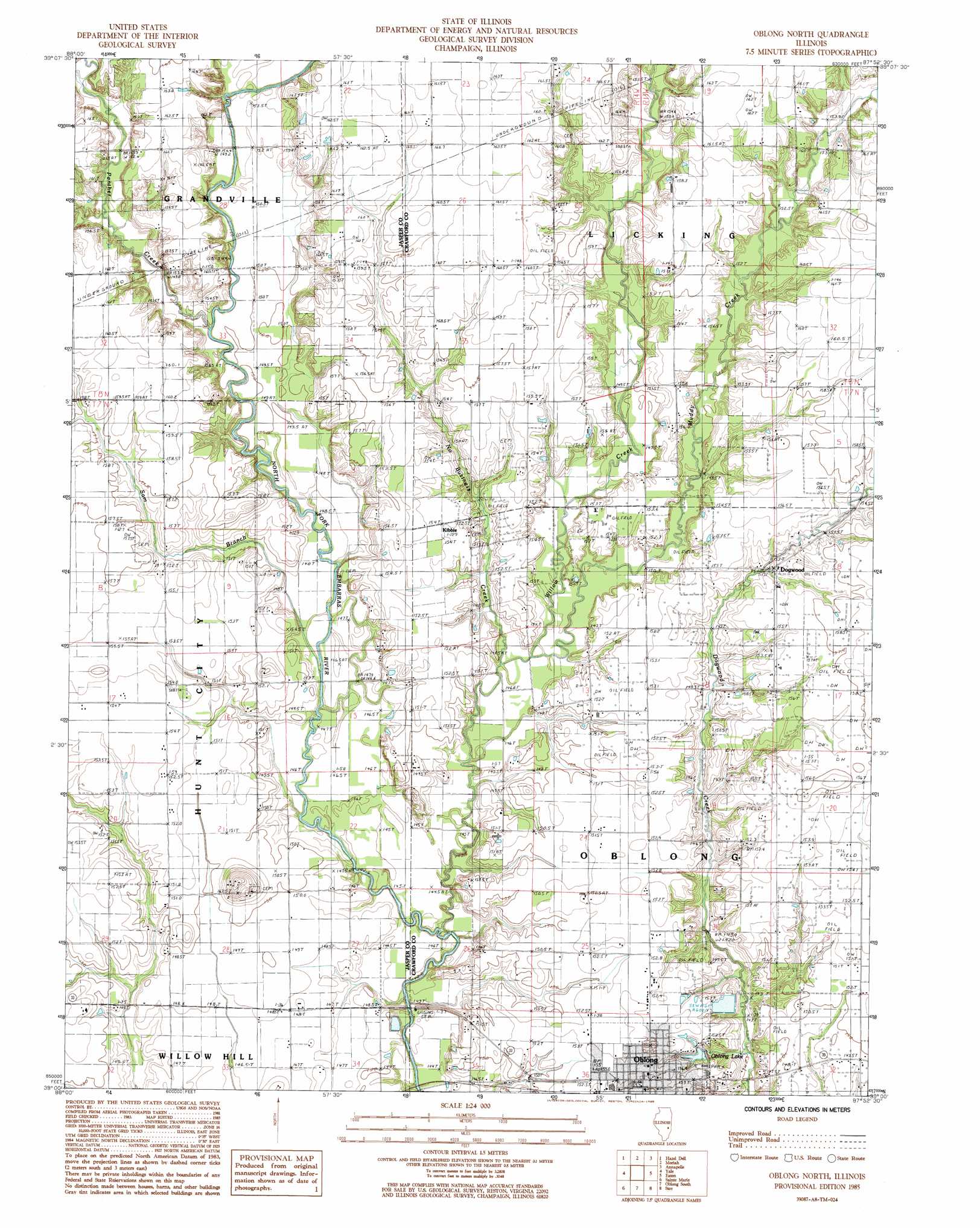
USGS Topo Quad 39087a8 - 1:24,000 scale
| Topo Map Name: | Oblong North |
| USGS Topo Quad ID: | 39087a8 |
| Print Size: | ca. 21 1/4" wide x 27" high |
| Southeast Coordinates: | 39° N latitude / 87.875° W longitude |
| Map Center Coordinates: | 39.0625° N latitude / 87.9375° W longitude |
| U.S. State: | IL |
| Filename: | o39087a8.jpg |
| Download Map JPG Image: | Oblong North topo map 1:24,000 scale |
| Map Type: | Topographic |
| Topo Series: | 7.5´ |
| Map Scale: | 1:24,000 |
| Source of Map Images: | United States Geological Survey (USGS) |
| Alternate Map Versions: |
Oblong North IL 1985, updated 1985 Download PDF Buy paper map Oblong North IL 1998, updated 2002 Download PDF Buy paper map Oblong North IL 2012 Download PDF Buy paper map Oblong North IL 2015 Download PDF Buy paper map |
1:24,000 Topo Quads surrounding Oblong North
Toledo |
Union Center |
Casey |
Clark Center |
Snyder |
Greenup |
Hazel Dell |
Moriah |
Annapolis |
West Union |
Rose Hill |
Yale |
Oblong North |
Eaton |
Hutsonville |
Newton |
Sainte Marie |
Oblong South |
Stoy |
Flat Rock |
Wakefield |
Dundas |
Landes |
Chauncey |
Birds |
> Back to 39087a1 at 1:100,000 scale
> Back to 39086a1 at 1:250,000 scale
> Back to U.S. Topo Maps home
Oblong North topo map: Gazetteer
Oblong North: Lakes
Oblong Lake elevation 149m 488′Oblong North: Populated Places
Dogwood elevation 152m 498′Kibbie elevation 153m 501′
Oblong elevation 156m 511′
Oblong North: Streams
Muddy Creek elevation 146m 479′No Business Creek elevation 148m 485′
Panther Creek elevation 148m 485′
Sam Branch elevation 146m 479′
Willow Creek elevation 144m 472′
Oblong North digital topo map on disk
Buy this Oblong North topo map showing relief, roads, GPS coordinates and other geographical features, as a high-resolution digital map file on DVD:
Northern Illinois, Northern Indiana & Southwestern Michigan
Buy digital topo maps: Northern Illinois, Northern Indiana & Southwestern Michigan