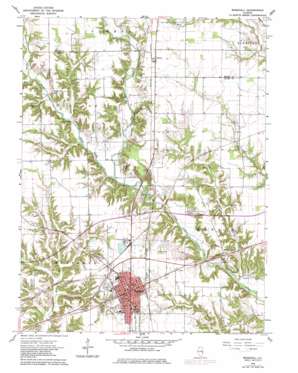
Marshall Topo Map Illinois
To zoom in, hover over the map of Marshall
USGS Topo Quad 39087d6 - 1:24,000 scale
| Topo Map Name: | Marshall |
| USGS Topo Quad ID: | 39087d6 |
| Print Size: | ca. 21 1/4" wide x 27" high |
| Southeast Coordinates: | 39.375° N latitude / 87.625° W longitude |
| Map Center Coordinates: | 39.4375° N latitude / 87.6875° W longitude |
| U.S. State: | IL |
| Filename: | o39087d6.jpg |
| Download Map JPG Image: | Marshall topo map 1:24,000 scale |
| Map Type: | Topographic |
| Topo Series: | 7.5´ |
| Map Scale: | 1:24,000 |
| Source of Map Images: | United States Geological Survey (USGS) |
| Alternate Map Versions: |
Marshall IL 1964, updated 1965 Download PDF Buy paper map Marshall IL 1964, updated 1979 Download PDF Buy paper map Marshall IL 2012 Download PDF Buy paper map Marshall IL 2015 Download PDF Buy paper map |
1:24,000 Topo Quads surrounding Marshall
> Back to 39087a1 at 1:100,000 scale
> Back to 39086a1 at 1:250,000 scale
> Back to U.S. Topo Maps home
Marshall topo map: Gazetteer
Marshall: Airports
Kibler Airport elevation 177m 580′Marshall: Crossings
Blizzard Ford elevation 156m 511′Interchange 147 elevation 190m 623′
Vandalia Crossing elevation 179m 587′
Marshall: Dams
Mill Creek Structure Number 3 Dam elevation 163m 534′Marshall: Parks
Clark County Fairgrounds elevation 189m 620′Marshall: Populated Places
Castle Fin elevation 192m 629′Fox Run elevation 181m 593′
Golf Lakes elevation 180m 590′
Griffin (historical) elevation 177m 580′
Livingston elevation 178m 583′
Marshall elevation 194m 636′
Oakcrest elevation 181m 593′
Oliver elevation 192m 629′
Marshall: Post Offices
Marshall Post Office elevation 195m 639′Marshall: Reservoirs
Mill Creek Watershed Impoundment Reservoir elevation 163m 534′Marshall: Streams
East Fork Big Creek elevation 159m 521′East Little Creek elevation 146m 479′
Flemington Creek elevation 170m 557′
West Fork Big Creek elevation 159m 521′
Marshall: Trails
Lincoln Heritage Trail elevation 184m 603′Marshall digital topo map on disk
Buy this Marshall topo map showing relief, roads, GPS coordinates and other geographical features, as a high-resolution digital map file on DVD:
Northern Illinois, Northern Indiana & Southwestern Michigan
Buy digital topo maps: Northern Illinois, Northern Indiana & Southwestern Michigan


