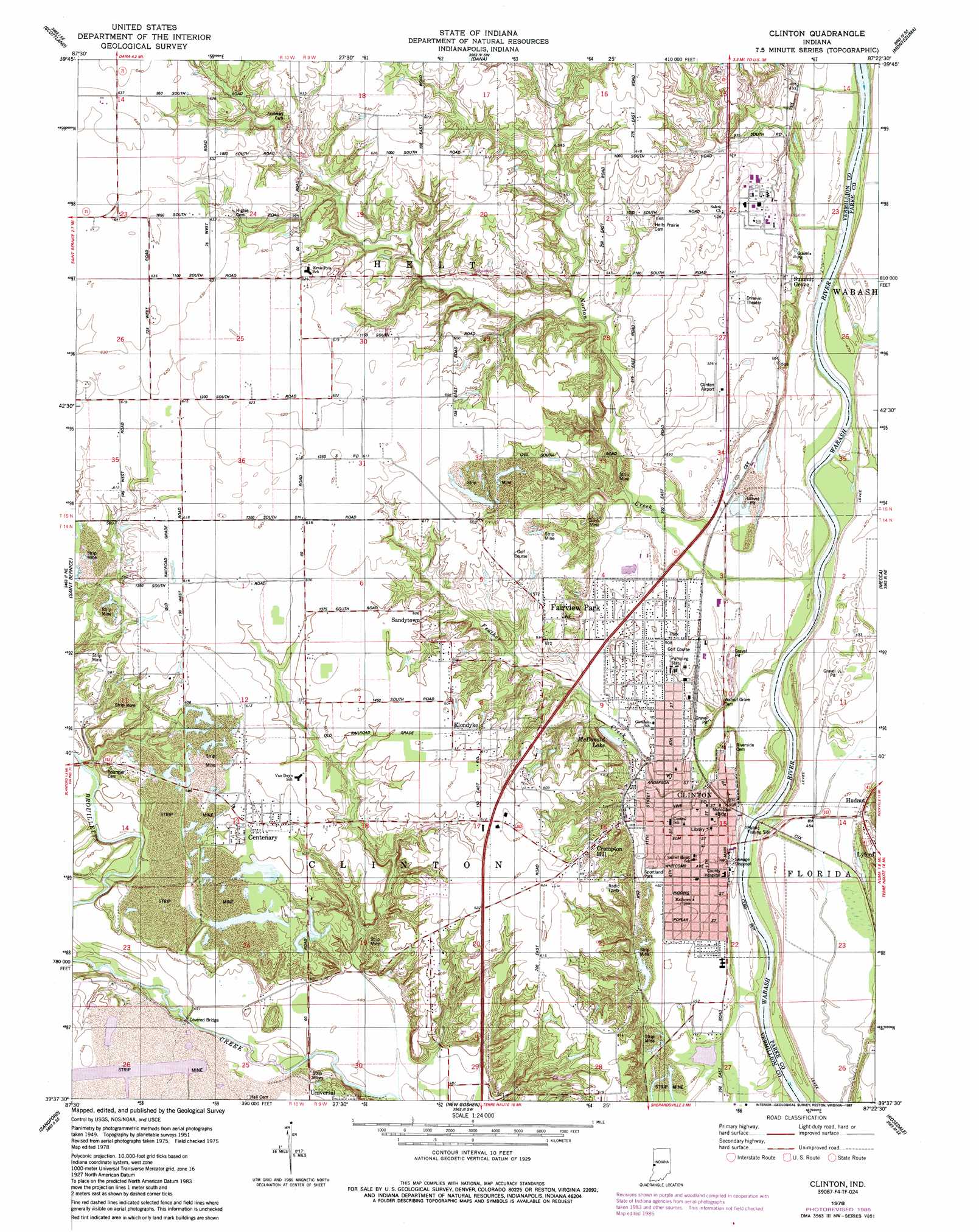
Clinton Topo Map Indiana
To zoom in, hover over the map of Clinton
USGS Topo Quad 39087f4 - 1:24,000 scale
| Topo Map Name: | Clinton |
| USGS Topo Quad ID: | 39087f4 |
| Print Size: | ca. 21 1/4" wide x 27" high |
| Southeast Coordinates: | 39.625° N latitude / 87.375° W longitude |
| Map Center Coordinates: | 39.6875° N latitude / 87.4375° W longitude |
| U.S. State: | IN |
| Filename: | o39087f4.jpg |
| Download Map JPG Image: | Clinton topo map 1:24,000 scale |
| Map Type: | Topographic |
| Topo Series: | 7.5´ |
| Map Scale: | 1:24,000 |
| Source of Map Images: | United States Geological Survey (USGS) |
| Alternate Map Versions: |
Clinton IN 1951, updated 1953 Download PDF Buy paper map Clinton IN 1951, updated 1966 Download PDF Buy paper map Clinton IN 1978, updated 1979 Download PDF Buy paper map Clinton IN 1978, updated 1987 Download PDF Buy paper map Clinton IN 2010 Download PDF Buy paper map Clinton IN 2013 Download PDF Buy paper map Clinton IN 2016 Download PDF Buy paper map |
1:24,000 Topo Quads surrounding Clinton
Georgetown |
Humrick |
Newport |
Kingman |
Wallace |
Chrisman |
Scottland |
Dana |
Montezuma |
Rockville |
Paris North |
Saint Bernice |
Clinton |
Mecca |
Catlin |
Paris South |
Sandford |
New Goshen |
Rosedale |
Brazil West |
Marshall |
Dennison |
Terre Haute |
Seelyville |
Staunton |
> Back to 39087e1 at 1:100,000 scale
> Back to 39086a1 at 1:250,000 scale
> Back to U.S. Topo Maps home
Clinton topo map: Gazetteer
Clinton: Airports
Clinton Airport elevation 161m 528′Clinton: Lakes
McDonald Lake elevation 152m 498′Clinton: Parks
Sportland Park elevation 149m 488′Clinton: Populated Places
Centenary elevation 185m 606′Clinton elevation 152m 498′
Crompton Hill elevation 187m 613′
Fairview Park elevation 158m 518′
Hudnut elevation 151m 495′
Klondyke elevation 184m 603′
Sandytown elevation 184m 603′
Summit Grove elevation 159m 521′
Clinton: Streams
Feather Creek elevation 144m 472′Norton Creek elevation 145m 475′
Clinton digital topo map on disk
Buy this Clinton topo map showing relief, roads, GPS coordinates and other geographical features, as a high-resolution digital map file on DVD:
Northern Illinois, Northern Indiana & Southwestern Michigan
Buy digital topo maps: Northern Illinois, Northern Indiana & Southwestern Michigan