Saint Bernice Topo Map Illinois
To zoom in, hover over the map of Saint Bernice
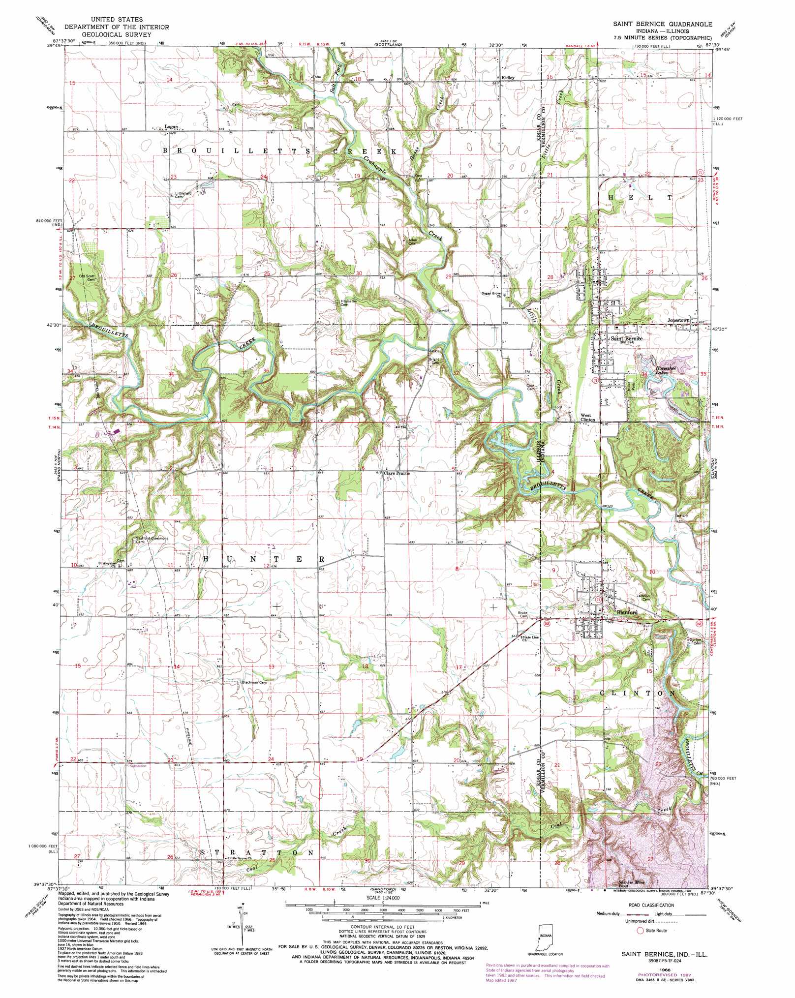
USGS Topo Quad 39087f5 - 1:24,000 scale
| Topo Map Name: | Saint Bernice |
| USGS Topo Quad ID: | 39087f5 |
| Print Size: | ca. 21 1/4" wide x 27" high |
| Southeast Coordinates: | 39.625° N latitude / 87.5° W longitude |
| Map Center Coordinates: | 39.6875° N latitude / 87.5625° W longitude |
| U.S. States: | IL, IN |
| Filename: | o39087f5.jpg |
| Download Map JPG Image: | Saint Bernice topo map 1:24,000 scale |
| Map Type: | Topographic |
| Topo Series: | 7.5´ |
| Map Scale: | 1:24,000 |
| Source of Map Images: | United States Geological Survey (USGS) |
| Alternate Map Versions: |
Saint Bernice IN 1951, updated 1956 Download PDF Buy paper map Saint Bernice IN 1966, updated 1967 Download PDF Buy paper map Saint Bernice IN 1966, updated 1983 Download PDF Buy paper map Saint Bernice IN 1966, updated 1987 Download PDF Buy paper map Saint Bernice IN 2011 Download PDF Buy paper map Saint Bernice IN 2013 Download PDF Buy paper map Saint Bernice IN 2016 Download PDF Buy paper map |
1:24,000 Topo Quads surrounding Saint Bernice
Sidell |
Georgetown |
Humrick |
Newport |
Kingman |
Hume |
Chrisman |
Scottland |
Dana |
Montezuma |
Redmon |
Paris North |
Saint Bernice |
Clinton |
Mecca |
Grandview |
Paris South |
Sandford |
New Goshen |
Rosedale |
Clarksville |
Marshall |
Dennison |
Terre Haute |
Seelyville |
> Back to 39087e1 at 1:100,000 scale
> Back to 39086a1 at 1:250,000 scale
> Back to U.S. Topo Maps home
Saint Bernice topo map: Gazetteer
Saint Bernice: Lakes
Horseshoe Lakes elevation 186m 610′Saint Bernice: Parks
Miller Park elevation 177m 580′Saint Bernice: Populated Places
Blanford elevation 175m 574′Clays Prairie elevation 186m 610′
Huffmanville elevation 188m 616′
Jonestown elevation 193m 633′
Kidley elevation 187m 613′
Logan elevation 192m 629′
Saint Bernice elevation 176m 577′
West Clinton elevation 177m 580′
Saint Bernice: Reservoirs
Shirkie Mine Pond elevation 178m 583′Saint Bernice: Streams
Coal Creek elevation 151m 495′Coal Creek elevation 151m 495′
Crabapple Creek elevation 159m 521′
Goose Creek elevation 162m 531′
Little Creek elevation 159m 521′
Little Creek elevation 159m 521′
Salt Fork elevation 166m 544′
Saint Bernice digital topo map on disk
Buy this Saint Bernice topo map showing relief, roads, GPS coordinates and other geographical features, as a high-resolution digital map file on DVD:
Northern Illinois, Northern Indiana & Southwestern Michigan
Buy digital topo maps: Northern Illinois, Northern Indiana & Southwestern Michigan