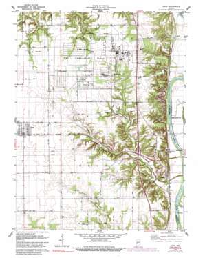
Dana Topo Map Indiana
To zoom in, hover over the map of Dana
USGS Topo Quad 39087g4 - 1:24,000 scale
| Topo Map Name: | Dana |
| USGS Topo Quad ID: | 39087g4 |
| Print Size: | ca. 21 1/4" wide x 27" high |
| Southeast Coordinates: | 39.75° N latitude / 87.375° W longitude |
| Map Center Coordinates: | 39.8125° N latitude / 87.4375° W longitude |
| U.S. State: | IN |
| Filename: | o39087g4.jpg |
| Download Map JPG Image: | Dana topo map 1:24,000 scale |
| Map Type: | Topographic |
| Topo Series: | 7.5´ |
| Map Scale: | 1:24,000 |
| Source of Map Images: | United States Geological Survey (USGS) |
| Alternate Map Versions: |
Dana IN 1955, updated 1957 Download PDF Buy paper map Dana IN 1955, updated 1972 Download PDF Buy paper map Dana IN 1978, updated 1981 Download PDF Buy paper map Dana IN 1978, updated 1990 Download PDF Buy paper map Dana IN 1978, updated 1990 Download PDF Buy paper map Dana IN 2010 Download PDF Buy paper map Dana IN 2013 Download PDF Buy paper map Dana IN 2016 Download PDF Buy paper map |
1:24,000 Topo Quads surrounding Dana
> Back to 39087e1 at 1:100,000 scale
> Back to 39086a1 at 1:250,000 scale
> Back to U.S. Topo Maps home
Dana topo map: Gazetteer
Dana: Dams
Shell Lake Dam elevation 168m 551′Dana: Parks
Ernie Pyle Rest Park elevation 192m 629′Dana: Populated Places
Alta elevation 153m 501′Bono elevation 194m 636′
Dana elevation 195m 639′
Early Station elevation 155m 508′
Highland elevation 191m 626′
Hillsdale elevation 190m 623′
Montezuma Station elevation 151m 495′
Toronto elevation 194m 636′
Dana: Reservoirs
Shell Lake elevation 168m 551′Dana: Streams
Big Raccoon Creek elevation 144m 472′Buck Creek elevation 153m 501′
Little Raccoon Creek elevation 143m 469′
Dana digital topo map on disk
Buy this Dana topo map showing relief, roads, GPS coordinates and other geographical features, as a high-resolution digital map file on DVD:
Northern Illinois, Northern Indiana & Southwestern Michigan
Buy digital topo maps: Northern Illinois, Northern Indiana & Southwestern Michigan


