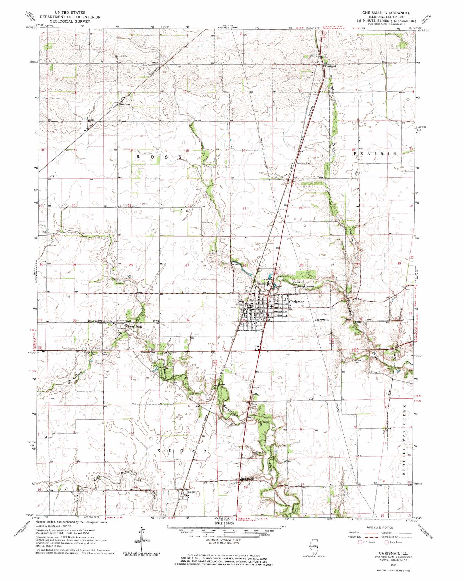
Chrisman Topo Map Illinois
To zoom in, hover over the map of Chrisman
USGS Topo Quad 39087g6 - 1:24,000 scale
| Topo Map Name: | Chrisman |
| USGS Topo Quad ID: | 39087g6 |
| Print Size: | ca. 21 1/4" wide x 27" high |
| Southeast Coordinates: | 39.75° N latitude / 87.625° W longitude |
| Map Center Coordinates: | 39.8125° N latitude / 87.6875° W longitude |
| U.S. State: | IL |
| Filename: | o39087g6.jpg |
| Download Map JPG Image: | Chrisman topo map 1:24,000 scale |
| Map Type: | Topographic |
| Topo Series: | 7.5´ |
| Map Scale: | 1:24,000 |
| Source of Map Images: | United States Geological Survey (USGS) |
| Alternate Map Versions: |
Chrisman IL 1966, updated 1967 Download PDF Buy paper map Chrisman IL 1998, updated 2002 Download PDF Buy paper map Chrisman IL 2012 Download PDF Buy paper map Chrisman IL 2015 Download PDF Buy paper map |
1:24,000 Topo Quads surrounding Chrisman
Homer |
Oakwood |
Danville Sw |
Danville Se |
Perrysville |
Allerton |
Sidell |
Georgetown |
Humrick |
Newport |
Newman |
Hume |
Chrisman |
Scottland |
Dana |
Brocton |
Redmon |
Paris North |
Saint Bernice |
Clinton |
Kansas |
Grandview |
Paris South |
Sandford |
New Goshen |
> Back to 39087e1 at 1:100,000 scale
> Back to 39086a1 at 1:250,000 scale
> Back to U.S. Topo Maps home
Chrisman topo map: Gazetteer
Chrisman: Parks
Four-H Club Fairgrounds elevation 199m 652′Chrisman: Populated Places
Bloomfield elevation 194m 636′Cherry Point elevation 199m 652′
Chrisman elevation 196m 643′
Edgar elevation 198m 649′
Mortimer elevation 214m 702′
Scotts elevation 200m 656′
Woodyard elevation 205m 672′
Chrisman: Post Offices
Chrisman Post Office elevation 198m 649′Chrisman digital topo map on disk
Buy this Chrisman topo map showing relief, roads, GPS coordinates and other geographical features, as a high-resolution digital map file on DVD:
Northern Illinois, Northern Indiana & Southwestern Michigan
Buy digital topo maps: Northern Illinois, Northern Indiana & Southwestern Michigan