Sidell Topo Map Illinois
To zoom in, hover over the map of Sidell
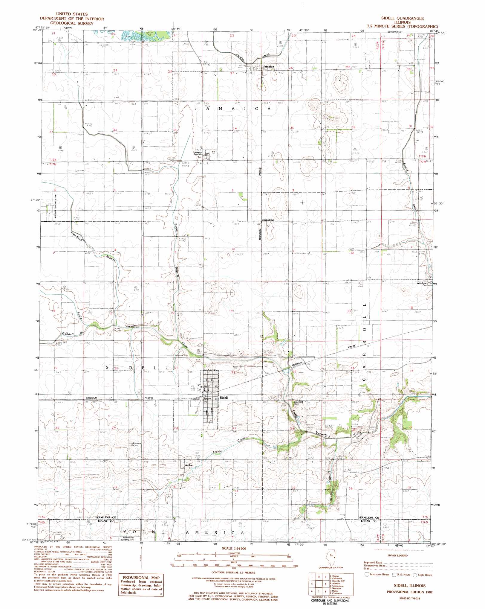
USGS Topo Quad 39087h7 - 1:24,000 scale
| Topo Map Name: | Sidell |
| USGS Topo Quad ID: | 39087h7 |
| Print Size: | ca. 21 1/4" wide x 27" high |
| Southeast Coordinates: | 39.875° N latitude / 87.75° W longitude |
| Map Center Coordinates: | 39.9375° N latitude / 87.8125° W longitude |
| U.S. State: | IL |
| Filename: | o39087h7.jpg |
| Download Map JPG Image: | Sidell topo map 1:24,000 scale |
| Map Type: | Topographic |
| Topo Series: | 7.5´ |
| Map Scale: | 1:24,000 |
| Source of Map Images: | United States Geological Survey (USGS) |
| Alternate Map Versions: |
Sidell IL 1982, updated 1983 Download PDF Buy paper map Sidell IL 1998, updated 2002 Download PDF Buy paper map Sidell IL 2012 Download PDF Buy paper map Sidell IL 2015 Download PDF Buy paper map |
1:24,000 Topo Quads surrounding Sidell
Flatville |
Royal |
Collison |
Danville Nw |
Danville Ne |
Saint Joseph |
Homer |
Oakwood |
Danville Sw |
Danville Se |
Longview |
Allerton |
Sidell |
Georgetown |
Humrick |
Murdock |
Newman |
Hume |
Chrisman |
Scottland |
Oakland |
Brocton |
Redmon |
Paris North |
Saint Bernice |
> Back to 39087e1 at 1:100,000 scale
> Back to 39086a1 at 1:250,000 scale
> Back to U.S. Topo Maps home
Sidell topo map: Gazetteer
Sidell: Airports
Hildreth Air Park elevation 221m 725′Maddox Airport elevation 207m 679′
Sidell: Populated Places
Archie elevation 212m 695′Jamaica elevation 206m 675′
Maizetown elevation 208m 682′
Sidell elevation 208m 682′
Sidell: Streams
Archie Creek elevation 195m 639′Baum Branch elevation 198m 649′
Dillon Branch elevation 195m 639′
Freedwell Branch elevation 198m 649′
Goodall Branch elevation 199m 652′
Sidell digital topo map on disk
Buy this Sidell topo map showing relief, roads, GPS coordinates and other geographical features, as a high-resolution digital map file on DVD:
Northern Illinois, Northern Indiana & Southwestern Michigan
Buy digital topo maps: Northern Illinois, Northern Indiana & Southwestern Michigan