Wheeler Topo Map Illinois
To zoom in, hover over the map of Wheeler
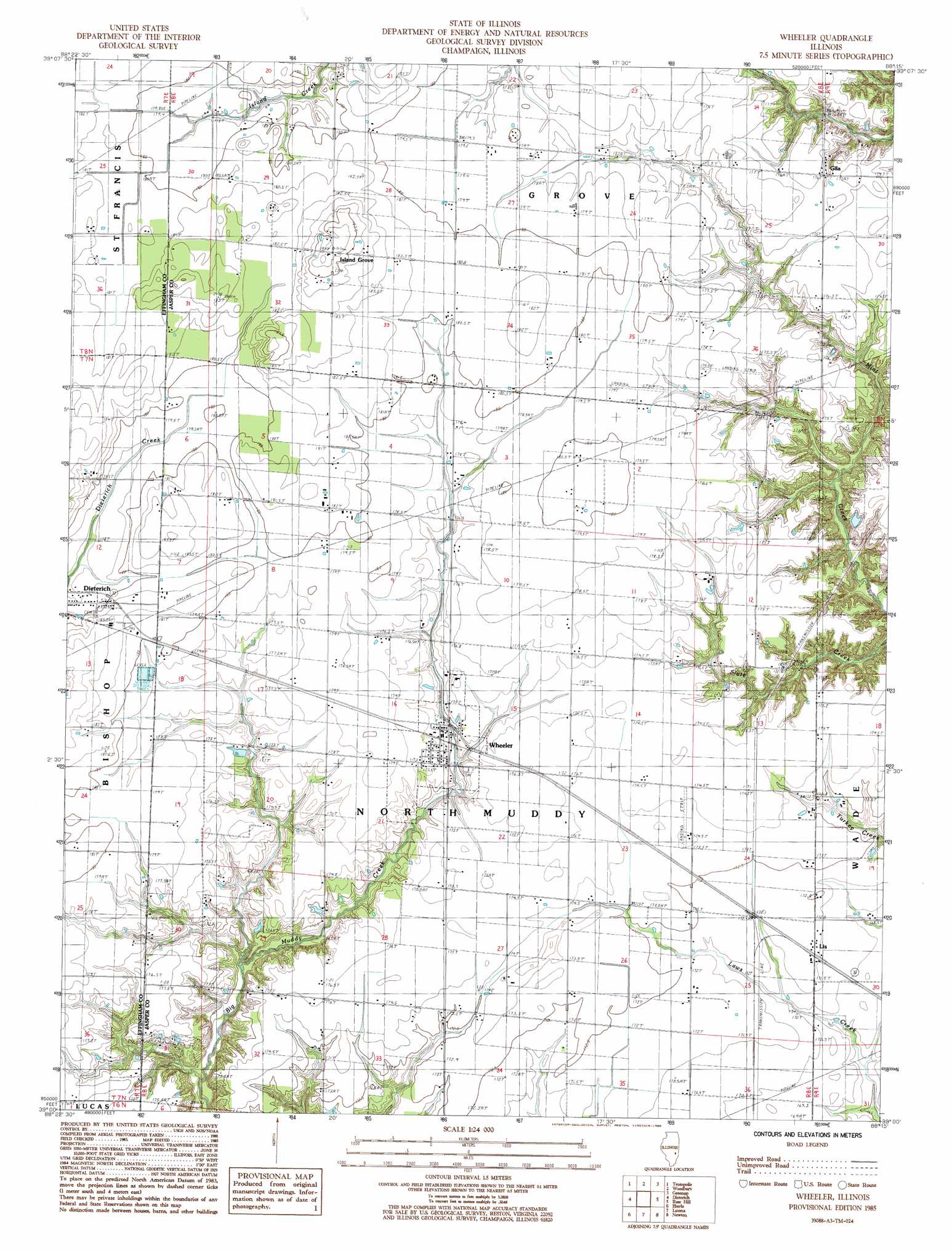
USGS Topo Quad 39088a3 - 1:24,000 scale
| Topo Map Name: | Wheeler |
| USGS Topo Quad ID: | 39088a3 |
| Print Size: | ca. 21 1/4" wide x 27" high |
| Southeast Coordinates: | 39° N latitude / 88.25° W longitude |
| Map Center Coordinates: | 39.0625° N latitude / 88.3125° W longitude |
| U.S. State: | IL |
| Filename: | o39088a3.jpg |
| Download Map JPG Image: | Wheeler topo map 1:24,000 scale |
| Map Type: | Topographic |
| Topo Series: | 7.5´ |
| Map Scale: | 1:24,000 |
| Source of Map Images: | United States Geological Survey (USGS) |
| Alternate Map Versions: |
Wheeler IL 1985, updated 1985 Download PDF Buy paper map Wheeler IL 2012 Download PDF Buy paper map Wheeler IL 2015 Download PDF Buy paper map |
1:24,000 Topo Quads surrounding Wheeler
Stewardson East |
Neoga |
Johnstown |
Toledo |
Union Center |
Effingham North |
Teutopolis |
Woodbury |
Greenup |
Hazel Dell |
Effingham South |
Dieterich |
Wheeler |
Rose Hill |
Yale |
Hord |
Eberle |
Latona |
Newton |
Sainte Marie |
Louisville West |
Louisville East |
Sailor Springs |
Wakefield |
Dundas |
> Back to 39088a1 at 1:100,000 scale
> Back to 39088a1 at 1:250,000 scale
> Back to U.S. Topo Maps home
Wheeler topo map: Gazetteer
Wheeler: Airports
Isley Airport elevation 178m 583′Wheeler: Populated Places
Gila elevation 175m 574′Island Grove elevation 189m 620′
Lis elevation 171m 561′
Wheeler elevation 172m 564′
Wheeler: Post Offices
Linder Post Office (historical) elevation 172m 564′Wheeler Post Office elevation 173m 567′
Wheeler digital topo map on disk
Buy this Wheeler topo map showing relief, roads, GPS coordinates and other geographical features, as a high-resolution digital map file on DVD:
Northern Illinois, Northern Indiana & Southwestern Michigan
Buy digital topo maps: Northern Illinois, Northern Indiana & Southwestern Michigan