Altamont West Topo Map Illinois
To zoom in, hover over the map of Altamont West
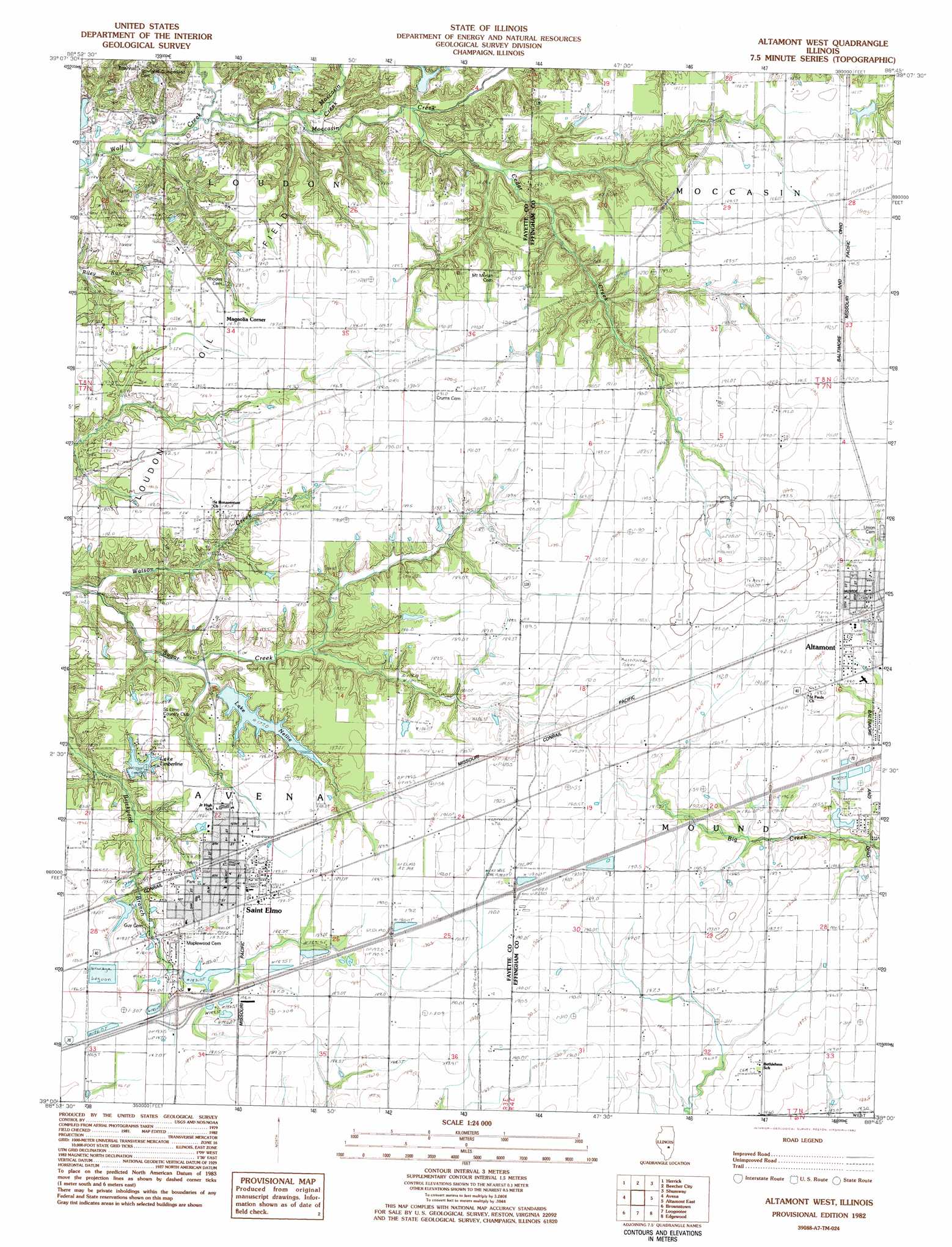
USGS Topo Quad 39088a7 - 1:24,000 scale
| Topo Map Name: | Altamont West |
| USGS Topo Quad ID: | 39088a7 |
| Print Size: | ca. 21 1/4" wide x 27" high |
| Southeast Coordinates: | 39° N latitude / 88.75° W longitude |
| Map Center Coordinates: | 39.0625° N latitude / 88.8125° W longitude |
| U.S. State: | IL |
| Filename: | o39088a7.jpg |
| Download Map JPG Image: | Altamont West topo map 1:24,000 scale |
| Map Type: | Topographic |
| Topo Series: | 7.5´ |
| Map Scale: | 1:24,000 |
| Source of Map Images: | United States Geological Survey (USGS) |
| Alternate Map Versions: |
Altamont West IL 1982, updated 1982 Download PDF Buy paper map Altamont West IL 1998, updated 2003 Download PDF Buy paper map Altamont West IL 2012 Download PDF Buy paper map Altamont West IL 2015 Download PDF Buy paper map |
1:24,000 Topo Quads surrounding Altamont West
Oconee |
Lakewood |
Fancher |
Stewardson West |
Stewardson East |
Ramsey |
Herrick |
Beecher City |
Shumway |
Effingham North |
Vera |
Avena |
Altamont West |
Altamont East |
Effingham South |
Vandalia |
Brownstown |
Loogootee |
Edgewood |
Hord |
Patoka |
Saint Paul |
Kinmundy |
Oskaloosa |
Louisville West |
> Back to 39088a1 at 1:100,000 scale
> Back to 39088a1 at 1:250,000 scale
> Back to U.S. Topo Maps home
Altamont West topo map: Gazetteer
Altamont West: Crossings
Interchange 76 elevation 189m 620′Altamont West: Dams
Bails Timberline Lake Dam elevation 178m 583′Lake Nellie Dam elevation 177m 580′
Saint Elmo Old City Reservoir Dam elevation 185m 606′
Altamont West: Parks
Rock Cave Nature Preserve elevation 179m 587′Altamont West: Populated Places
Howards Point (historical) elevation 184m 603′Magnolia Corner elevation 183m 600′
Saint Elmo elevation 189m 620′
Altamont West: Reservoirs
Bails Timberline Lake elevation 178m 583′Lake Nellie elevation 177m 580′
Lake Nellie elevation 177m 580′
Lake Timberland elevation 178m 583′
Saint Elmo Old City Reservoir elevation 185m 606′
Altamont West: Streams
Cedar Creek elevation 164m 538′Little Moccasin Creek elevation 161m 528′
Moccasin Creek elevation 159m 521′
Sugar Creek elevation 164m 538′
Altamont West digital topo map on disk
Buy this Altamont West topo map showing relief, roads, GPS coordinates and other geographical features, as a high-resolution digital map file on DVD:
Northern Illinois, Northern Indiana & Southwestern Michigan
Buy digital topo maps: Northern Illinois, Northern Indiana & Southwestern Michigan