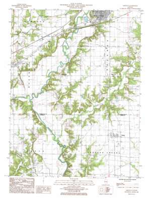
Greenup Topo Map Illinois
To zoom in, hover over the map of Greenup
USGS Topo Quad 39088b2 - 1:24,000 scale
| Topo Map Name: | Greenup |
| USGS Topo Quad ID: | 39088b2 |
| Print Size: | ca. 21 1/4" wide x 27" high |
| Southeast Coordinates: | 39.125° N latitude / 88.125° W longitude |
| Map Center Coordinates: | 39.1875° N latitude / 88.1875° W longitude |
| U.S. State: | IL |
| Filename: | o39088b2.jpg |
| Download Map JPG Image: | Greenup topo map 1:24,000 scale |
| Map Type: | Topographic |
| Topo Series: | 7.5´ |
| Map Scale: | 1:24,000 |
| Source of Map Images: | United States Geological Survey (USGS) |
| Alternate Map Versions: |
Greenup IL 1985, updated 1985 Download PDF Buy paper map Greenup IL 1998, updated 2002 Download PDF Buy paper map Greenup IL 2012 Download PDF Buy paper map Greenup IL 2015 Download PDF Buy paper map |
1:24,000 Topo Quads surrounding Greenup
> Back to 39088a1 at 1:100,000 scale
> Back to 39088a1 at 1:250,000 scale
> Back to U.S. Topo Maps home
Greenup topo map: Gazetteer
Greenup: Crossings
Cherwood Ford elevation 155m 508′Greenup: Parks
Greenup Commercial Historic District elevation 181m 593′Greenup: Populated Places
Dees elevation 182m 597′Greenup elevation 181m 593′
Hidalgo elevation 177m 580′
Jewett elevation 178m 583′
Liberty Hill elevation 179m 587′
Walla Walla elevation 179m 587′
Greenup: Post Offices
Greenup Post Office elevation 181m 593′Hidalgo Post Office elevation 177m 580′
Jewett Post Office elevation 177m 580′
Greenup: Streams
Bruce Creek elevation 155m 508′Muddy Creek elevation 152m 498′
Range Creek elevation 152m 498′
Greenup digital topo map on disk
Buy this Greenup topo map showing relief, roads, GPS coordinates and other geographical features, as a high-resolution digital map file on DVD:
Northern Illinois, Northern Indiana & Southwestern Michigan
Buy digital topo maps: Northern Illinois, Northern Indiana & Southwestern Michigan


