Shumway Topo Map Illinois
To zoom in, hover over the map of Shumway
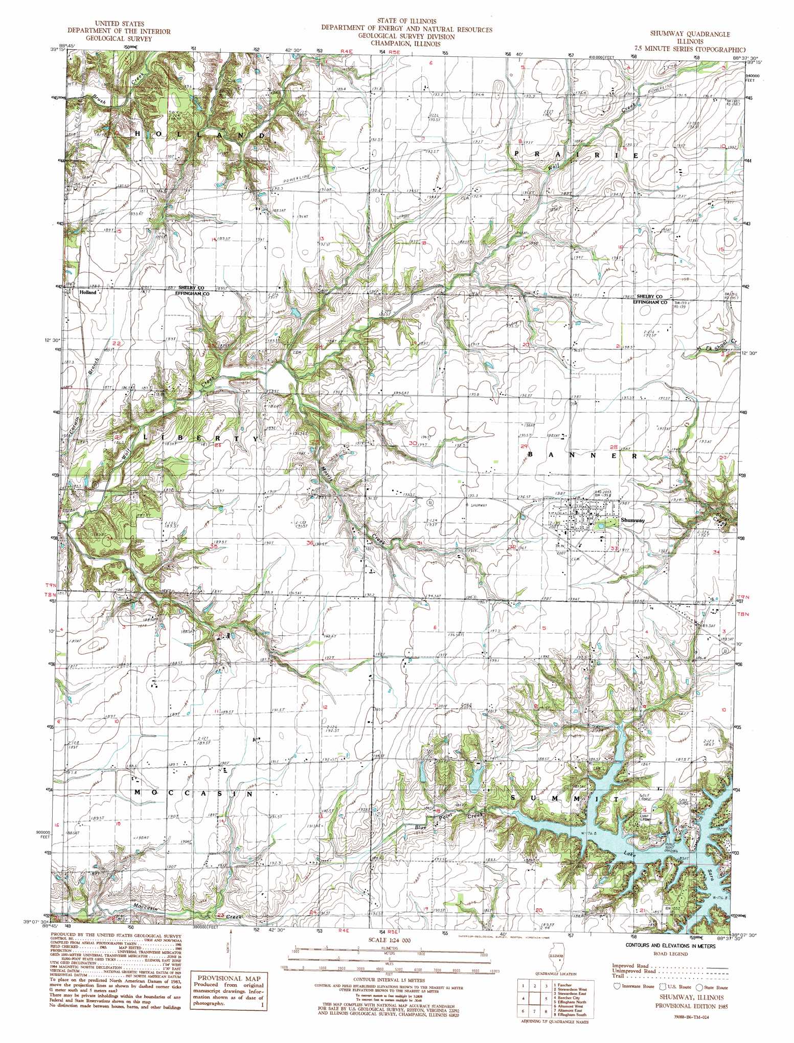
USGS Topo Quad 39088b6 - 1:24,000 scale
| Topo Map Name: | Shumway |
| USGS Topo Quad ID: | 39088b6 |
| Print Size: | ca. 21 1/4" wide x 27" high |
| Southeast Coordinates: | 39.125° N latitude / 88.625° W longitude |
| Map Center Coordinates: | 39.1875° N latitude / 88.6875° W longitude |
| U.S. State: | IL |
| Filename: | o39088b6.jpg |
| Download Map JPG Image: | Shumway topo map 1:24,000 scale |
| Map Type: | Topographic |
| Topo Series: | 7.5´ |
| Map Scale: | 1:24,000 |
| Source of Map Images: | United States Geological Survey (USGS) |
| Alternate Map Versions: |
Shumway IL 1985, updated 1985 Download PDF Buy paper map Shumway IL 1998, updated 2003 Download PDF Buy paper map Shumway IL 2012 Download PDF Buy paper map Shumway IL 2015 Download PDF Buy paper map |
1:24,000 Topo Quads surrounding Shumway
Tower Hill |
Shelbyville |
Middlesworth |
Windsor |
Mattoon West |
Lakewood |
Fancher |
Stewardson West |
Stewardson East |
Neoga |
Herrick |
Beecher City |
Shumway |
Effingham North |
Teutopolis |
Avena |
Altamont West |
Altamont East |
Effingham South |
Dieterich |
Brownstown |
Loogootee |
Edgewood |
Hord |
Eberle |
> Back to 39088a1 at 1:100,000 scale
> Back to 39088a1 at 1:250,000 scale
> Back to U.S. Topo Maps home
Shumway topo map: Gazetteer
Shumway: Populated Places
Holland elevation 186m 610′Shumway elevation 200m 656′
Shumway: Post Offices
Brush Creek Post Office (historical) elevation 189m 620′Shumway: Streams
Morris Creek elevation 176m 577′Shumway digital topo map on disk
Buy this Shumway topo map showing relief, roads, GPS coordinates and other geographical features, as a high-resolution digital map file on DVD:
Northern Illinois, Northern Indiana & Southwestern Michigan
Buy digital topo maps: Northern Illinois, Northern Indiana & Southwestern Michigan