Fancher Topo Map Illinois
To zoom in, hover over the map of Fancher
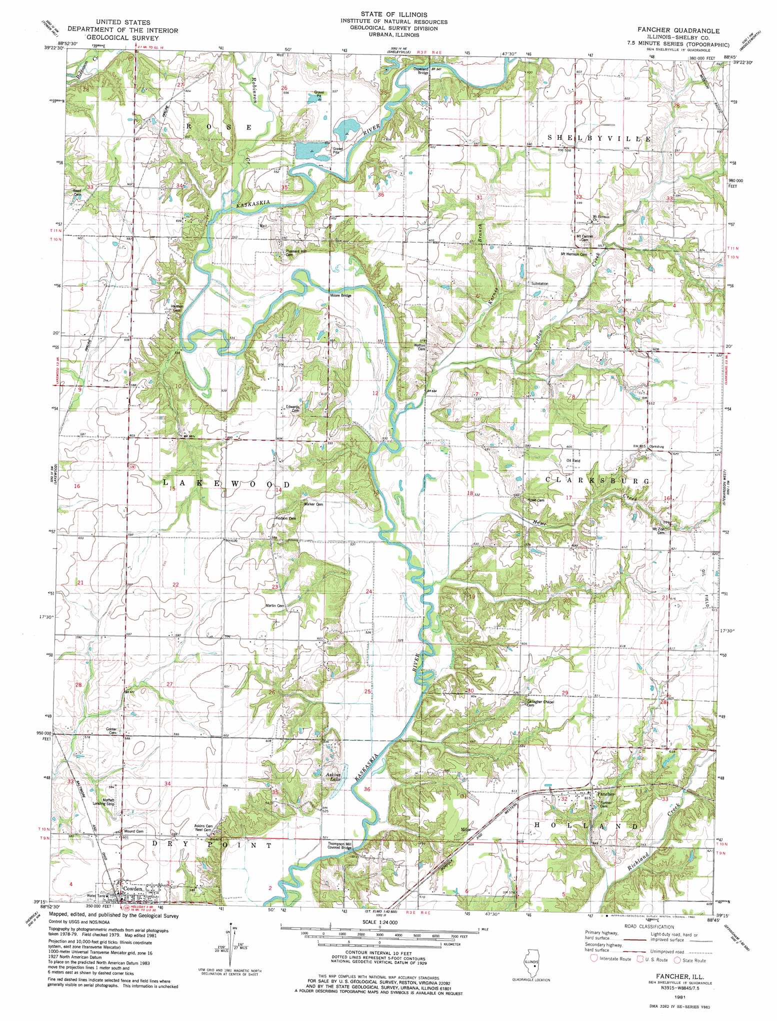
USGS Topo Quad 39088c7 - 1:24,000 scale
| Topo Map Name: | Fancher |
| USGS Topo Quad ID: | 39088c7 |
| Print Size: | ca. 21 1/4" wide x 27" high |
| Southeast Coordinates: | 39.25° N latitude / 88.75° W longitude |
| Map Center Coordinates: | 39.3125° N latitude / 88.8125° W longitude |
| U.S. State: | IL |
| Filename: | o39088c7.jpg |
| Download Map JPG Image: | Fancher topo map 1:24,000 scale |
| Map Type: | Topographic |
| Topo Series: | 7.5´ |
| Map Scale: | 1:24,000 |
| Source of Map Images: | United States Geological Survey (USGS) |
| Alternate Map Versions: |
Fancher IL 1981, updated 1982 Download PDF Buy paper map Fancher IL 1998, updated 2003 Download PDF Buy paper map Fancher IL 2012 Download PDF Buy paper map Fancher IL 2015 Download PDF Buy paper map |
1:24,000 Topo Quads surrounding Fancher
Assumption |
Obed |
Findlay |
Kirksville |
Sullivan |
Pana |
Tower Hill |
Shelbyville |
Middlesworth |
Windsor |
Oconee |
Lakewood |
Fancher |
Stewardson West |
Stewardson East |
Ramsey |
Herrick |
Beecher City |
Shumway |
Effingham North |
Vera |
Avena |
Altamont West |
Altamont East |
Effingham South |
> Back to 39088a1 at 1:100,000 scale
> Back to 39088a1 at 1:250,000 scale
> Back to U.S. Topo Maps home
Fancher topo map: Gazetteer
Fancher: Airports
Moffet Landing Strip elevation 180m 590′Fancher: Bridges
Copeland Bridge elevation 164m 538′Moore Bridge elevation 161m 528′
Thompson Mill Covered Bridge elevation 158m 518′
Fancher: Lakes
Askins Lake elevation 161m 528′Fancher: Populated Places
Clarksburg elevation 186m 610′Fancher elevation 186m 610′
Milne elevation 186m 610′
Fancher: Streams
Howe Creek elevation 159m 521′Jordan Creek elevation 161m 528′
Karnes Branch elevation 161m 528′
Opossum Creek elevation 164m 538′
Robinson Creek elevation 162m 531′
Fancher digital topo map on disk
Buy this Fancher topo map showing relief, roads, GPS coordinates and other geographical features, as a high-resolution digital map file on DVD:
Northern Illinois, Northern Indiana & Southwestern Michigan
Buy digital topo maps: Northern Illinois, Northern Indiana & Southwestern Michigan