Middlesworth Topo Map Illinois
To zoom in, hover over the map of Middlesworth
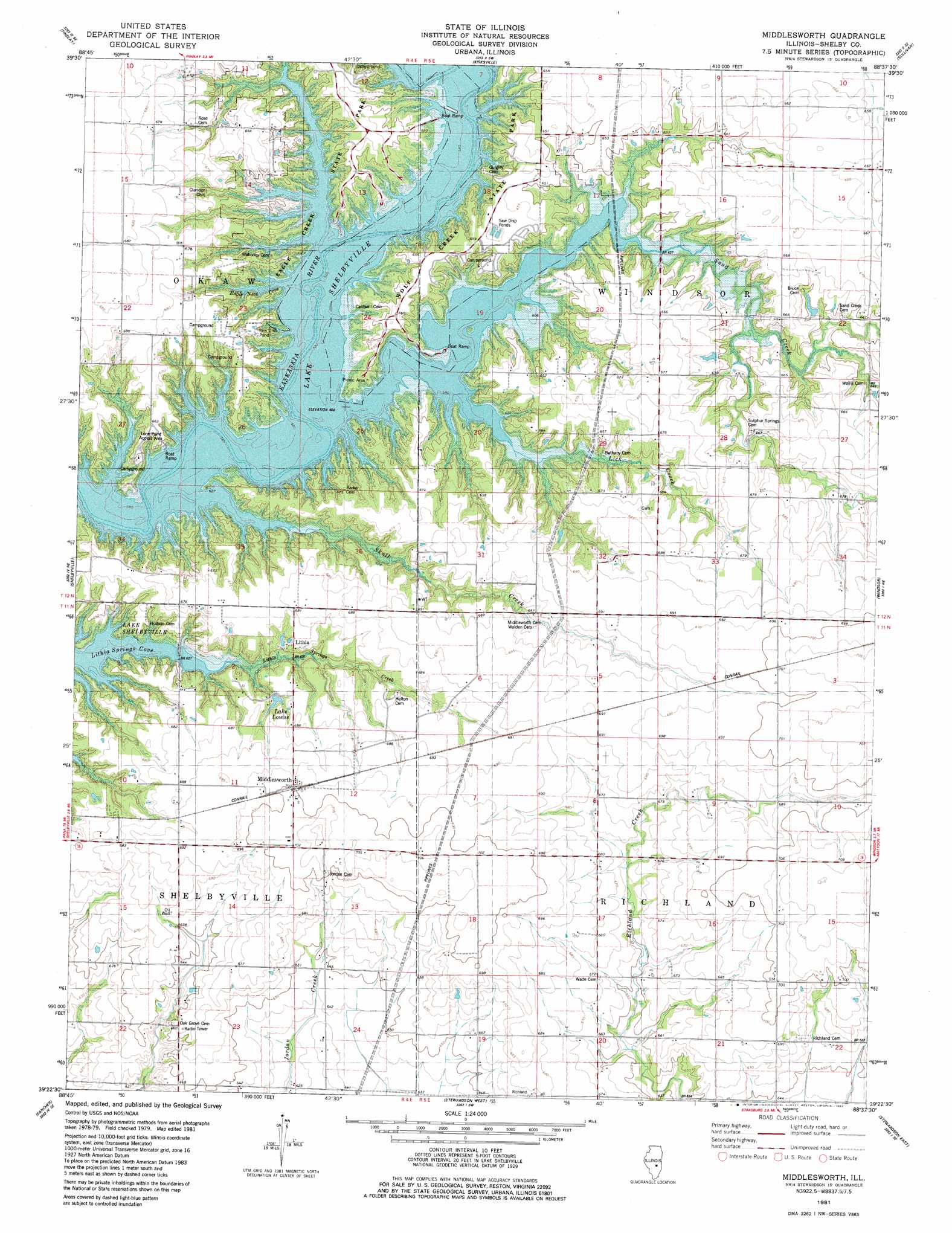
USGS Topo Quad 39088d6 - 1:24,000 scale
| Topo Map Name: | Middlesworth |
| USGS Topo Quad ID: | 39088d6 |
| Print Size: | ca. 21 1/4" wide x 27" high |
| Southeast Coordinates: | 39.375° N latitude / 88.625° W longitude |
| Map Center Coordinates: | 39.4375° N latitude / 88.6875° W longitude |
| U.S. State: | IL |
| Filename: | o39088d6.jpg |
| Download Map JPG Image: | Middlesworth topo map 1:24,000 scale |
| Map Type: | Topographic |
| Topo Series: | 7.5´ |
| Map Scale: | 1:24,000 |
| Source of Map Images: | United States Geological Survey (USGS) |
| Alternate Map Versions: |
Middlesworth IL 1980, updated 1980 Download PDF Buy paper map Middlesworth IL 1981, updated 1982 Download PDF Buy paper map Middlesworth IL 1981, updated 1982 Download PDF Buy paper map Middlesworth IL 1999, updated 2003 Download PDF Buy paper map Middlesworth IL 2012 Download PDF Buy paper map Middlesworth IL 2015 Download PDF Buy paper map |
1:24,000 Topo Quads surrounding Middlesworth
Macon East |
Dalton City |
Lovington |
Cadwell |
Arthur |
Obed |
Findlay |
Kirksville |
Sullivan |
Cooksmill |
Tower Hill |
Shelbyville |
Middlesworth |
Windsor |
Mattoon West |
Lakewood |
Fancher |
Stewardson West |
Stewardson East |
Neoga |
Herrick |
Beecher City |
Shumway |
Effingham North |
Teutopolis |
> Back to 39088a1 at 1:100,000 scale
> Back to 39088a1 at 1:250,000 scale
> Back to U.S. Topo Maps home
Middlesworth topo map: Gazetteer
Middlesworth: Bays
Eagle Nest Cove elevation 183m 600′Middlesworth: Parks
Eagle Creek State Park elevation 199m 652′Lone Point Access Area elevation 197m 646′
Wolf Creek State Park elevation 201m 659′
Middlesworth: Populated Places
Lithia elevation 190m 623′Middlesworth elevation 213m 698′
Middlesworth: Post Offices
Lithia Post Office (historical) elevation 192m 629′Middlesworth: Reservoirs
Lake Louise elevation 200m 656′Middlesworth: Streams
Eagle Creek elevation 183m 600′Lick Creek elevation 183m 600′
Sand Creek elevation 183m 600′
Skull Creek elevation 183m 600′
Middlesworth digital topo map on disk
Buy this Middlesworth topo map showing relief, roads, GPS coordinates and other geographical features, as a high-resolution digital map file on DVD:
Northern Illinois, Northern Indiana & Southwestern Michigan
Buy digital topo maps: Northern Illinois, Northern Indiana & Southwestern Michigan