Tower Hill Topo Map Illinois
To zoom in, hover over the map of Tower Hill
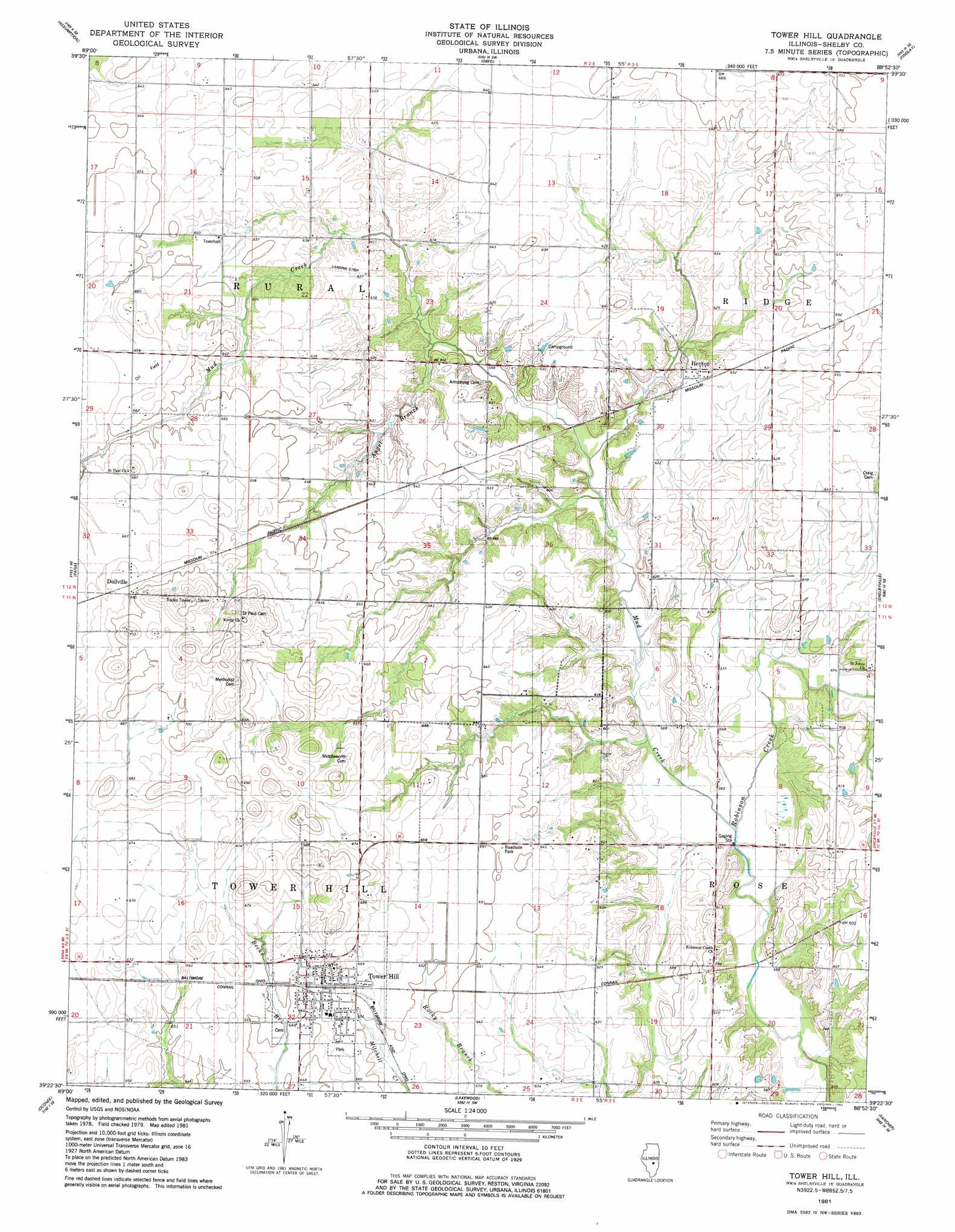
USGS Topo Quad 39088d8 - 1:24,000 scale
| Topo Map Name: | Tower Hill |
| USGS Topo Quad ID: | 39088d8 |
| Print Size: | ca. 21 1/4" wide x 27" high |
| Southeast Coordinates: | 39.375° N latitude / 88.875° W longitude |
| Map Center Coordinates: | 39.4375° N latitude / 88.9375° W longitude |
| U.S. State: | IL |
| Filename: | o39088d8.jpg |
| Download Map JPG Image: | Tower Hill topo map 1:24,000 scale |
| Map Type: | Topographic |
| Topo Series: | 7.5´ |
| Map Scale: | 1:24,000 |
| Source of Map Images: | United States Geological Survey (USGS) |
| Alternate Map Versions: |
Tower Hill IL 1981, updated 1982 Download PDF Buy paper map Tower Hill IL 2012 Download PDF Buy paper map Tower Hill IL 2015 Download PDF Buy paper map |
1:24,000 Topo Quads surrounding Tower Hill
Stonington |
Macon West |
Macon East |
Dalton City |
Lovington |
Willeys |
Assumption |
Obed |
Findlay |
Kirksville |
Owaneco |
Pana |
Tower Hill |
Shelbyville |
Middlesworth |
Ohlman |
Oconee |
Lakewood |
Fancher |
Stewardson West |
Ramsey Lake |
Ramsey |
Herrick |
Beecher City |
Shumway |
> Back to 39088a1 at 1:100,000 scale
> Back to 39088a1 at 1:250,000 scale
> Back to U.S. Topo Maps home
Tower Hill topo map: Gazetteer
Tower Hill: Airports
Stoune RLA Airport elevation 193m 633′Tower Hill: Populated Places
Dollville elevation 209m 685′Henton elevation 189m 620′
Tower Hill elevation 202m 662′
Tower Hill: Streams
Angel Branch elevation 181m 593′Mud Creek elevation 173m 567′
Tower Hill digital topo map on disk
Buy this Tower Hill topo map showing relief, roads, GPS coordinates and other geographical features, as a high-resolution digital map file on DVD:
Northern Illinois, Northern Indiana & Southwestern Michigan
Buy digital topo maps: Northern Illinois, Northern Indiana & Southwestern Michigan