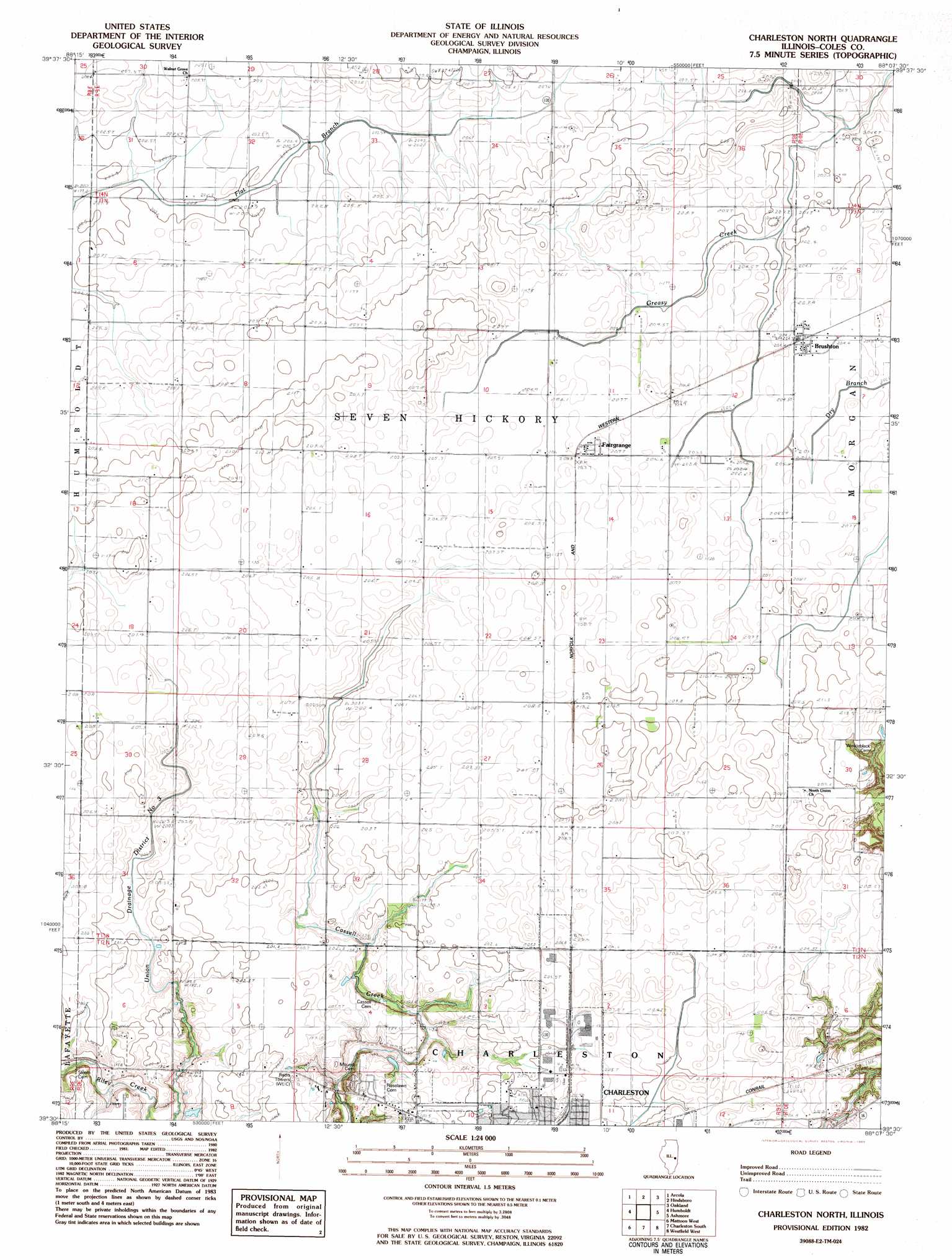
Charleston North Topo Map Illinois
To zoom in, hover over the map of Charleston North
USGS Topo Quad 39088e2 - 1:24,000 scale
| Topo Map Name: | Charleston North |
| USGS Topo Quad ID: | 39088e2 |
| Print Size: | ca. 21 1/4" wide x 27" high |
| Southeast Coordinates: | 39.5° N latitude / 88.125° W longitude |
| Map Center Coordinates: | 39.5625° N latitude / 88.1875° W longitude |
| U.S. State: | IL |
| Filename: | o39088e2.jpg |
| Download Map JPG Image: | Charleston North topo map 1:24,000 scale |
| Map Type: | Topographic |
| Topo Series: | 7.5´ |
| Map Scale: | 1:24,000 |
| Source of Map Images: | United States Geological Survey (USGS) |
| Alternate Map Versions: |
Charleston North IL 1982, updated 1983 Download PDF Buy paper map Charleston North IL 1998, updated 2003 Download PDF Buy paper map Charleston North IL 2012 Download PDF Buy paper map Charleston North IL 2015 Download PDF Buy paper map |
1:24,000 Topo Quads surrounding Charleston North
Atwood |
Tuscola |
Villa Grove |
Murdock |
Newman |
Arthur |
Arcola |
Hindsburg |
Oakland |
Brocton |
Cooksmill |
Humboldt |
Charleston North |
Ashmore |
Kansas |
Mattoon West |
Mattoon East |
Charleston South |
Westfield West |
Westfield East |
Neoga |
Johnstown |
Toledo |
Union Center |
Casey |
> Back to 39088e1 at 1:100,000 scale
> Back to 39088a1 at 1:250,000 scale
> Back to U.S. Topo Maps home
Charleston North topo map: Gazetteer
Charleston North: Canals
Union Drainage District Number 3 elevation 204m 669′Charleston North: Populated Places
Bushton elevation 207m 679′Fairgrange elevation 207m 679′
Charleston North: Post Offices
Bushton Post Office (historical) elevation 207m 679′Charleston North digital topo map on disk
Buy this Charleston North topo map showing relief, roads, GPS coordinates and other geographical features, as a high-resolution digital map file on DVD:
Northern Illinois, Northern Indiana & Southwestern Michigan
Buy digital topo maps: Northern Illinois, Northern Indiana & Southwestern Michigan