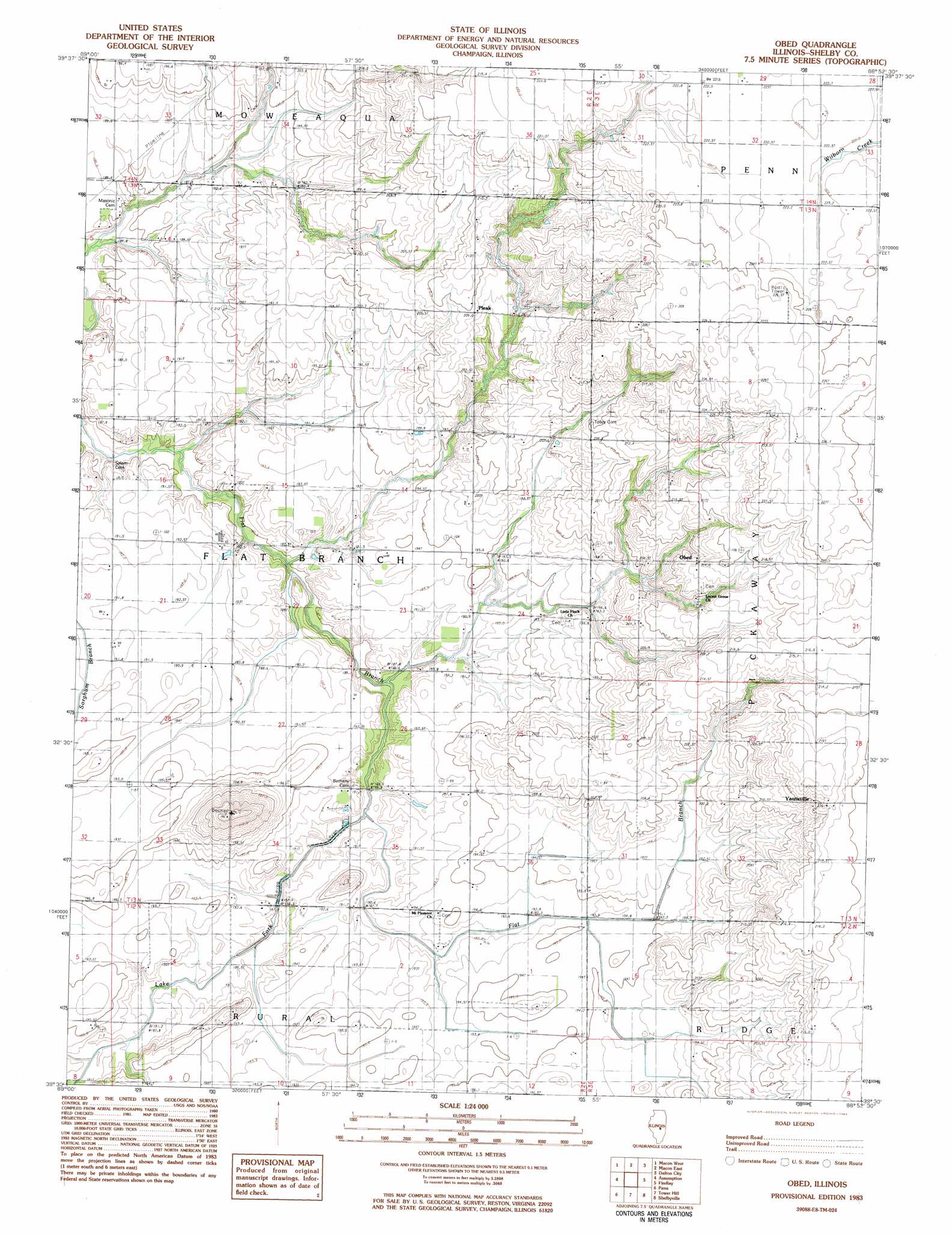
Obed Topo Map Illinois
To zoom in, hover over the map of Obed
USGS Topo Quad 39088e8 - 1:24,000 scale
| Topo Map Name: | Obed |
| USGS Topo Quad ID: | 39088e8 |
| Print Size: | ca. 21 1/4" wide x 27" high |
| Southeast Coordinates: | 39.5° N latitude / 88.875° W longitude |
| Map Center Coordinates: | 39.5625° N latitude / 88.9375° W longitude |
| U.S. State: | IL |
| Filename: | o39088e8.jpg |
| Download Map JPG Image: | Obed topo map 1:24,000 scale |
| Map Type: | Topographic |
| Topo Series: | 7.5´ |
| Map Scale: | 1:24,000 |
| Source of Map Images: | United States Geological Survey (USGS) |
| Alternate Map Versions: |
Obed IL 1983, updated 1983 Download PDF Buy paper map Obed IL 1998, updated 2003 Download PDF Buy paper map Obed IL 2012 Download PDF Buy paper map Obed IL 2015 Download PDF Buy paper map |
1:24,000 Topo Quads surrounding Obed
Niantic |
Harristown |
Decatur |
Long Creek |
La Place |
Stonington |
Macon West |
Macon East |
Dalton City |
Lovington |
Willeys |
Assumption |
Obed |
Findlay |
Kirksville |
Owaneco |
Pana |
Tower Hill |
Shelbyville |
Middlesworth |
Ohlman |
Oconee |
Lakewood |
Fancher |
Stewardson West |
> Back to 39088e1 at 1:100,000 scale
> Back to 39088a1 at 1:250,000 scale
> Back to U.S. Topo Maps home
Obed topo map: Gazetteer
Obed: Populated Places
Obed elevation 214m 702′Pleak elevation 208m 682′
Yantisville elevation 216m 708′
Obed: Streams
Lake Fork elevation 189m 620′Obed digital topo map on disk
Buy this Obed topo map showing relief, roads, GPS coordinates and other geographical features, as a high-resolution digital map file on DVD:
Northern Illinois, Northern Indiana & Southwestern Michigan
Buy digital topo maps: Northern Illinois, Northern Indiana & Southwestern Michigan