Atwood Topo Map Illinois
To zoom in, hover over the map of Atwood
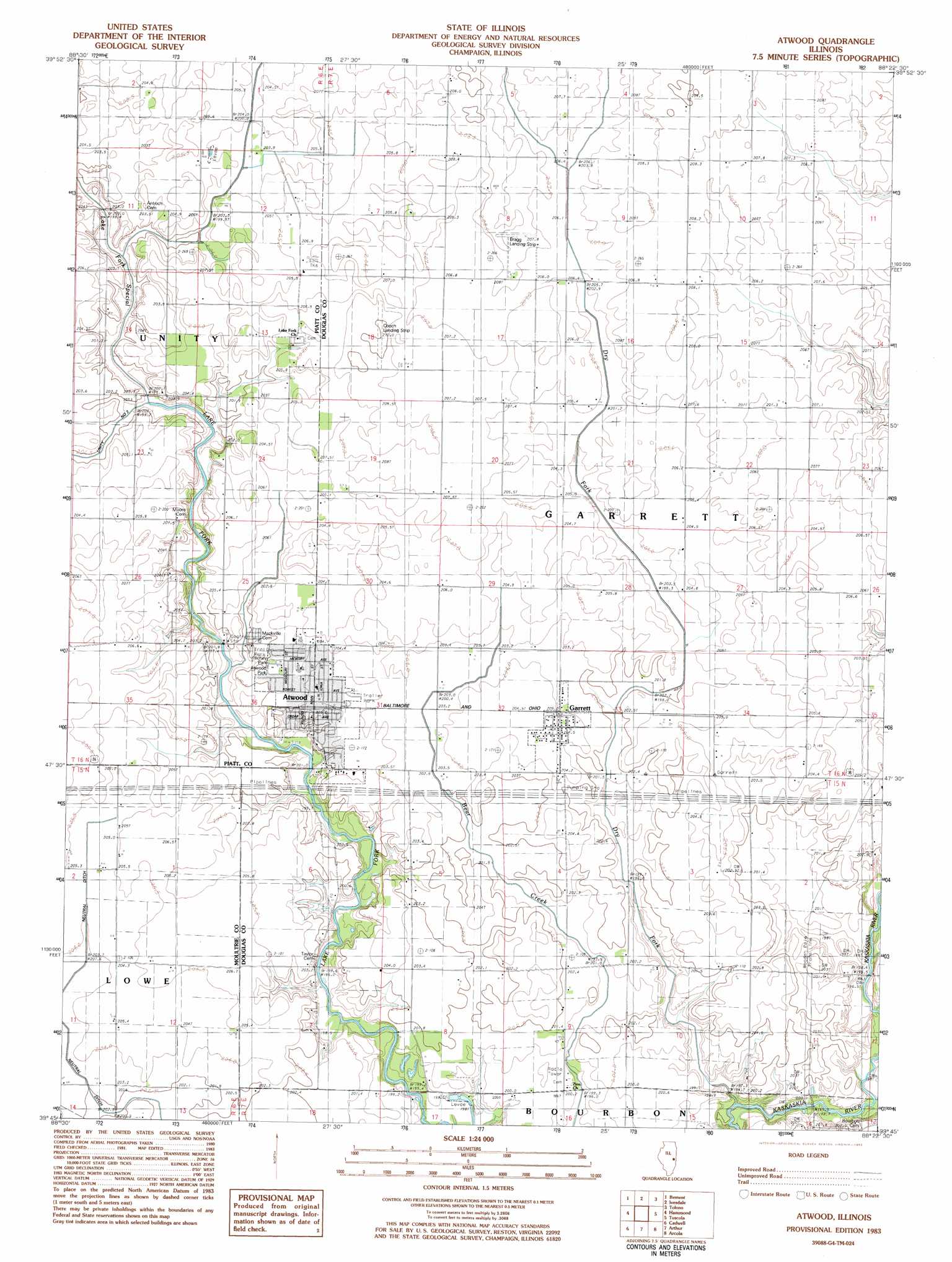
USGS Topo Quad 39088g4 - 1:24,000 scale
| Topo Map Name: | Atwood |
| USGS Topo Quad ID: | 39088g4 |
| Print Size: | ca. 21 1/4" wide x 27" high |
| Southeast Coordinates: | 39.75° N latitude / 88.375° W longitude |
| Map Center Coordinates: | 39.8125° N latitude / 88.4375° W longitude |
| U.S. State: | IL |
| Filename: | o39088g4.jpg |
| Download Map JPG Image: | Atwood topo map 1:24,000 scale |
| Map Type: | Topographic |
| Topo Series: | 7.5´ |
| Map Scale: | 1:24,000 |
| Source of Map Images: | United States Geological Survey (USGS) |
| Alternate Map Versions: |
Tuscola SW IL 1975, updated 1977 Download PDF Buy paper map Atwood IL 1983, updated 1983 Download PDF Buy paper map Atwood IL 1998, updated 2003 Download PDF Buy paper map Atwood IL 2012 Download PDF Buy paper map Atwood IL 2015 Download PDF Buy paper map |
1:24,000 Topo Quads surrounding Atwood
Weldon East |
Monticello |
Seymour |
Bondville |
Urbana |
Cerro Gordo |
Bement |
Ivesdale |
Tolono |
Villa Grove Nw |
La Place |
Hammond |
Atwood |
Tuscola |
Villa Grove |
Lovington |
Cadwell |
Arthur |
Arcola |
Hindsburg |
Kirksville |
Sullivan |
Cooksmill |
Humboldt |
Charleston North |
> Back to 39088e1 at 1:100,000 scale
> Back to 39088a1 at 1:250,000 scale
> Back to U.S. Topo Maps home
Atwood topo map: Gazetteer
Atwood: Airports
Bragg Landing Strip elevation 208m 682′Cooch Landing Area elevation 210m 688′
Kamm Airport elevation 204m 669′
Atwood: Canals
Neutral Ditch elevation 204m 669′Atwood: Parks
Atwood Park elevation 202m 662′Richey Park elevation 202m 662′
Atwood: Populated Places
Atwood elevation 204m 669′Garrett elevation 204m 669′
Mackville elevation 201m 659′
Atwood: Streams
Dry Fork elevation 195m 639′Atwood digital topo map on disk
Buy this Atwood topo map showing relief, roads, GPS coordinates and other geographical features, as a high-resolution digital map file on DVD:
Northern Illinois, Northern Indiana & Southwestern Michigan
Buy digital topo maps: Northern Illinois, Northern Indiana & Southwestern Michigan