Cerro Gordo Topo Map Illinois
To zoom in, hover over the map of Cerro Gordo
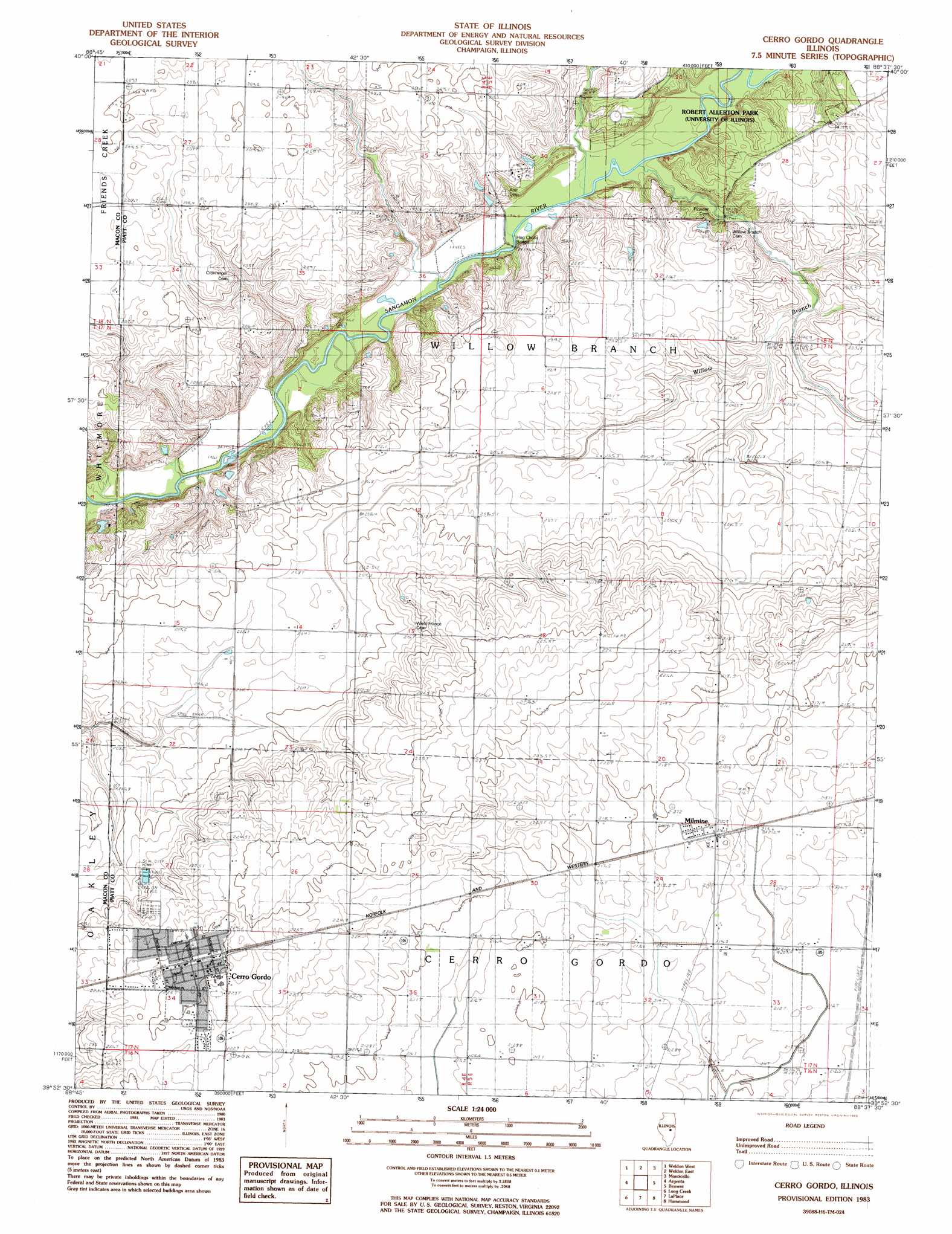
USGS Topo Quad 39088h6 - 1:24,000 scale
| Topo Map Name: | Cerro Gordo |
| USGS Topo Quad ID: | 39088h6 |
| Print Size: | ca. 21 1/4" wide x 27" high |
| Southeast Coordinates: | 39.875° N latitude / 88.625° W longitude |
| Map Center Coordinates: | 39.9375° N latitude / 88.6875° W longitude |
| U.S. State: | IL |
| Filename: | o39088h6.jpg |
| Download Map JPG Image: | Cerro Gordo topo map 1:24,000 scale |
| Map Type: | Topographic |
| Topo Series: | 7.5´ |
| Map Scale: | 1:24,000 |
| Source of Map Images: | United States Geological Survey (USGS) |
| Alternate Map Versions: |
Cerro Gordo IL 1983, updated 1983 Download PDF Buy paper map Cerro Gordo IL 1999, updated 2003 Download PDF Buy paper map Cerro Gordo IL 2012 Download PDF Buy paper map Cerro Gordo IL 2015 Download PDF Buy paper map |
1:24,000 Topo Quads surrounding Cerro Gordo
Clinton |
De Witt |
Farmer City South |
Mansfield |
Mahomet |
Maroa |
Weldon West |
Weldon East |
Monticello |
Seymour |
Forsyth |
Argenta |
Cerro Gordo |
Bement |
Ivesdale |
Decatur |
Long Creek |
La Place |
Hammond |
Atwood |
Macon East |
Dalton City |
Lovington |
Cadwell |
Arthur |
> Back to 39088e1 at 1:100,000 scale
> Back to 39088a1 at 1:250,000 scale
> Back to U.S. Topo Maps home
Cerro Gordo topo map: Gazetteer
Cerro Gordo: Bridges
County Line Bridge elevation 191m 626′Hog Chute Bridge elevation 191m 626′
Cerro Gordo: Populated Places
Cerro Gordo elevation 226m 741′Milmine elevation 217m 711′
Cerro Gordo: Streams
Willow Branch elevation 192m 629′Cerro Gordo digital topo map on disk
Buy this Cerro Gordo topo map showing relief, roads, GPS coordinates and other geographical features, as a high-resolution digital map file on DVD:
Northern Illinois, Northern Indiana & Southwestern Michigan
Buy digital topo maps: Northern Illinois, Northern Indiana & Southwestern Michigan