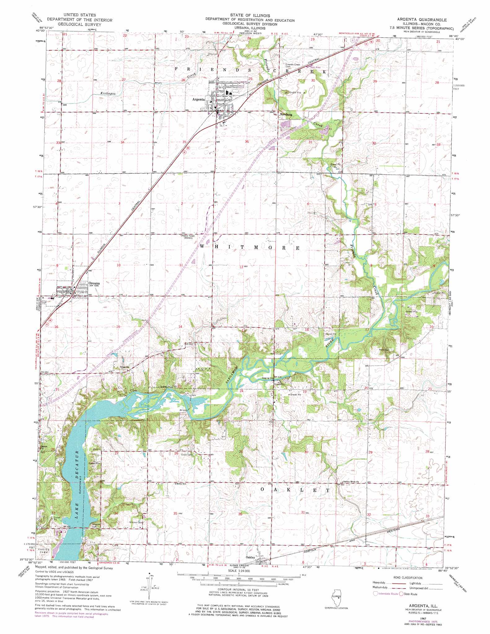
Argenta Topo Map Illinois
To zoom in, hover over the map of Argenta
USGS Topo Quad 39088h7 - 1:24,000 scale
| Topo Map Name: | Argenta |
| USGS Topo Quad ID: | 39088h7 |
| Print Size: | ca. 21 1/4" wide x 27" high |
| Southeast Coordinates: | 39.875° N latitude / 88.75° W longitude |
| Map Center Coordinates: | 39.9375° N latitude / 88.8125° W longitude |
| U.S. State: | IL |
| Filename: | o39088h7.jpg |
| Download Map JPG Image: | Argenta topo map 1:24,000 scale |
| Map Type: | Topographic |
| Topo Series: | 7.5´ |
| Map Scale: | 1:24,000 |
| Source of Map Images: | United States Geological Survey (USGS) |
| Alternate Map Versions: |
Argenta IL 1967, updated 1968 Download PDF Buy paper map Argenta IL 1967, updated 1976 Download PDF Buy paper map Argenta IL 1998, updated 2003 Download PDF Buy paper map Argenta IL 2012 Download PDF Buy paper map Argenta IL 2015 Download PDF Buy paper map |
1:24,000 Topo Quads surrounding Argenta
Waynesville East |
Clinton |
De Witt |
Farmer City South |
Mansfield |
Kenney |
Maroa |
Weldon West |
Weldon East |
Monticello |
Warrensburg |
Forsyth |
Argenta |
Cerro Gordo |
Bement |
Harristown |
Decatur |
Long Creek |
La Place |
Hammond |
Macon West |
Macon East |
Dalton City |
Lovington |
Cadwell |
> Back to 39088e1 at 1:100,000 scale
> Back to 39088a1 at 1:250,000 scale
> Back to U.S. Topo Maps home
Argenta topo map: Gazetteer
Argenta: Bridges
Reas Bridge elevation 187m 613′Argenta: Crossings
Interchange 150 elevation 209m 685′Interchange 47 elevation 210m 688′
Argenta: Populated Places
Argenta elevation 209m 685′Chapin elevation 204m 669′
Newburg elevation 208m 682′
Oakley elevation 208m 682′
Oreana elevation 210m 688′
Argenta: Streams
Friends Creek elevation 188m 616′Kickapoo Creek elevation 197m 646′
Argenta digital topo map on disk
Buy this Argenta topo map showing relief, roads, GPS coordinates and other geographical features, as a high-resolution digital map file on DVD:
Northern Illinois, Northern Indiana & Southwestern Michigan
Buy digital topo maps: Northern Illinois, Northern Indiana & Southwestern Michigan