Fillmore Topo Map Illinois
To zoom in, hover over the map of Fillmore
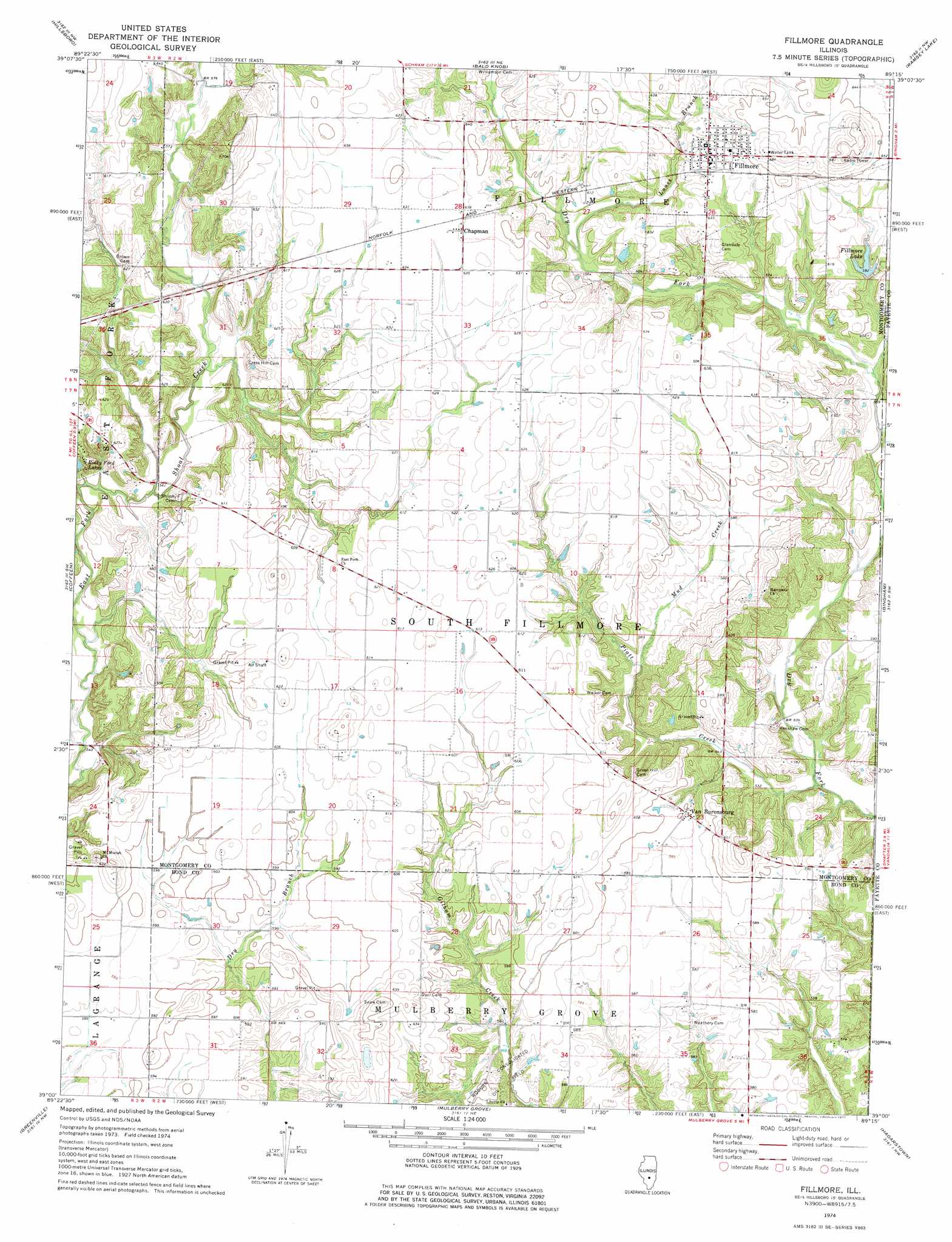
USGS Topo Quad 39089a3 - 1:24,000 scale
| Topo Map Name: | Fillmore |
| USGS Topo Quad ID: | 39089a3 |
| Print Size: | ca. 21 1/4" wide x 27" high |
| Southeast Coordinates: | 39° N latitude / 89.25° W longitude |
| Map Center Coordinates: | 39.0625° N latitude / 89.3125° W longitude |
| U.S. State: | IL |
| Filename: | o39089a3.jpg |
| Download Map JPG Image: | Fillmore topo map 1:24,000 scale |
| Map Type: | Topographic |
| Topo Series: | 7.5´ |
| Map Scale: | 1:24,000 |
| Source of Map Images: | United States Geological Survey (USGS) |
| Alternate Map Versions: |
Fillmore IL 1974, updated 1977 Download PDF Buy paper map Fillmore IL 1998, updated 2002 Download PDF Buy paper map Fillmore IL 2012 Download PDF Buy paper map Fillmore IL 2015 Download PDF Buy paper map |
1:24,000 Topo Quads surrounding Fillmore
Raymond |
Nokomis Sw |
Nokomis |
Ohlman |
Oconee |
Butler |
Hillsboro |
Bald Knob |
Ramsey Lake |
Ramsey |
Sorento North |
Coffeen |
Fillmore |
Bingham |
Vera |
Sorento South |
Greenville |
Mulberry Grove |
Hagarstown |
Vandalia |
Pocahontas |
Beaver Creek |
Pleasant Mound |
Wildcat Lake |
Patoka |
> Back to 39089a1 at 1:100,000 scale
> Back to 39088a1 at 1:250,000 scale
> Back to U.S. Topo Maps home
Fillmore topo map: Gazetteer
Fillmore: Dams
Fillmore Lake Dam elevation 180m 590′Fillmore: Populated Places
Chapman elevation 195m 639′Fillmore elevation 193m 633′
Van Burensburg elevation 182m 597′
Fillmore: Post Offices
Fillmore Post Office elevation 193m 633′Fillmore: Reservoirs
Fillmore Lake elevation 180m 590′Rocky Ford Lakes elevation 178m 583′
Fillmore: Streams
Lanes Branch elevation 176m 577′Mud Creek elevation 170m 557′
Piatt Creek elevation 158m 518′
Fillmore digital topo map on disk
Buy this Fillmore topo map showing relief, roads, GPS coordinates and other geographical features, as a high-resolution digital map file on DVD:
Northern Illinois, Northern Indiana & Southwestern Michigan
Buy digital topo maps: Northern Illinois, Northern Indiana & Southwestern Michigan