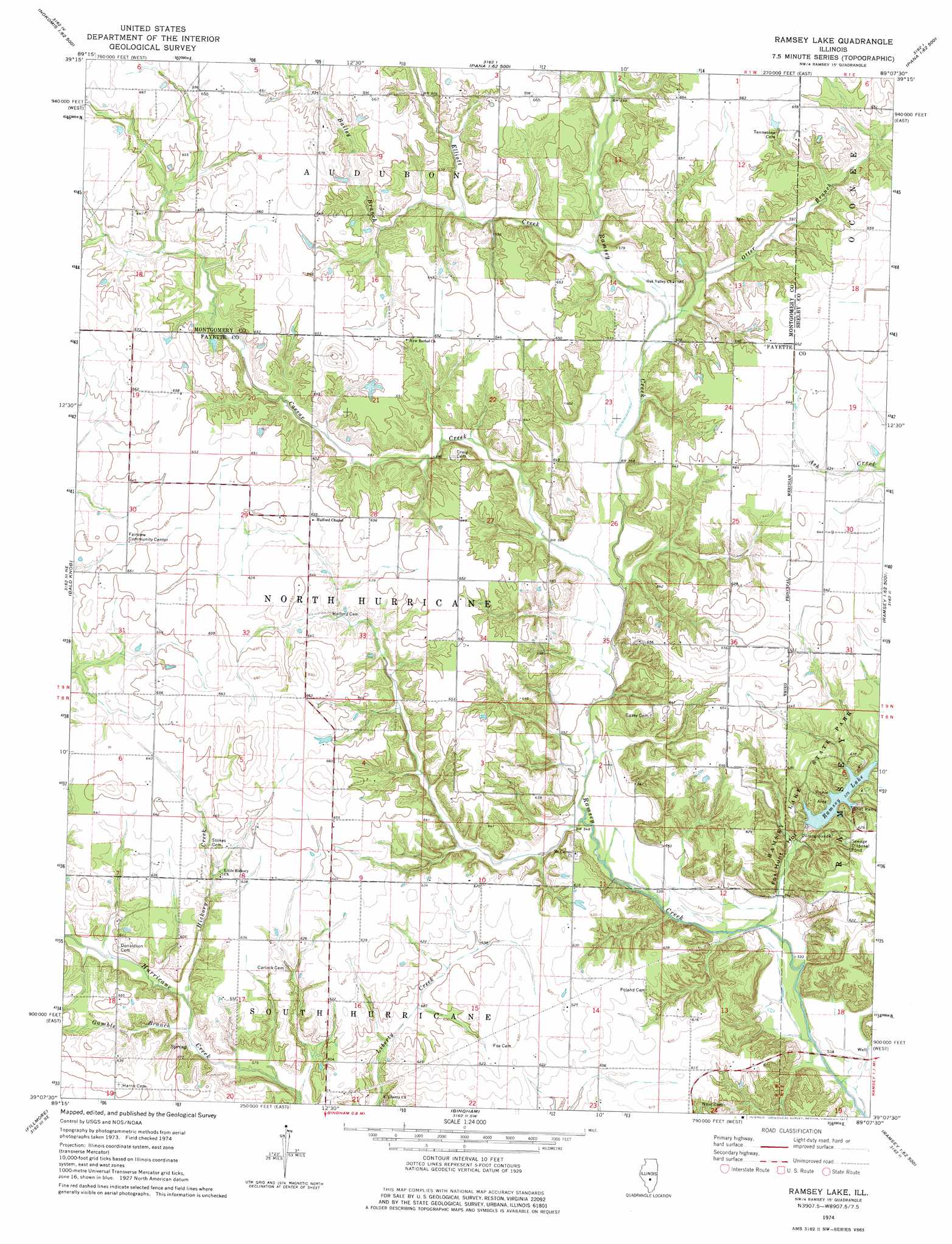
Ramsey Lake Topo Map Illinois
To zoom in, hover over the map of Ramsey Lake
USGS Topo Quad 39089b2 - 1:24,000 scale
| Topo Map Name: | Ramsey Lake |
| USGS Topo Quad ID: | 39089b2 |
| Print Size: | ca. 21 1/4" wide x 27" high |
| Southeast Coordinates: | 39.125° N latitude / 89.125° W longitude |
| Map Center Coordinates: | 39.1875° N latitude / 89.1875° W longitude |
| U.S. State: | IL |
| Filename: | o39089b2.jpg |
| Download Map JPG Image: | Ramsey Lake topo map 1:24,000 scale |
| Map Type: | Topographic |
| Topo Series: | 7.5´ |
| Map Scale: | 1:24,000 |
| Source of Map Images: | United States Geological Survey (USGS) |
| Alternate Map Versions: |
Ramsey Lake IL 1998, updated 2002 Download PDF Buy paper map Ramsey Lake IL 2012 Download PDF Buy paper map Ramsey Lake IL 2015 Download PDF Buy paper map |
1:24,000 Topo Quads surrounding Ramsey Lake
Morrisonville |
Clarksdale |
Owaneco |
Pana |
Tower Hill |
Nokomis Sw |
Nokomis |
Ohlman |
Oconee |
Lakewood |
Hillsboro |
Bald Knob |
Ramsey Lake |
Ramsey |
Herrick |
Coffeen |
Fillmore |
Bingham |
Vera |
Avena |
Greenville |
Mulberry Grove |
Hagarstown |
Vandalia |
Brownstown |
> Back to 39089a1 at 1:100,000 scale
> Back to 39088a1 at 1:250,000 scale
> Back to U.S. Topo Maps home
Ramsey Lake topo map: Gazetteer
Ramsey Lake: Dams
Ramsey Lake Dam elevation 174m 570′Whitfield Lake Dam elevation 189m 620′
Ramsey Lake: Parks
Ramsey Lake State Park elevation 192m 629′Ramsey Lake: Reservoirs
Ramsey Lake elevation 174m 570′Whitfield Lake elevation 189m 620′
Ramsey Lake: Streams
Bailey Branch elevation 178m 583′Caesar Creek elevation 168m 551′
Elliott Creek elevation 174m 570′
Gamble Branch elevation 175m 574′
Hickory Creek elevation 176m 577′
Otter Branch elevation 174m 570′
Ramsey Lake: Trails
Ramsey Hills Nature Trail elevation 170m 557′Ramsey Lake: Valleys
Fox Hunt Hollow elevation 161m 528′Ramsey Lake digital topo map on disk
Buy this Ramsey Lake topo map showing relief, roads, GPS coordinates and other geographical features, as a high-resolution digital map file on DVD:
Northern Illinois, Northern Indiana & Southwestern Michigan
Buy digital topo maps: Northern Illinois, Northern Indiana & Southwestern Michigan