Litchfield Topo Map Illinois
To zoom in, hover over the map of Litchfield
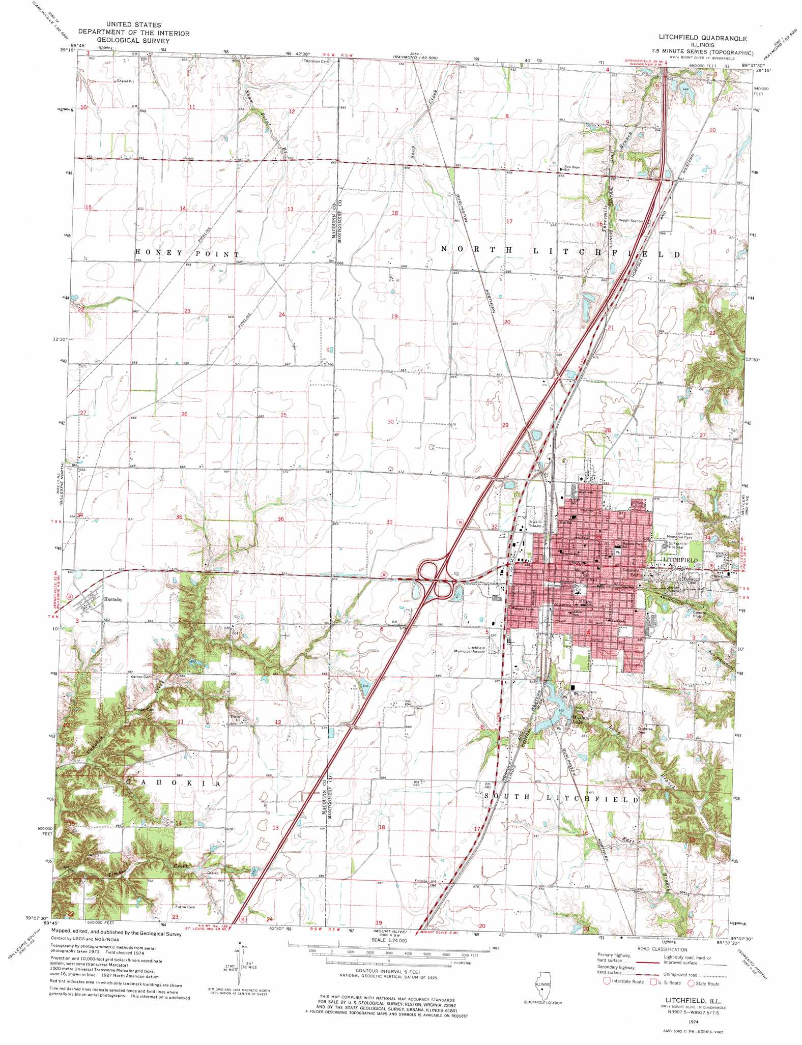
USGS Topo Quad 39089b6 - 1:24,000 scale
| Topo Map Name: | Litchfield |
| USGS Topo Quad ID: | 39089b6 |
| Print Size: | ca. 21 1/4" wide x 27" high |
| Southeast Coordinates: | 39.125° N latitude / 89.625° W longitude |
| Map Center Coordinates: | 39.1875° N latitude / 89.6875° W longitude |
| U.S. State: | IL |
| Filename: | o39089b6.jpg |
| Download Map JPG Image: | Litchfield topo map 1:24,000 scale |
| Map Type: | Topographic |
| Topo Series: | 7.5´ |
| Map Scale: | 1:24,000 |
| Source of Map Images: | United States Geological Survey (USGS) |
| Alternate Map Versions: |
Litchfield IL 1974, updated 1977 Download PDF Buy paper map Litchfield IL 2012 Download PDF Buy paper map Litchfield IL 2015 Download PDF Buy paper map |
1:24,000 Topo Quads surrounding Litchfield
Palmyra |
Virden South |
Farmersville |
Raymond Ne |
Morrisonville |
Carlinville West |
Carlinville East |
Atwater |
Raymond |
Nokomis Sw |
Plainview |
Gillespie North |
Litchfield |
Butler |
Hillsboro |
Bunker Hill |
Gillespie South |
Mount Olive |
Sorento North |
Coffeen |
Prairietown |
Worden |
New Douglas |
Sorento South |
Greenville |
> Back to 39089a1 at 1:100,000 scale
> Back to 39088a1 at 1:250,000 scale
> Back to U.S. Topo Maps home
Litchfield topo map: Gazetteer
Litchfield: Airports
Litchfield Municipal Airport elevation 209m 685′Litchfield: Crossings
Interchange 52 elevation 211m 692′Litchfield: Dams
Kilton Lake Dam elevation 198m 649′Walton Park Lake Dam elevation 203m 666′
Litchfield: Parks
Madison Park elevation 209m 685′Sunshine Park elevation 201m 659′
Walton Park elevation 204m 669′
Litchfield: Populated Places
Hornsby elevation 204m 669′Litchfield elevation 211m 692′
Litchfield: Post Offices
Litchfield Post Office elevation 210m 688′Litchfield: Reservoirs
Kilton Lake elevation 198m 649′Walton Lake elevation 203m 666′
Litchfield: Streams
Timber Creek elevation 183m 600′Litchfield digital topo map on disk
Buy this Litchfield topo map showing relief, roads, GPS coordinates and other geographical features, as a high-resolution digital map file on DVD:
Northern Illinois, Northern Indiana & Southwestern Michigan
Buy digital topo maps: Northern Illinois, Northern Indiana & Southwestern Michigan