Oconee Topo Map Illinois
To zoom in, hover over the map of Oconee
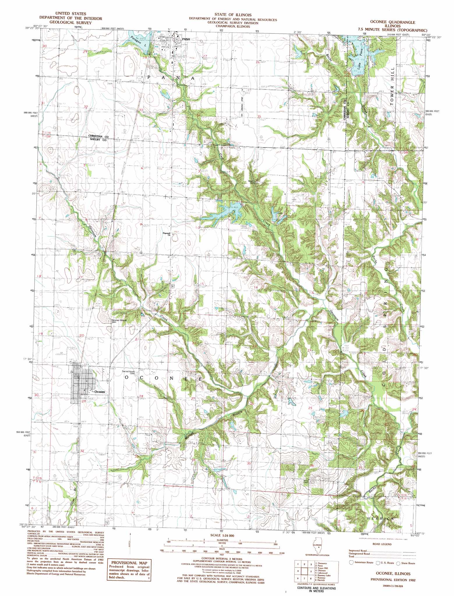
USGS Topo Quad 39089c1 - 1:24,000 scale
| Topo Map Name: | Oconee |
| USGS Topo Quad ID: | 39089c1 |
| Print Size: | ca. 21 1/4" wide x 27" high |
| Southeast Coordinates: | 39.25° N latitude / 89° W longitude |
| Map Center Coordinates: | 39.3125° N latitude / 89.0625° W longitude |
| U.S. State: | IL |
| Filename: | o39089c1.jpg |
| Download Map JPG Image: | Oconee topo map 1:24,000 scale |
| Map Type: | Topographic |
| Topo Series: | 7.5´ |
| Map Scale: | 1:24,000 |
| Source of Map Images: | United States Geological Survey (USGS) |
| Alternate Map Versions: |
Oconee IL 1982, updated 1982 Download PDF Buy paper map Oconee IL 1998, updated 2002 Download PDF Buy paper map Oconee IL 2012 Download PDF Buy paper map Oconee IL 2015 Download PDF Buy paper map |
1:24,000 Topo Quads surrounding Oconee
Taylorville |
Willeys |
Assumption |
Obed |
Findlay |
Clarksdale |
Owaneco |
Pana |
Tower Hill |
Shelbyville |
Nokomis |
Ohlman |
Oconee |
Lakewood |
Fancher |
Bald Knob |
Ramsey Lake |
Ramsey |
Herrick |
Beecher City |
Fillmore |
Bingham |
Vera |
Avena |
Altamont West |
> Back to 39089a1 at 1:100,000 scale
> Back to 39088a1 at 1:250,000 scale
> Back to U.S. Topo Maps home
Oconee topo map: Gazetteer
Oconee: Airports
Tex Landing Strip elevation 204m 669′Oconee: Dams
Boy Scout Lake Dam elevation 196m 643′Pana Lake Dam elevation 187m 613′
Paragon Lake Dam elevation 201m 659′
Oconee: Populated Places
Oconee elevation 204m 669′Oconee: Reservoirs
Boy Scout Lake elevation 196m 643′Pana Lake elevation 187m 613′
Paragon Lake elevation 201m 659′
Oconee: Streams
Coal Creek elevation 171m 561′Matney Branch elevation 177m 580′
Opossum Creek elevation 166m 544′
Oconee digital topo map on disk
Buy this Oconee topo map showing relief, roads, GPS coordinates and other geographical features, as a high-resolution digital map file on DVD:
Northern Illinois, Northern Indiana & Southwestern Michigan
Buy digital topo maps: Northern Illinois, Northern Indiana & Southwestern Michigan