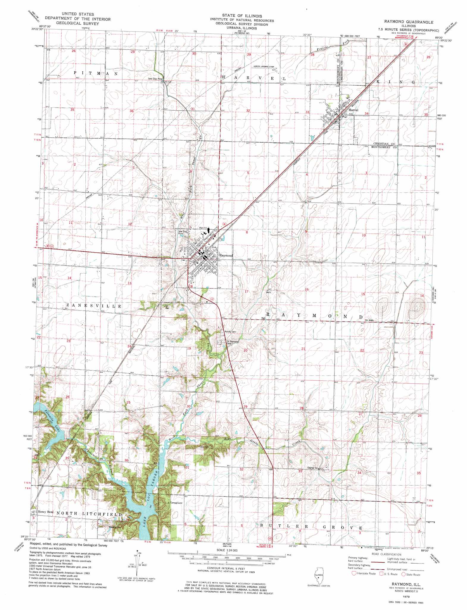
Raymond Topo Map Illinois
To zoom in, hover over the map of Raymond
USGS Topo Quad 39089c5 - 1:24,000 scale
| Topo Map Name: | Raymond |
| USGS Topo Quad ID: | 39089c5 |
| Print Size: | ca. 21 1/4" wide x 27" high |
| Southeast Coordinates: | 39.25° N latitude / 89.5° W longitude |
| Map Center Coordinates: | 39.3125° N latitude / 89.5625° W longitude |
| U.S. State: | IL |
| Filename: | o39089c5.jpg |
| Download Map JPG Image: | Raymond topo map 1:24,000 scale |
| Map Type: | Topographic |
| Topo Series: | 7.5´ |
| Map Scale: | 1:24,000 |
| Source of Map Images: | United States Geological Survey (USGS) |
| Alternate Map Versions: |
Raymond IL 1979, updated 1980 Download PDF Buy paper map Raymond IL 1998, updated 2002 Download PDF Buy paper map Raymond IL 2012 Download PDF Buy paper map Raymond IL 2015 Download PDF Buy paper map |
1:24,000 Topo Quads surrounding Raymond
Virden North |
Divernon |
Pawnee |
Kincaid |
Taylorville |
Virden South |
Farmersville |
Raymond Ne |
Morrisonville |
Clarksdale |
Carlinville East |
Atwater |
Raymond |
Nokomis Sw |
Nokomis |
Gillespie North |
Litchfield |
Butler |
Hillsboro |
Bald Knob |
Gillespie South |
Mount Olive |
Sorento North |
Coffeen |
Fillmore |
> Back to 39089a1 at 1:100,000 scale
> Back to 39088a1 at 1:250,000 scale
> Back to U.S. Topo Maps home
Raymond topo map: Gazetteer
Raymond: Airports
Lebeck Landing Strip elevation 193m 633′Raymond: Bridges
Five Mile Bridge elevation 181m 593′Raymond: Dams
Shoal Creek Watershed Structure Number 2 Dam elevation 187m 613′Raymond: Parks
Roberts Cemetery Savanna Nature Preserve elevation 195m 639′Raymond: Populated Places
Harvel elevation 194m 636′Honey Bend elevation 200m 656′
Raymond elevation 196m 643′
Raymond: Reservoirs
Fivemile Lake elevation 184m 603′Shoal Creek Watershed Impoundment Reservoir elevation 187m 613′
Raymond: Streams
Blue Grass Creek elevation 181m 593′Threemile Branch elevation 180m 590′
Raymond digital topo map on disk
Buy this Raymond topo map showing relief, roads, GPS coordinates and other geographical features, as a high-resolution digital map file on DVD:
Northern Illinois, Northern Indiana & Southwestern Michigan
Buy digital topo maps: Northern Illinois, Northern Indiana & Southwestern Michigan