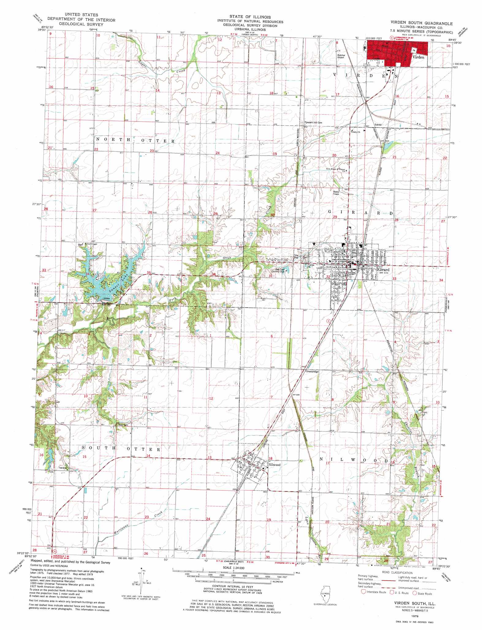
Virden South Topo Map Illinois
To zoom in, hover over the map of Virden South
USGS Topo Quad 39089d7 - 1:24,000 scale
| Topo Map Name: | Virden South |
| USGS Topo Quad ID: | 39089d7 |
| Print Size: | ca. 21 1/4" wide x 27" high |
| Southeast Coordinates: | 39.375° N latitude / 89.75° W longitude |
| Map Center Coordinates: | 39.4375° N latitude / 89.8125° W longitude |
| U.S. State: | IL |
| Filename: | o39089d7.jpg |
| Download Map JPG Image: | Virden South topo map 1:24,000 scale |
| Map Type: | Topographic |
| Topo Series: | 7.5´ |
| Map Scale: | 1:24,000 |
| Source of Map Images: | United States Geological Survey (USGS) |
| Alternate Map Versions: |
Virden South IL 1979, updated 1980 Download PDF Buy paper map Virden South IL 1998, updated 2002 Download PDF Buy paper map Virden South IL 2012 Download PDF Buy paper map Virden South IL 2015 Download PDF Buy paper map |
1:24,000 Topo Quads surrounding Virden South
Alexander |
New Berlin |
Loami |
Chatham |
New City |
Franklin |
Waverly |
Virden North |
Divernon |
Pawnee |
Scottville |
Palmyra |
Virden South |
Farmersville |
Raymond Ne |
Hettick |
Carlinville West |
Carlinville East |
Atwater |
Raymond |
Summerville |
Plainview |
Gillespie North |
Litchfield |
Butler |
> Back to 39089a1 at 1:100,000 scale
> Back to 39088a1 at 1:250,000 scale
> Back to U.S. Topo Maps home
Virden South topo map: Gazetteer
Virden South: Airports
Hulcher RLA Airport elevation 204m 669′Virden South: Dams
Girard Sunset Lake Dam elevation 199m 652′Whites Pond Dam elevation 196m 643′
Virden South: Populated Places
Girard elevation 204m 669′Greenridge elevation 202m 662′
Nilwood elevation 204m 669′
Virden South: Reservoirs
Girard Sunset Lake elevation 199m 652′Sunset Lake elevation 196m 643′
Whites Pond elevation 196m 643′
Virden South digital topo map on disk
Buy this Virden South topo map showing relief, roads, GPS coordinates and other geographical features, as a high-resolution digital map file on DVD:
Northern Illinois, Northern Indiana & Southwestern Michigan
Buy digital topo maps: Northern Illinois, Northern Indiana & Southwestern Michigan