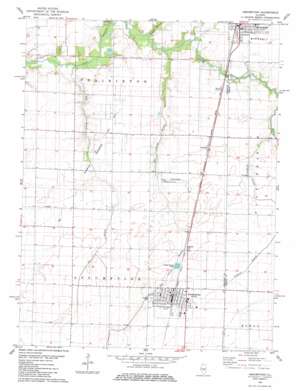
Assumption Topo Map Illinois
To zoom in, hover over the map of Assumption
USGS Topo Quad 39089e1 - 1:24,000 scale
| Topo Map Name: | Assumption |
| USGS Topo Quad ID: | 39089e1 |
| Print Size: | ca. 21 1/4" wide x 27" high |
| Southeast Coordinates: | 39.5° N latitude / 89° W longitude |
| Map Center Coordinates: | 39.5625° N latitude / 89.0625° W longitude |
| U.S. State: | IL |
| Filename: | o39089e1.jpg |
| Download Map JPG Image: | Assumption topo map 1:24,000 scale |
| Map Type: | Topographic |
| Topo Series: | 7.5´ |
| Map Scale: | 1:24,000 |
| Source of Map Images: | United States Geological Survey (USGS) |
| Alternate Map Versions: |
Assumption IL 1982, updated 1983 Download PDF Buy paper map Assumption IL 1998, updated 2002 Download PDF Buy paper map Assumption IL 2012 Download PDF Buy paper map Assumption IL 2015 Download PDF Buy paper map |
1:24,000 Topo Quads surrounding Assumption
> Back to 39089e1 at 1:100,000 scale
> Back to 39088a1 at 1:250,000 scale
> Back to U.S. Topo Maps home
Assumption topo map: Gazetteer
Assumption: Oilfields
Assumption Consolidated Oil Field elevation 187m 613′Assumption: Populated Places
Assumption elevation 197m 646′Moweaqua elevation 194m 636′
Radford elevation 190m 623′
Assumption: Streams
Big George Branch elevation 180m 590′Oak Branch elevation 178m 583′
Sorghum Branch elevation 190m 623′
Willow Branch elevation 180m 590′
Assumption digital topo map on disk
Buy this Assumption topo map showing relief, roads, GPS coordinates and other geographical features, as a high-resolution digital map file on DVD:
Northern Illinois, Northern Indiana & Southwestern Michigan
Buy digital topo maps: Northern Illinois, Northern Indiana & Southwestern Michigan


