Divernon Topo Map Illinois
To zoom in, hover over the map of Divernon
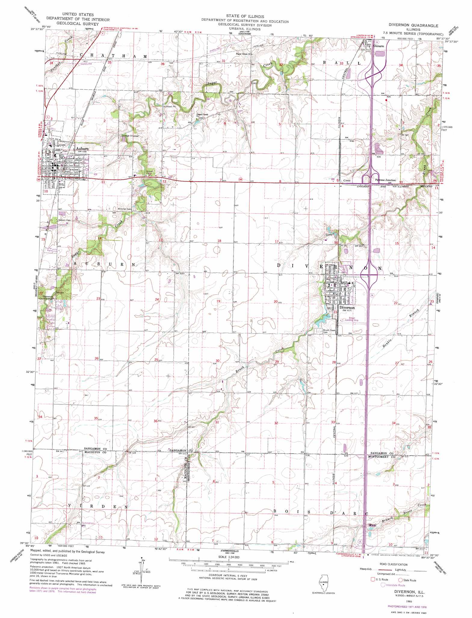
USGS Topo Quad 39089e6 - 1:24,000 scale
| Topo Map Name: | Divernon |
| USGS Topo Quad ID: | 39089e6 |
| Print Size: | ca. 21 1/4" wide x 27" high |
| Southeast Coordinates: | 39.5° N latitude / 89.625° W longitude |
| Map Center Coordinates: | 39.5625° N latitude / 89.6875° W longitude |
| U.S. State: | IL |
| Filename: | o39089e6.jpg |
| Download Map JPG Image: | Divernon topo map 1:24,000 scale |
| Map Type: | Topographic |
| Topo Series: | 7.5´ |
| Map Scale: | 1:24,000 |
| Source of Map Images: | United States Geological Survey (USGS) |
| Alternate Map Versions: |
Divernon IL 1965, updated 1966 Download PDF Buy paper map Divernon IL 1965, updated 1972 Download PDF Buy paper map Divernon IL 1965, updated 1978 Download PDF Buy paper map Divernon IL 2012 Download PDF Buy paper map Divernon IL 2015 Download PDF Buy paper map |
1:24,000 Topo Quads surrounding Divernon
Pleasant Plains |
Farmingdale |
Springfield West |
Springfield East |
Mechanicsburg |
New Berlin |
Loami |
Chatham |
New City |
Edinburg |
Waverly |
Virden North |
Divernon |
Pawnee |
Kincaid |
Palmyra |
Virden South |
Farmersville |
Raymond Ne |
Morrisonville |
Carlinville West |
Carlinville East |
Atwater |
Raymond |
Nokomis Sw |
> Back to 39089e1 at 1:100,000 scale
> Back to 39088a1 at 1:250,000 scale
> Back to U.S. Topo Maps home
Divernon topo map: Gazetteer
Divernon: Airports
Brown Landing Strip elevation 189m 620′Divernon: Crossings
Interchange 80 elevation 188m 616′Interchange 82 elevation 191m 626′
Interchange 83 elevation 184m 603′
Divernon: Parks
Union Park elevation 190m 623′Divernon: Populated Places
Auburn elevation 191m 626′Cimic elevation 186m 610′
Divernon elevation 187m 613′
Glenarm elevation 182m 597′
Pawnee Junction elevation 186m 610′
Divernon: Post Offices
Auburn Post Office elevation 191m 626′Glenarm Post Office elevation 183m 600′
Divernon: Reservoirs
Lake Commanche elevation 178m 583′Divernon digital topo map on disk
Buy this Divernon topo map showing relief, roads, GPS coordinates and other geographical features, as a high-resolution digital map file on DVD:
Northern Illinois, Northern Indiana & Southwestern Michigan
Buy digital topo maps: Northern Illinois, Northern Indiana & Southwestern Michigan