Macon West Topo Map Illinois
To zoom in, hover over the map of Macon West
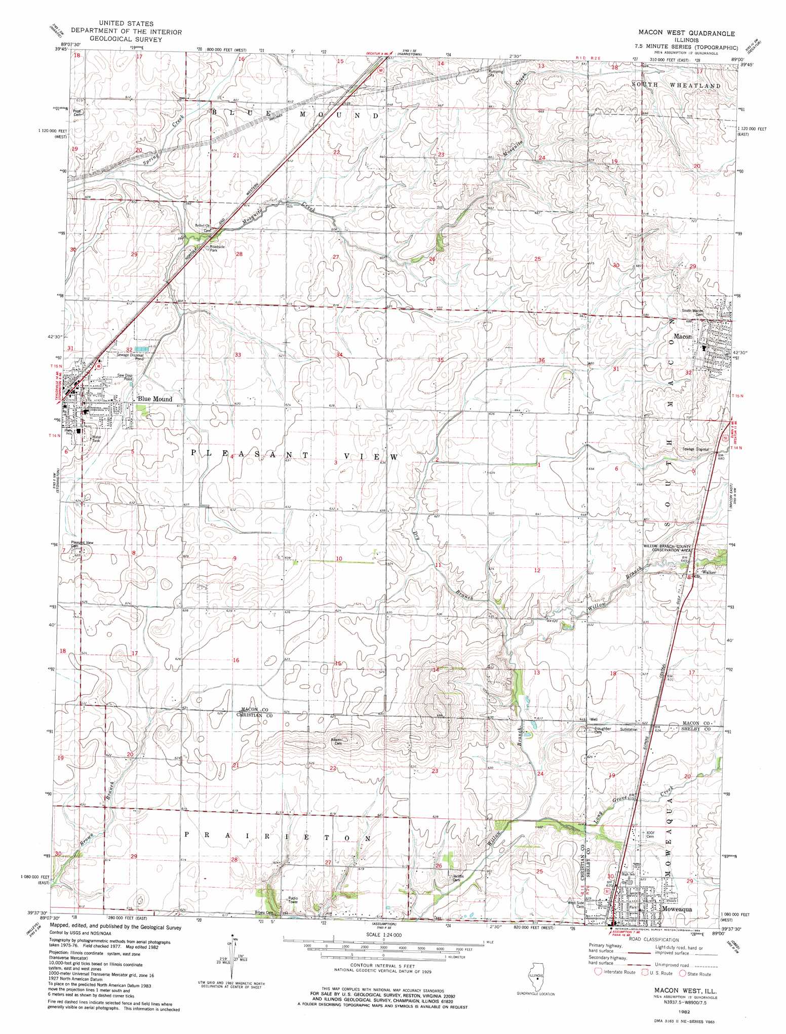
USGS Topo Quad 39089f1 - 1:24,000 scale
| Topo Map Name: | Macon West |
| USGS Topo Quad ID: | 39089f1 |
| Print Size: | ca. 21 1/4" wide x 27" high |
| Southeast Coordinates: | 39.625° N latitude / 89° W longitude |
| Map Center Coordinates: | 39.6875° N latitude / 89.0625° W longitude |
| U.S. State: | IL |
| Filename: | o39089f1.jpg |
| Download Map JPG Image: | Macon West topo map 1:24,000 scale |
| Map Type: | Topographic |
| Topo Series: | 7.5´ |
| Map Scale: | 1:24,000 |
| Source of Map Images: | United States Geological Survey (USGS) |
| Alternate Map Versions: |
Macon West IL 1982, updated 1984 Download PDF Buy paper map Macon West IL 2012 Download PDF Buy paper map Macon West IL 2015 Download PDF Buy paper map |
1:24,000 Topo Quads surrounding Macon West
Lake Fork |
Latham |
Warrensburg |
Forsyth |
Argenta |
Mount Auburn |
Niantic |
Harristown |
Decatur |
Long Creek |
Grove City |
Stonington |
Macon West |
Macon East |
Dalton City |
Taylorville |
Willeys |
Assumption |
Obed |
Findlay |
Clarksdale |
Owaneco |
Pana |
Tower Hill |
Shelbyville |
> Back to 39089e1 at 1:100,000 scale
> Back to 39088a1 at 1:250,000 scale
> Back to U.S. Topo Maps home
Macon West topo map: Gazetteer
Macon West: Airports
Cribbet Airport elevation 195m 639′Macon West: Parks
Willow Branch County Conservation Area elevation 193m 633′Macon West: Populated Places
Blue Mound elevation 190m 623′Walker elevation 197m 646′
Macon West: Streams
Dry Branch elevation 191m 626′Long Grove Creek elevation 182m 597′
Spring Creek elevation 180m 590′
Macon West digital topo map on disk
Buy this Macon West topo map showing relief, roads, GPS coordinates and other geographical features, as a high-resolution digital map file on DVD:
Northern Illinois, Northern Indiana & Southwestern Michigan
Buy digital topo maps: Northern Illinois, Northern Indiana & Southwestern Michigan