Loami Topo Map Illinois
To zoom in, hover over the map of Loami
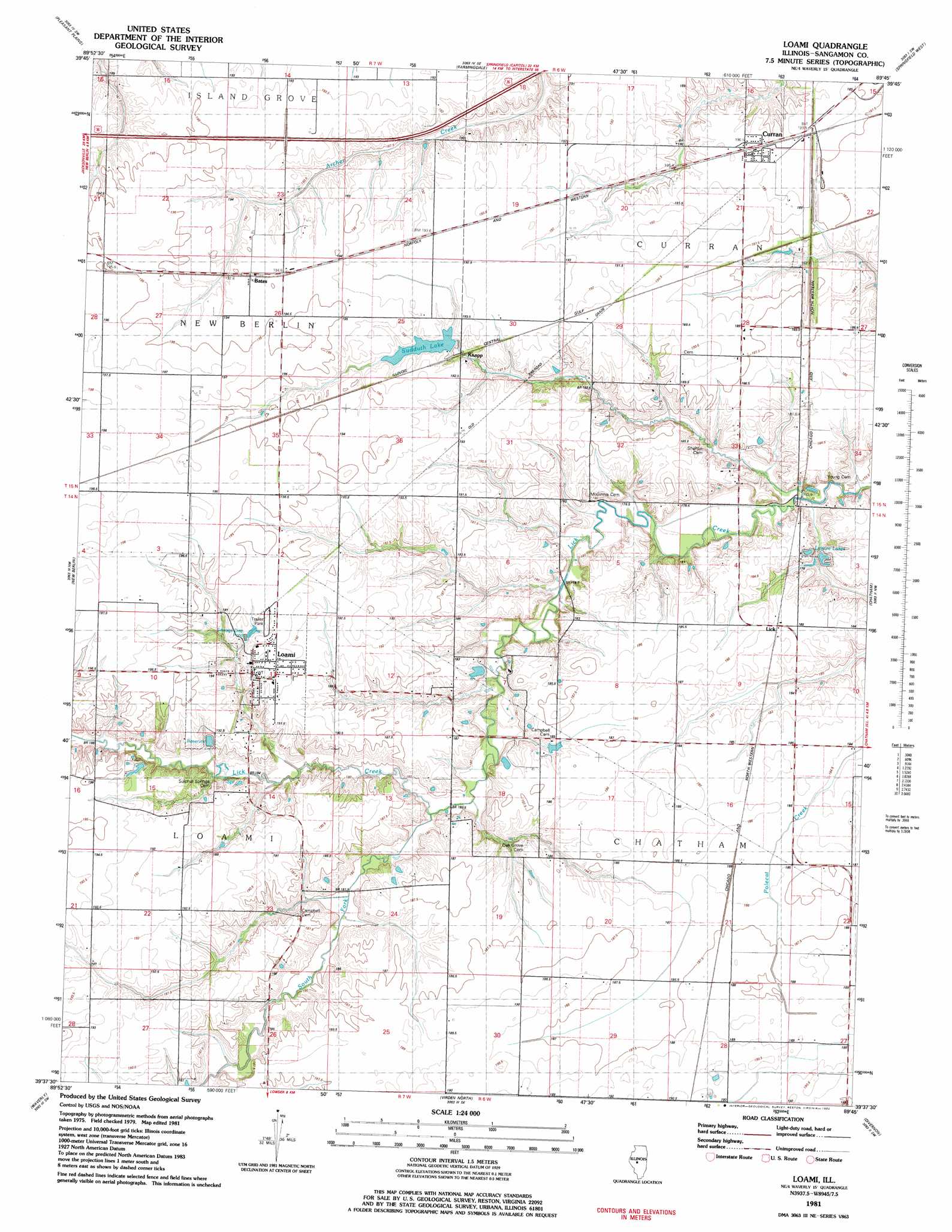
USGS Topo Quad 39089f7 - 1:24,000 scale
| Topo Map Name: | Loami |
| USGS Topo Quad ID: | 39089f7 |
| Print Size: | ca. 21 1/4" wide x 27" high |
| Southeast Coordinates: | 39.625° N latitude / 89.75° W longitude |
| Map Center Coordinates: | 39.6875° N latitude / 89.8125° W longitude |
| U.S. State: | IL |
| Filename: | o39089f7.jpg |
| Download Map JPG Image: | Loami topo map 1:24,000 scale |
| Map Type: | Topographic |
| Topo Series: | 7.5´ |
| Map Scale: | 1:24,000 |
| Source of Map Images: | United States Geological Survey (USGS) |
| Alternate Map Versions: |
Loami IL 1981, updated 1982 Download PDF Buy paper map Loami IL 2012 Download PDF Buy paper map Loami IL 2015 Download PDF Buy paper map |
1:24,000 Topo Quads surrounding Loami
Ashland |
Tallula |
Salisbury |
Athens |
Williamsville |
Prentice |
Pleasant Plains |
Farmingdale |
Springfield West |
Springfield East |
Alexander |
New Berlin |
Loami |
Chatham |
New City |
Franklin |
Waverly |
Virden North |
Divernon |
Pawnee |
Scottville |
Palmyra |
Virden South |
Farmersville |
Raymond Ne |
> Back to 39089e1 at 1:100,000 scale
> Back to 39088a1 at 1:250,000 scale
> Back to U.S. Topo Maps home
Loami topo map: Gazetteer
Loami: Airports
Reyhan Heliport elevation 184m 603′Springfield Southwest Airpark elevation 193m 633′
Loami: Dams
Sudduth Lake Dam elevation 190m 623′Loami: Populated Places
Bates elevation 195m 639′Curran elevation 190m 623′
Knapp elevation 192m 629′
Loami elevation 194m 636′
Sudduth (historical) elevation 192m 629′
Loami: Reservoirs
Lake Loami elevation 187m 613′Leisure Lakes elevation 178m 583′
Sudduth Lake elevation 190m 623′
Loami: Streams
Johns Creek elevation 181m 593′South Fork Lick Creek elevation 177m 580′
Loami digital topo map on disk
Buy this Loami topo map showing relief, roads, GPS coordinates and other geographical features, as a high-resolution digital map file on DVD:
Northern Illinois, Northern Indiana & Southwestern Michigan
Buy digital topo maps: Northern Illinois, Northern Indiana & Southwestern Michigan