Pleasant Plains Topo Map Illinois
To zoom in, hover over the map of Pleasant Plains
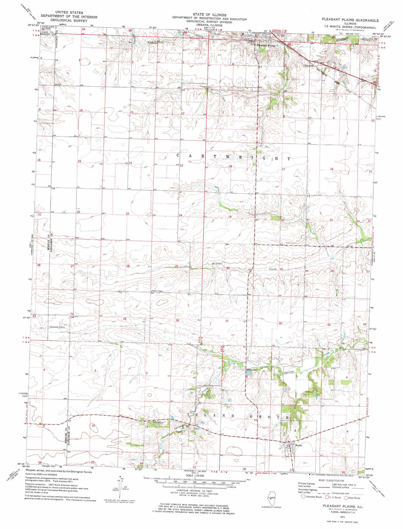
USGS Topo Quad 39089g8 - 1:24,000 scale
| Topo Map Name: | Pleasant Plains |
| USGS Topo Quad ID: | 39089g8 |
| Print Size: | ca. 21 1/4" wide x 27" high |
| Southeast Coordinates: | 39.75° N latitude / 89.875° W longitude |
| Map Center Coordinates: | 39.8125° N latitude / 89.9375° W longitude |
| U.S. State: | IL |
| Filename: | o39089g8.jpg |
| Download Map JPG Image: | Pleasant Plains topo map 1:24,000 scale |
| Map Type: | Topographic |
| Topo Series: | 7.5´ |
| Map Scale: | 1:24,000 |
| Source of Map Images: | United States Geological Survey (USGS) |
| Alternate Map Versions: |
Pleasant Plains IL 1971, updated 1973 Download PDF Buy paper map Pleasant Plains IL 2012 Download PDF Buy paper map Pleasant Plains IL 2015 Download PDF Buy paper map |
1:24,000 Topo Quads surrounding Pleasant Plains
Chandlerville |
Newmansville |
Oakford |
Petersburg |
Greenview |
Virginia |
Ashland |
Tallula |
Salisbury |
Athens |
Literberry |
Prentice |
Pleasant Plains |
Farmingdale |
Springfield West |
Jacksonville |
Alexander |
New Berlin |
Loami |
Chatham |
Nortonville |
Franklin |
Waverly |
Virden North |
Divernon |
> Back to 39089e1 at 1:100,000 scale
> Back to 39088a1 at 1:250,000 scale
> Back to U.S. Topo Maps home
Pleasant Plains topo map: Gazetteer
Pleasant Plains: Airports
Smith RLA Airport elevation 192m 629′Pleasant Plains: Populated Places
Berlin elevation 194m 636′Claysville elevation 186m 610′
Pleasant Plains elevation 186m 610′
Pleasant Plains digital topo map on disk
Buy this Pleasant Plains topo map showing relief, roads, GPS coordinates and other geographical features, as a high-resolution digital map file on DVD:
Northern Illinois, Northern Indiana & Southwestern Michigan
Buy digital topo maps: Northern Illinois, Northern Indiana & Southwestern Michigan