Latham Topo Map Illinois
To zoom in, hover over the map of Latham
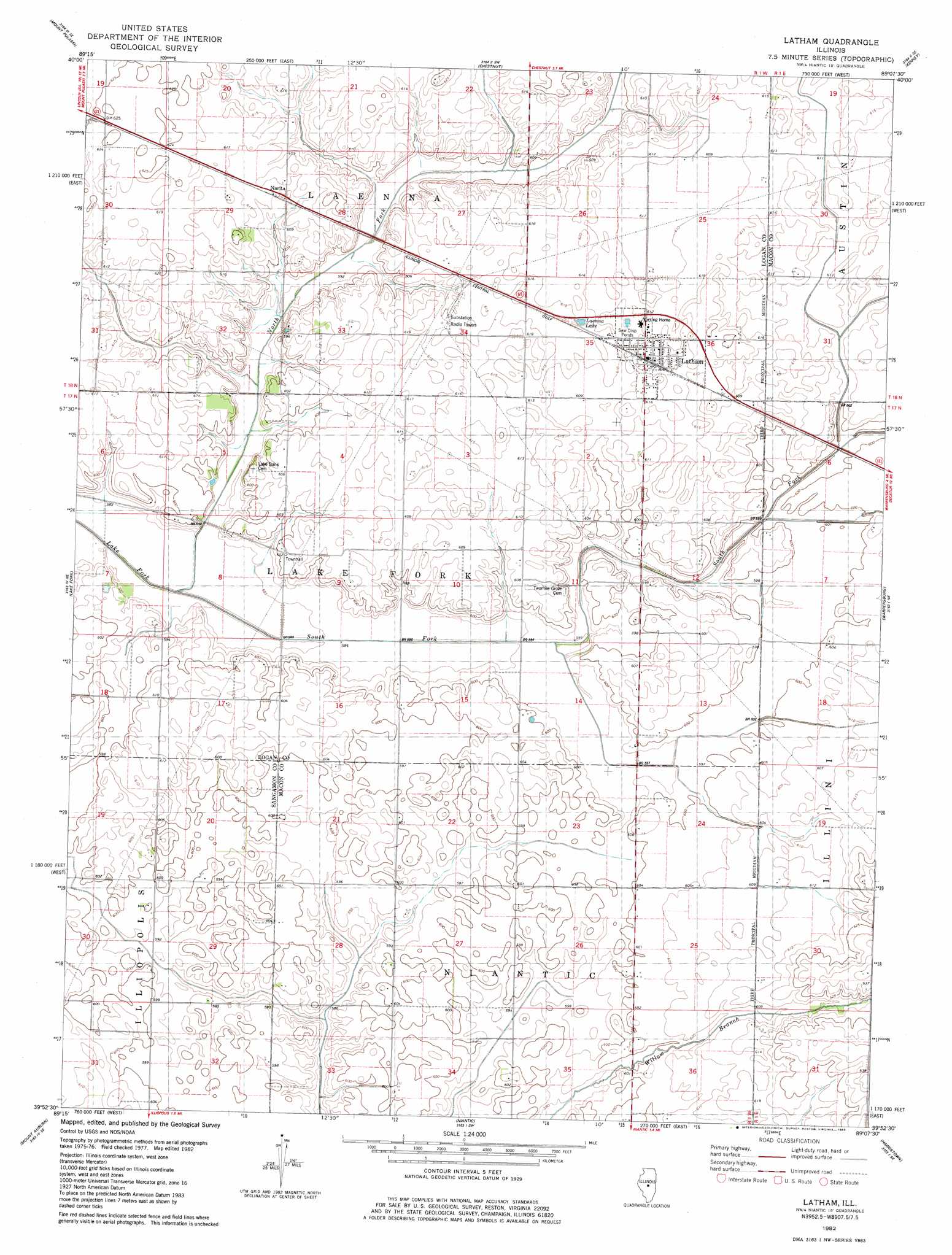
USGS Topo Quad 39089h2 - 1:24,000 scale
| Topo Map Name: | Latham |
| USGS Topo Quad ID: | 39089h2 |
| Print Size: | ca. 21 1/4" wide x 27" high |
| Southeast Coordinates: | 39.875° N latitude / 89.125° W longitude |
| Map Center Coordinates: | 39.9375° N latitude / 89.1875° W longitude |
| U.S. State: | IL |
| Filename: | o39089h2.jpg |
| Download Map JPG Image: | Latham topo map 1:24,000 scale |
| Map Type: | Topographic |
| Topo Series: | 7.5´ |
| Map Scale: | 1:24,000 |
| Source of Map Images: | United States Geological Survey (USGS) |
| Alternate Map Versions: |
Latham IL 1982, updated 1983 Download PDF Buy paper map Latham IL 2012 Download PDF Buy paper map Latham IL 2015 Download PDF Buy paper map |
1:24,000 Topo Quads surrounding Latham
Lincoln West |
Lincoln East |
Waynesville West |
Waynesville East |
Clinton |
Broadwell |
Mount Pulaski |
Chestnut |
Kenney |
Maroa |
Cornland |
Lake Fork |
Latham |
Warrensburg |
Forsyth |
Mechanicsburg |
Mount Auburn |
Niantic |
Harristown |
Decatur |
Edinburg |
Grove City |
Stonington |
Macon West |
Macon East |
> Back to 39089e1 at 1:100,000 scale
> Back to 39088a1 at 1:250,000 scale
> Back to U.S. Topo Maps home
Latham topo map: Gazetteer
Latham: Populated Places
Latham elevation 187m 613′Narita elevation 186m 610′
Latham: Reservoirs
Laenna Lake elevation 187m 613′Latham: Streams
North Fork Lake Fork elevation 175m 574′South Fork Lake Fork elevation 178m 583′
Latham digital topo map on disk
Buy this Latham topo map showing relief, roads, GPS coordinates and other geographical features, as a high-resolution digital map file on DVD:
Northern Illinois, Northern Indiana & Southwestern Michigan
Buy digital topo maps: Northern Illinois, Northern Indiana & Southwestern Michigan