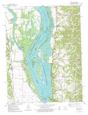
Foley Topo Map Illinois
To zoom in, hover over the map of Foley
USGS Topo Quad 39090a6 - 1:24,000 scale
| Topo Map Name: | Foley |
| USGS Topo Quad ID: | 39090a6 |
| Print Size: | ca. 21 1/4" wide x 27" high |
| Southeast Coordinates: | 39° N latitude / 90.625° W longitude |
| Map Center Coordinates: | 39.0625° N latitude / 90.6875° W longitude |
| U.S. States: | IL, MO |
| Filename: | o39090a6.jpg |
| Download Map JPG Image: | Foley topo map 1:24,000 scale |
| Map Type: | Topographic |
| Topo Series: | 7.5´ |
| Map Scale: | 1:24,000 |
| Source of Map Images: | United States Geological Survey (USGS) |
| Alternate Map Versions: |
Foley MO 1975, updated 1978 Download PDF Buy paper map Foley MO 1993, updated 1996 Download PDF Buy paper map Foley MO 2011 Download PDF Buy paper map Foley MO 2015 Download PDF Buy paper map |
1:24,000 Topo Quads surrounding Foley
> Back to 39090a1 at 1:100,000 scale
> Back to 39090a1 at 1:250,000 scale
> Back to U.S. Topo Maps home
Foley topo map: Gazetteer
Foley: Canals
Sandy Creek Ditch elevation 132m 433′Foley: Dams
Lock and Dam 25 elevation 131m 429′Lock and Dam Number 25 elevation 130m 426′
Lock and Dam Number Twenty-five elevation 129m 423′
Foley: Guts
Bates Slough elevation 131m 429′Birch Slough elevation 131m 429′
Church Slough elevation 132m 433′
Crooked Slough elevation 132m 433′
Dogfish Slough elevation 132m 433′
George Bain Slough elevation 132m 433′
Ligon Slough elevation 130m 426′
Logging Slough elevation 132m 433′
Foley: Islands
Campbells Island elevation 133m 436′Hausgen Island elevation 132m 433′
Jim Crow Island elevation 133m 436′
Keeton Island elevation 132m 433′
Little Stag Island elevation 133m 436′
Maple Island elevation 133m 436′
Maxey Island elevation 132m 433′
Sandy Island elevation 132m 433′
Sarah Ann Island elevation 132m 433′
Stag Island elevation 133m 436′
Turner Island elevation 133m 436′
Willow Island elevation 132m 433′
Foley: Lakes
Bailey Lake elevation 132m 433′Bell Pond elevation 132m 433′
Black Lake elevation 132m 433′
Burns Pond elevation 131m 429′
Clear Pond elevation 131m 429′
Dixon Pond elevation 133m 436′
Flat Pond elevation 133m 436′
Garden Pond (historical) elevation 130m 426′
Goose Pond elevation 131m 429′
Grots Pond elevation 132m 433′
Horseshoe Lake elevation 131m 429′
Jakes Pond elevation 133m 436′
Kings Lake elevation 129m 423′
Knocker Ponds elevation 132m 433′
Little Round Pond elevation 132m 433′
Long Lake elevation 132m 433′
Long Lake elevation 132m 433′
Lower Flat Pond elevation 132m 433′
Masons Pond elevation 131m 429′
Metz Lake elevation 132m 433′
Oasis Lake elevation 132m 433′
Ox Pond elevation 130m 426′
Prairie Lake elevation 132m 433′
Round Lake elevation 130m 426′
Round Lake elevation 132m 433′
Round Pond elevation 132m 433′
Sand Bay elevation 132m 433′
Skunk Pond elevation 132m 433′
Stump Lake elevation 132m 433′
Swan Pond elevation 132m 433′
Twin Ponds elevation 131m 429′
Upper Flat Pond elevation 132m 433′
Watson Lake elevation 132m 433′
Willow Pond elevation 131m 429′
Foley: Parks
Batchtown State Fish and Waterfowl Management Area elevation 134m 439′Bradley Island Public Use Area elevation 132m 433′
Titus Hollow Public Access Area elevation 133m 436′
Foley: Populated Places
Batchtown elevation 177m 580′Foley elevation 134m 439′
Gilead elevation 143m 469′
Kings Lake elevation 133m 436′
Kritesville elevation 142m 465′
Oasis elevation 151m 495′
Parkers Landing elevation 133m 436′
Parkers Park elevation 131m 429′
Sterling Landing elevation 133m 436′
Turner Landing elevation 133m 436′
Foley: Reservoirs
Pool 25 elevation 131m 429′Foley: Springs
Cave Spring elevation 164m 538′Lick Spring elevation 136m 446′
Salt Spring elevation 156m 511′
Foley: Streams
Barley Branch elevation 134m 439′Lost Creek elevation 131m 429′
Madison Creek elevation 130m 426′
Old Kings Lake Creek elevation 131m 429′
Sandy Chute elevation 129m 423′
Sandy Creek elevation 131m 429′
Turner Branch elevation 133m 436′
West Point Creek elevation 132m 433′
Whiteside Creek elevation 131m 429′
Foley: Valleys
Dixon Hollow elevation 135m 442′Lick Hollow elevation 137m 449′
Salt Spring Hollow elevation 145m 475′
Foley digital topo map on disk
Buy this Foley topo map showing relief, roads, GPS coordinates and other geographical features, as a high-resolution digital map file on DVD:


