Medora Topo Map Illinois
To zoom in, hover over the map of Medora
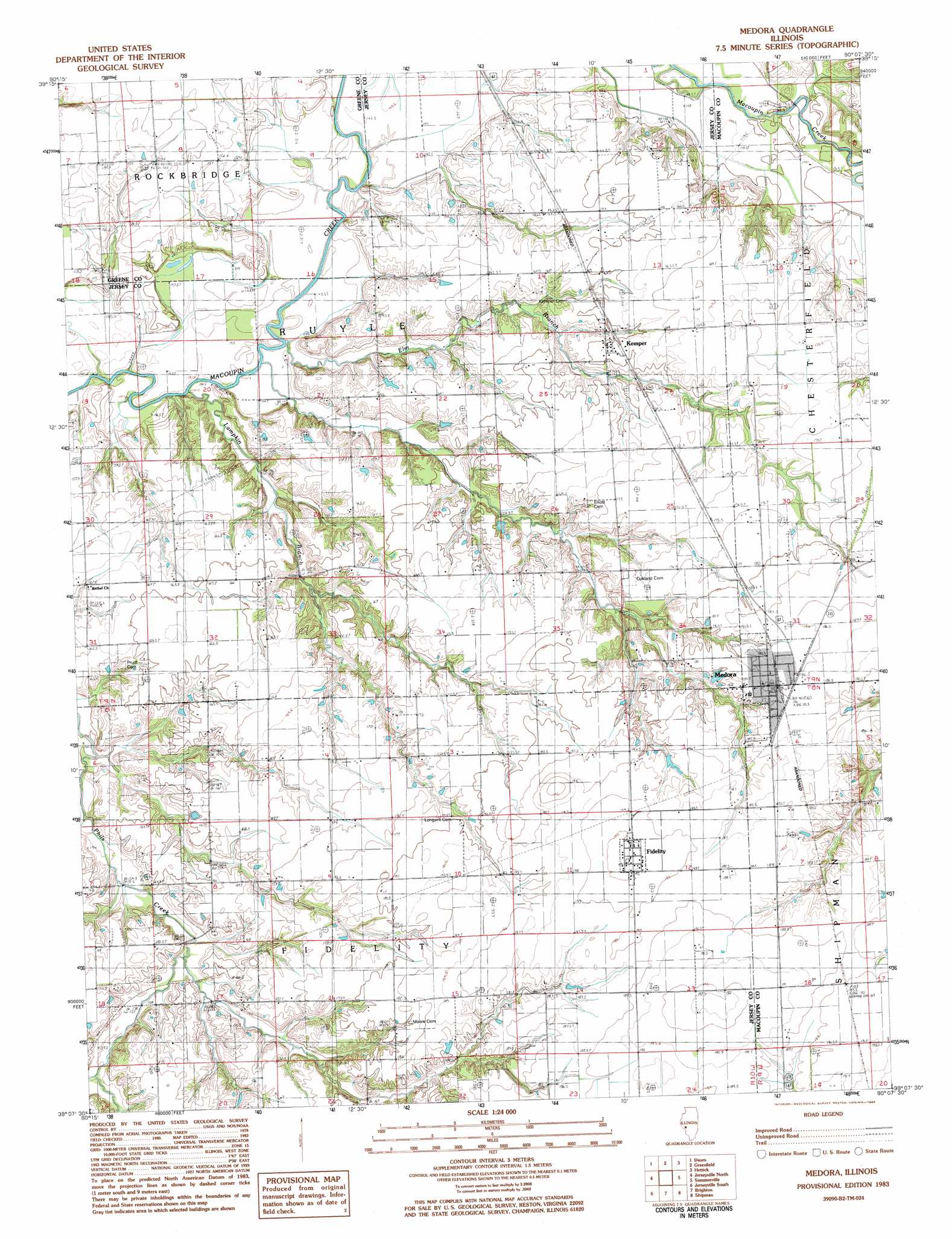
USGS Topo Quad 39090b2 - 1:24,000 scale
| Topo Map Name: | Medora |
| USGS Topo Quad ID: | 39090b2 |
| Print Size: | ca. 21 1/4" wide x 27" high |
| Southeast Coordinates: | 39.125° N latitude / 90.125° W longitude |
| Map Center Coordinates: | 39.1875° N latitude / 90.1875° W longitude |
| U.S. State: | IL |
| Filename: | o39090b2.jpg |
| Download Map JPG Image: | Medora topo map 1:24,000 scale |
| Map Type: | Topographic |
| Topo Series: | 7.5´ |
| Map Scale: | 1:24,000 |
| Source of Map Images: | United States Geological Survey (USGS) |
| Alternate Map Versions: |
Medora IL 1983, updated 1984 Download PDF Buy paper map Medora IL 2012 Download PDF Buy paper map Medora IL 2015 Download PDF Buy paper map |
1:24,000 Topo Quads surrounding Medora
Roodhouse West |
Roodhouse East |
Athensville |
Scottville |
Palmyra |
Carrollton |
Daum |
Greenfield |
Hettick |
Carlinville West |
Boyer Creek |
Jerseyville North |
Medora |
Summerville |
Plainview |
Otterville |
Jerseyville South |
Brighton |
Shipman |
Bunker Hill |
Grafton |
Elsah |
Alton |
Bethalto |
Prairietown |
> Back to 39090a1 at 1:100,000 scale
> Back to 39090a1 at 1:250,000 scale
> Back to U.S. Topo Maps home
Medora topo map: Gazetteer
Medora: Lakes
Foster Lake elevation 142m 465′Round Lake elevation 144m 472′
Medora: Populated Places
Bowman (historical) elevation 159m 521′Fidelity elevation 194m 636′
Kemper elevation 165m 541′
Medora elevation 186m 610′
Medora: Streams
Sugar Creek elevation 162m 531′Medora digital topo map on disk
Buy this Medora topo map showing relief, roads, GPS coordinates and other geographical features, as a high-resolution digital map file on DVD: