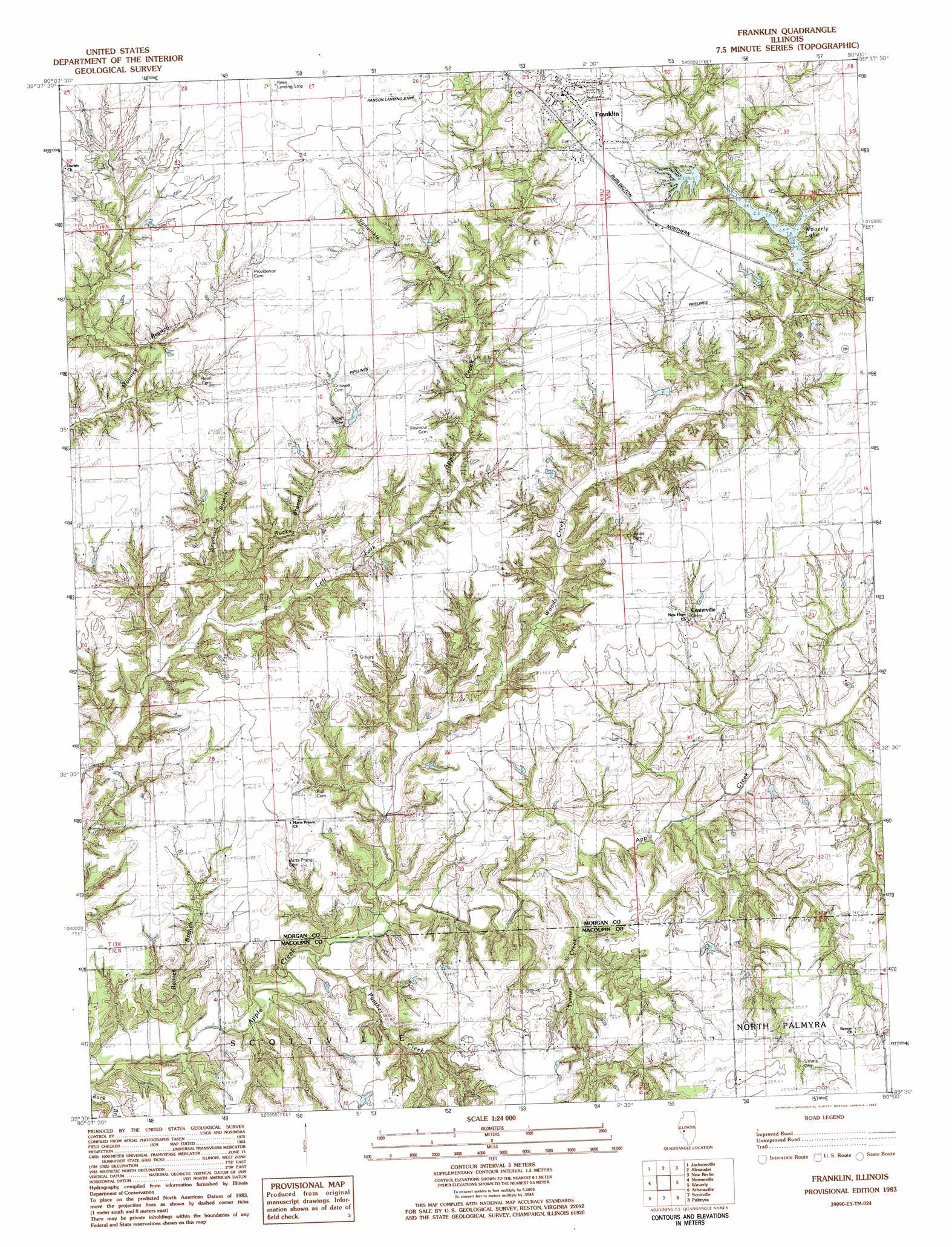
Franklin Topo Map Illinois
To zoom in, hover over the map of Franklin
USGS Topo Quad 39090e1 - 1:24,000 scale
| Topo Map Name: | Franklin |
| USGS Topo Quad ID: | 39090e1 |
| Print Size: | ca. 21 1/4" wide x 27" high |
| Southeast Coordinates: | 39.5° N latitude / 90° W longitude |
| Map Center Coordinates: | 39.5625° N latitude / 90.0625° W longitude |
| U.S. State: | IL |
| Filename: | o39090e1.jpg |
| Download Map JPG Image: | Franklin topo map 1:24,000 scale |
| Map Type: | Topographic |
| Topo Series: | 7.5´ |
| Map Scale: | 1:24,000 |
| Source of Map Images: | United States Geological Survey (USGS) |
| Alternate Map Versions: |
Franklin IL 1983, updated 1983 Download PDF Buy paper map Franklin IL 2012 Download PDF Buy paper map Franklin IL 2015 Download PDF Buy paper map |
1:24,000 Topo Quads surrounding Franklin
Concord |
Literberry |
Prentice |
Pleasant Plains |
Farmingdale |
Lynnville |
Jacksonville |
Alexander |
New Berlin |
Loami |
Manchester |
Nortonville |
Franklin |
Waverly |
Virden North |
Roodhouse East |
Athensville |
Scottville |
Palmyra |
Virden South |
Daum |
Greenfield |
Hettick |
Carlinville West |
Carlinville East |
> Back to 39090e1 at 1:100,000 scale
> Back to 39090a1 at 1:250,000 scale
> Back to U.S. Topo Maps home
Franklin topo map: Gazetteer
Franklin: Airports
Ranson Strip elevation 211m 692′Franklin: Dams
Franklin Waverly Outing Club Lake Dam elevation 200m 656′Waverly City Lake Dam elevation 190m 623′
Franklin: Populated Places
Centerville elevation 193m 633′Franklin elevation 208m 682′
Franklin: Reservoirs
Franklin Waverly Outing Club Lake elevation 200m 656′Waverly City Lake elevation 190m 623′
Waverly Lake elevation 190m 623′
Franklin: Streams
Baitter Branch elevation 161m 528′Bucks Branch elevation 173m 567′
Panther Creek elevation 162m 531′
Seymore Branch elevation 178m 583′
Turner Creek elevation 167m 547′
Vanwinkle Branch elevation 189m 620′
Woods Creek elevation 165m 541′
Franklin digital topo map on disk
Buy this Franklin topo map showing relief, roads, GPS coordinates and other geographical features, as a high-resolution digital map file on DVD: