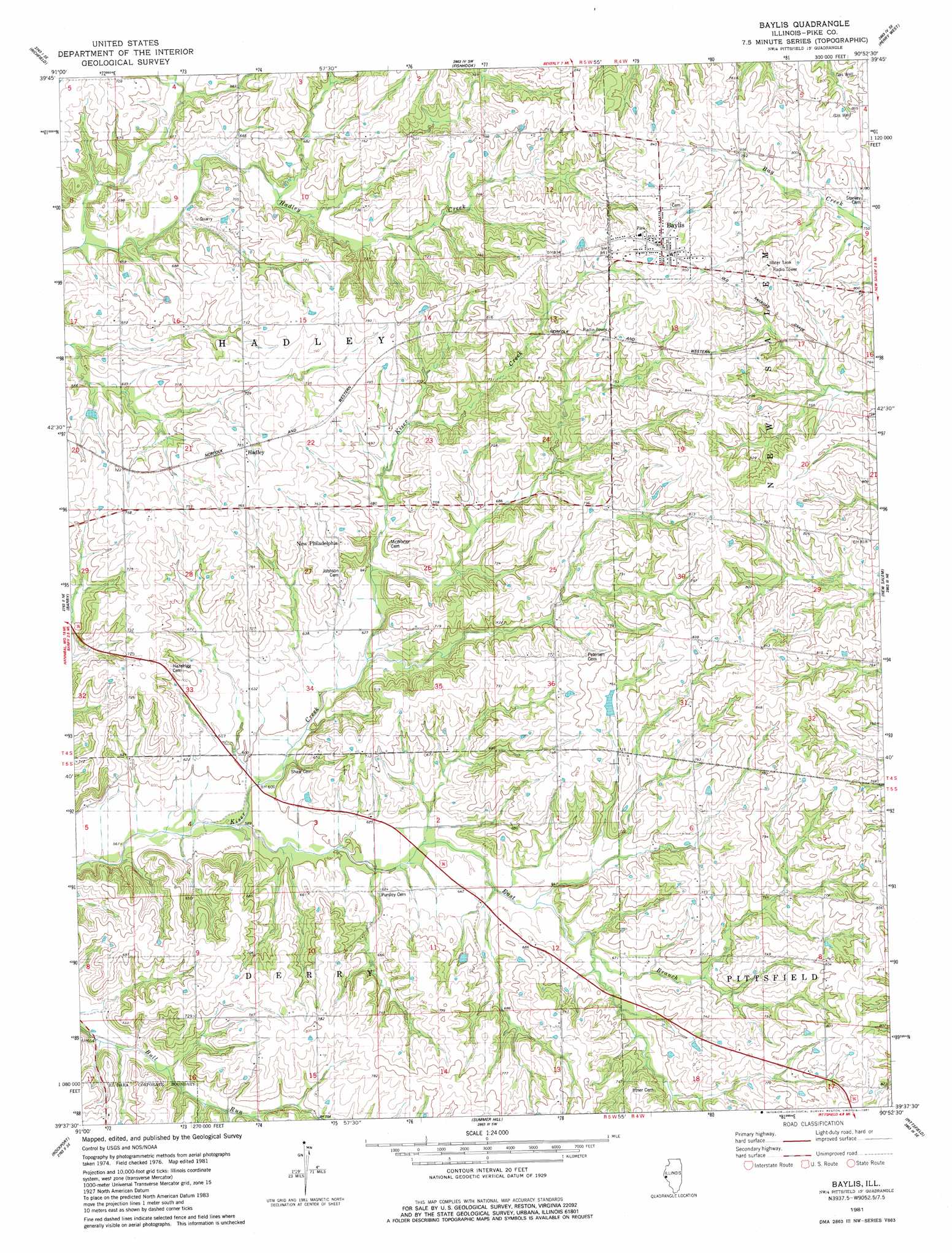
Baylis Topo Map Illinois
To zoom in, hover over the map of Baylis
USGS Topo Quad 39090f8 - 1:24,000 scale
| Topo Map Name: | Baylis |
| USGS Topo Quad ID: | 39090f8 |
| Print Size: | ca. 21 1/4" wide x 27" high |
| Southeast Coordinates: | 39.625° N latitude / 90.875° W longitude |
| Map Center Coordinates: | 39.6875° N latitude / 90.9375° W longitude |
| U.S. State: | IL |
| Filename: | o39090f8.jpg |
| Download Map JPG Image: | Baylis topo map 1:24,000 scale |
| Map Type: | Topographic |
| Topo Series: | 7.5´ |
| Map Scale: | 1:24,000 |
| Source of Map Images: | United States Geological Survey (USGS) |
| Alternate Map Versions: |
Baylis IL 1981, updated 1981 Download PDF Buy paper map Baylis IL 1998, updated 2001 Download PDF Buy paper map Baylis IL 2012 Download PDF Buy paper map Baylis IL 2015 Download PDF Buy paper map |
1:24,000 Topo Quads surrounding Baylis
Columbus |
Liberty |
Kellerville |
Mount Sterling |
Versailles |
Payson |
Richfield |
Fishhook |
Perry West |
Perry East |
Hull |
Barry |
Baylis |
New Salem |
Griggsville |
Ashburn |
Rockport |
Summer Hill |
Pittsfield |
Milton |
Vera |
Louisana |
Pleasant Hill West |
Pleasant Hill East |
Pearl West |
> Back to 39090e1 at 1:100,000 scale
> Back to 39090a1 at 1:250,000 scale
> Back to U.S. Topo Maps home
Baylis topo map: Gazetteer
Baylis: Dams
Farm Pond Dam elevation 234m 767′Rising Spring Orchard Lake Dam elevation 238m 780′
Baylis: Populated Places
Baylis elevation 263m 862′Hadley elevation 228m 748′
New Philadelphia elevation 223m 731′
Baylis: Reservoirs
Farm Pond elevation 234m 767′Rising Spring Orchard Lake elevation 238m 780′
Baylis: Streams
East Branch Kiser Creek elevation 177m 580′Baylis digital topo map on disk
Buy this Baylis topo map showing relief, roads, GPS coordinates and other geographical features, as a high-resolution digital map file on DVD: