Chapin Topo Map Illinois
To zoom in, hover over the map of Chapin
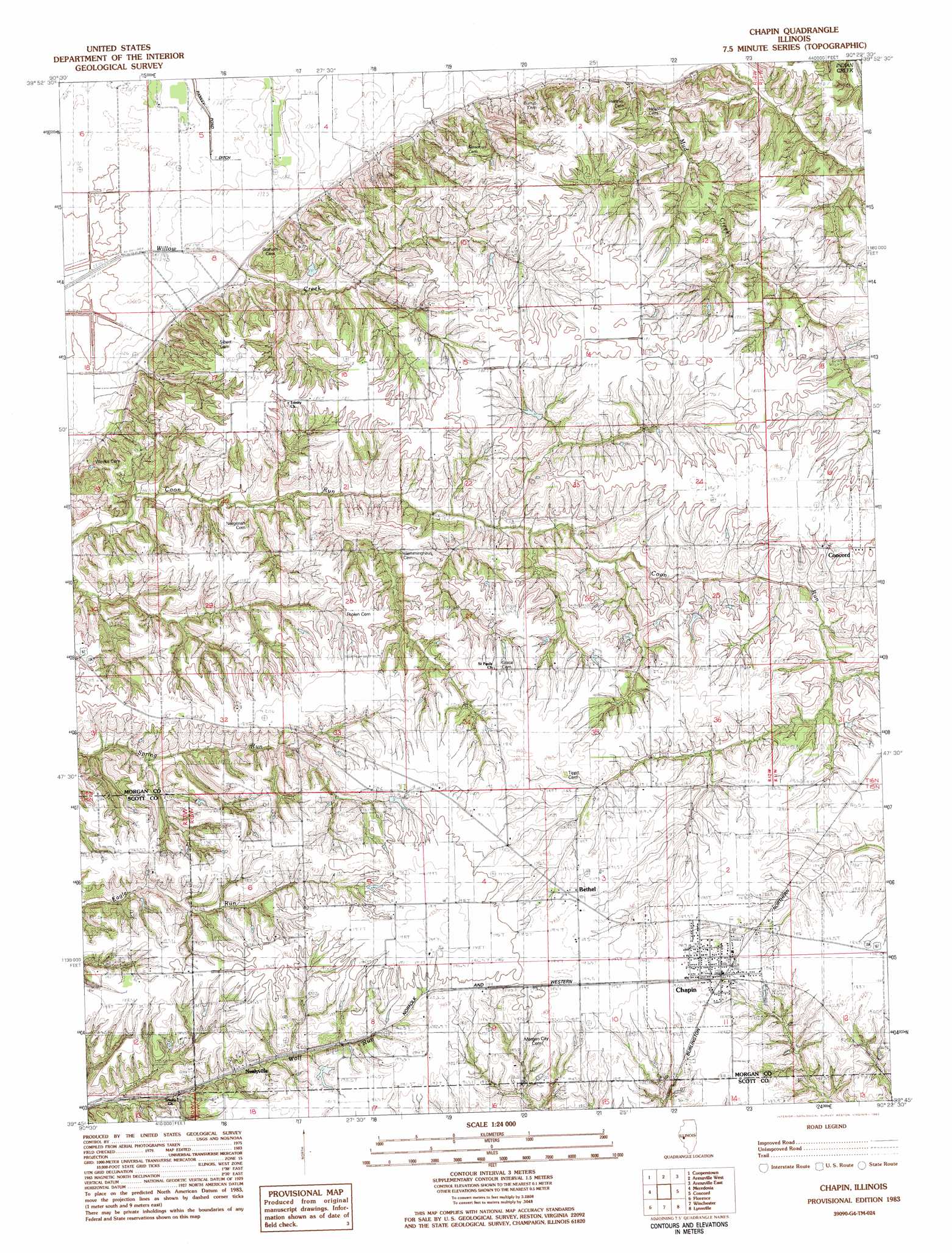
USGS Topo Quad 39090g4 - 1:24,000 scale
| Topo Map Name: | Chapin |
| USGS Topo Quad ID: | 39090g4 |
| Print Size: | ca. 21 1/4" wide x 27" high |
| Southeast Coordinates: | 39.75° N latitude / 90.375° W longitude |
| Map Center Coordinates: | 39.8125° N latitude / 90.4375° W longitude |
| U.S. State: | IL |
| Filename: | o39090g4.jpg |
| Download Map JPG Image: | Chapin topo map 1:24,000 scale |
| Map Type: | Topographic |
| Topo Series: | 7.5´ |
| Map Scale: | 1:24,000 |
| Source of Map Images: | United States Geological Survey (USGS) |
| Alternate Map Versions: |
Chapin IL 1983, updated 1983 Download PDF Buy paper map Chapin IL 2012 Download PDF Buy paper map Chapin IL 2015 Download PDF Buy paper map |
1:24,000 Topo Quads surrounding Chapin
Ripley |
Rushville South |
Beardstown |
Clear Lake |
Chandlerville |
Versailles |
Cooperstown |
Arenzville West |
Arenzville East |
Virginia |
Perry East |
Meredosia |
Chapin |
Concord |
Literberry |
Griggsville |
Florence |
Winchester |
Lynnville |
Jacksonville |
Milton |
Bedford |
Alsey |
Manchester |
Nortonville |
> Back to 39090e1 at 1:100,000 scale
> Back to 39090a1 at 1:250,000 scale
> Back to U.S. Topo Maps home
Chapin topo map: Gazetteer
Chapin: Parks
Meredosia Hill Prairie Nature Preserve elevation 180m 590′Chapin: Populated Places
Bethel elevation 192m 629′Chapin elevation 189m 620′
Morgan City (historical) elevation 195m 639′
Chapin: Post Offices
Neelyville elevation 174m 570′Chapin: Streams
Mud Creek elevation 146m 479′Chapin digital topo map on disk
Buy this Chapin topo map showing relief, roads, GPS coordinates and other geographical features, as a high-resolution digital map file on DVD: